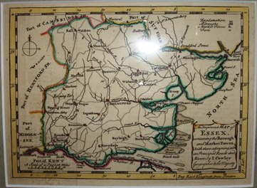
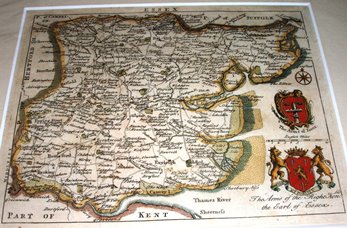
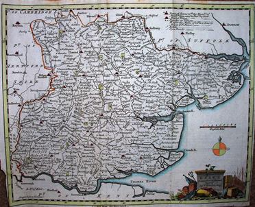
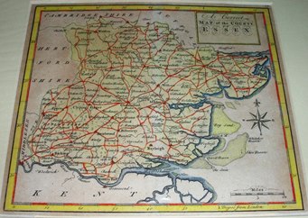
County maps of Essex from the 18th century
The table below lists flat maps of Essex in approximately chronological order; these are taken from Atlases, or in a few cases were published as maps of Essex alone. There is a link from each entry to a large picture.
Shown against items are Skelton/Hodson or other reference books - eg SH123 means atlas 123 from the Skelton & Hodson reference books and Roger 116 means entry 116 in the Roger book listed on the Books page.
The dimensions against each map are Height x Width, and as Essex is a little wider than it is tall the width is usually greater - assuming the map has north at the top. The measurements are of the outermost neat line of the map (not the size of the sheet of paper).
Alternatively, go to the preceding chronological listing, 17th century.
| Thumbnail maps |
Mapmakers, their Atlases and Maps |
|
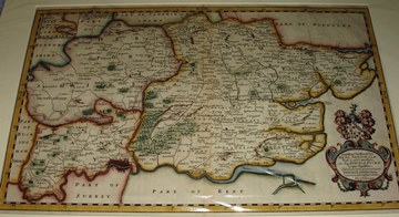
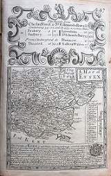
Morden & Pask
To the Nobility & Gentry of Essex Roger 116
1700
568mm x 747mm
Approx 2 miles = 1 inch
|
|
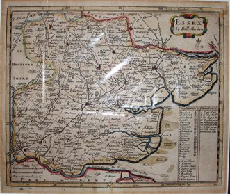
R Morden
The New description and State of England SH123
1701
171mm x 205mm
Three scales - Great, Middle & Small miles
|
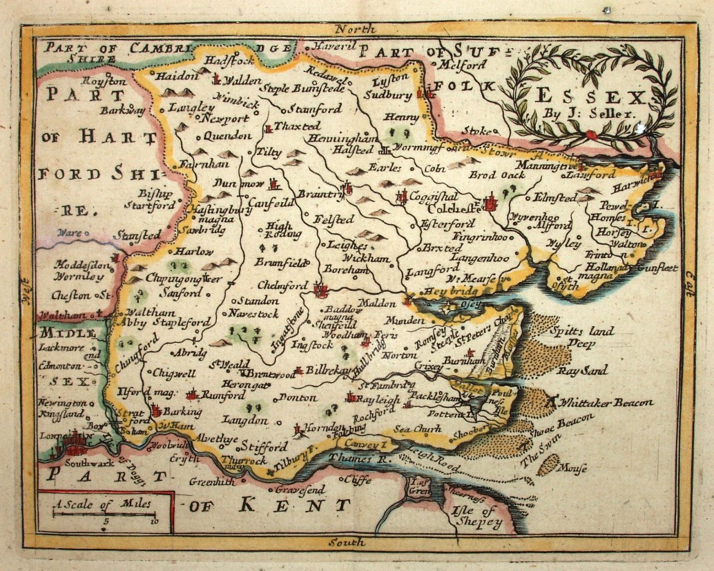 |
Seller
Camden's Britannia Abrig'd SH122
1701 116mm x 148mm
Maps re-issued by F Grose in 1780s. |
 |
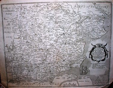
Newcourt
Dioeces Londinensis
1710 285mm x 464mm
Essex, Herts and Middlesex. No hundreds, but Deaneries shown. |
 |
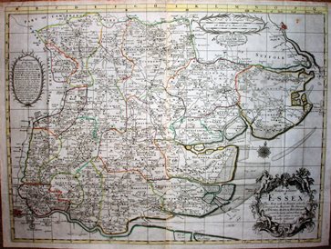
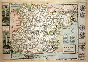
William Smith
1713 403mm x 503mm
County maps of the "Anonymous mapmaker".
Essex derived from Saxton; re-iss by Overton 1713 SH142. |
 |
Taylor & Blome
England Exactly Described SH140
1717 146mm x 210mm
Copy of Speed's Maps Epitomiz'd, 1681 |
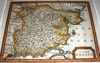 |
Van Der Aa
Le compte D'Essex
1719 157mm x 205mm
First mention of North Sea - "Mer du Nord". London at 32o45' East |
 |
Bowen & Owen
Britannia Depicta, or Ogilby Improv'd SH149
1720 114mm x 113mm (map only)
The Essex county map from what is mainly a road book. |
 |
Morden & Cox
Magna Britannia SH128
1720
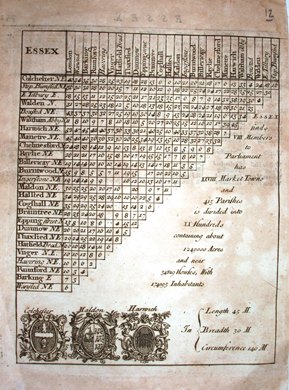
The triangular mileage table for Essex, issued with same map as the Morden 1701. |
 |
H Moll
A New Description of England & Wales SH173
1724 210mm x 318mm
Edges of map decorated by ancient coins and Tilbury caverns. |
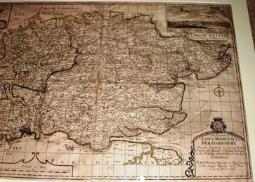 |
Overton
Reduced scale copy of Warburton's 1725 map Roger 118
1726 597mm x 947mm
Half size copy of Warburton, but still 2.4 miles to an inch. |
 |
Badeslade & Toms
Chorogrephia Britanniae SH188
1741 150mm x 150mm
First edition 1741, plus a 2nd edition the following year. |
 |
Cowley
The Geography of England SH194
1742 131mm x 182mm
Only towns, with approximated roads and rivers. |
 |
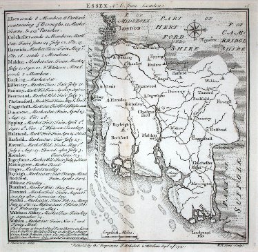
S Simpson & Walker
The Agreeable Historian, or the Compleat English Traveller SH204
1746 155mm x 196mm
Arms claimed for Essex are actually those of Colchester. |
 |
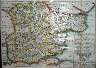
Thomas Kitchin
London Magazine SH229
June 1748 216mm x 267mm
Republished by Walpole 1787 |
 |
T Osborne & Hutchinson
Geographia Magnae Britanniae SH205
1748 147mm x 168mm
Based on Warburton, but not a commercial success. |
Return to table of County Maps list, or go to next chronological listing, 18th century - second half.
