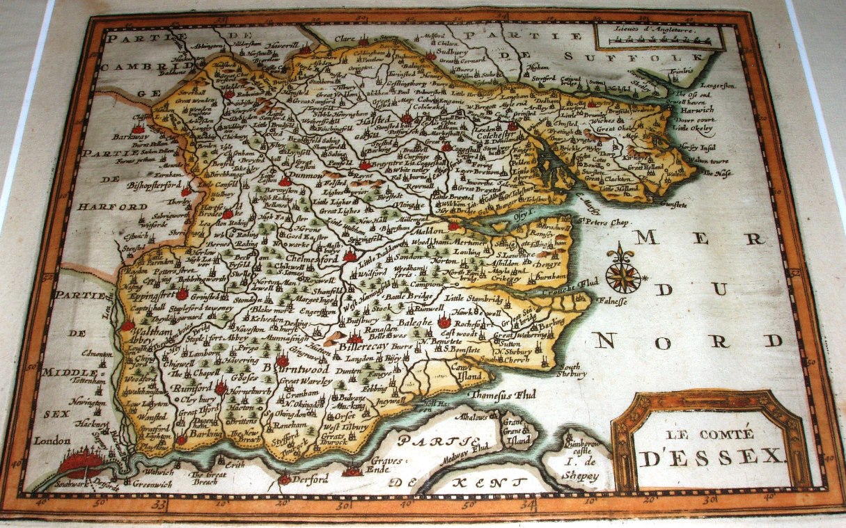
Atlas Soulage - Le compte D'Essex
For the German edition of 1648 of his Atlas Novus, Jansson added 8 new maps of English counties, including a map of Essex engraved by Peter van den Keere; there was a second issue in 1651. The plates were later acquired and re-worked by Peter van der Aa, who issued his new versions of the maps in his Atlas Soulage in 1712. In 1729 van de Aa re-issued the map, now with wide, engraved frame, in La Galerie Agreable du Monde.
Latitude & Longitude marked, but London is at 32o 45' east, so prime would be off the Azores(?).
This is the first Essex map that mentions the North Sea (or at least "Mer du Nord").
Displayed scale of 9mls = 31 mm, or 7.4 miles/inch; scale actual = 9.1 miles/inch, or 1:575,000.