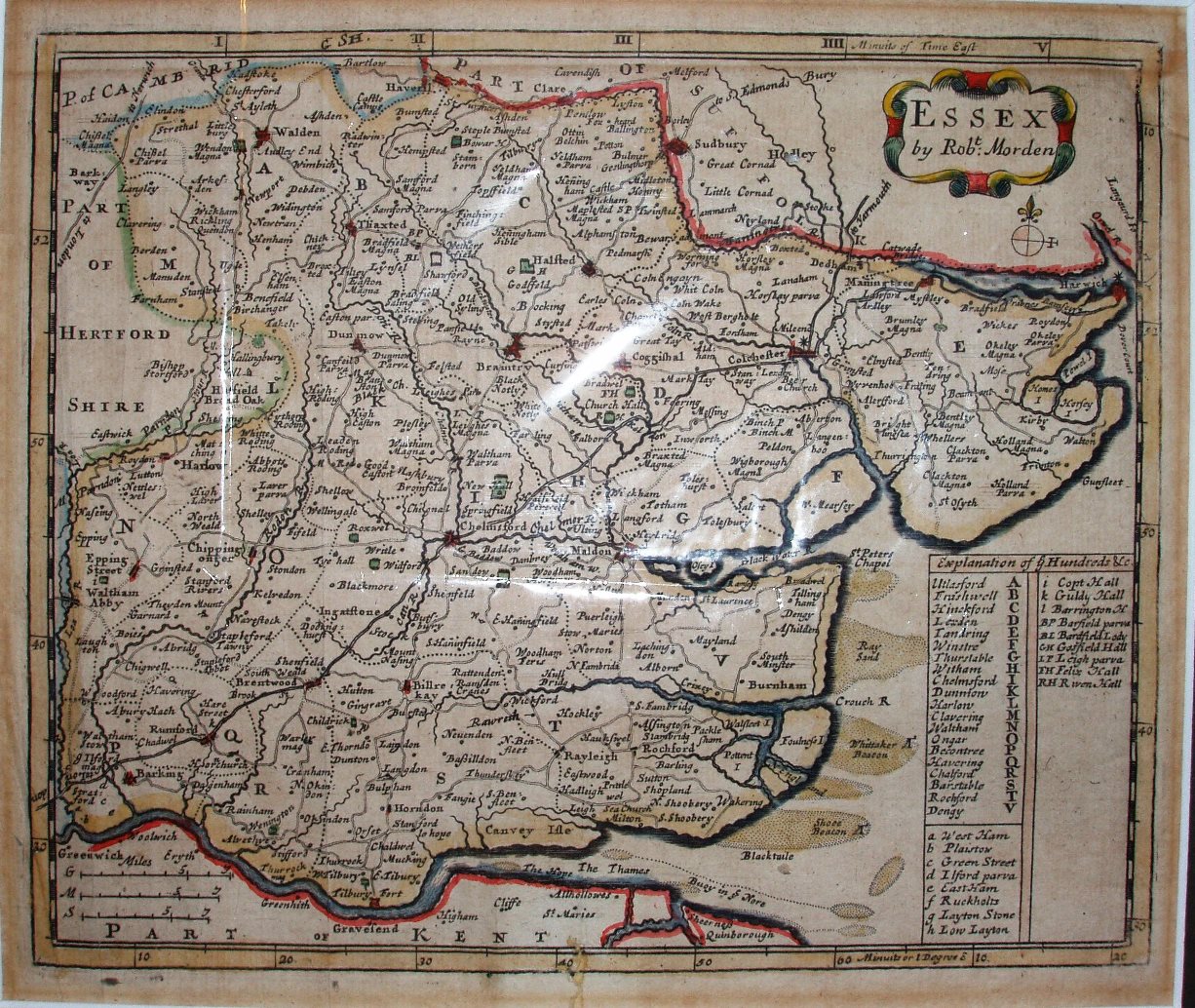
The New description and State of England
These look like reductions of his 1695 maps, but it is believed that these smaller maps were created first, in about 1693, with the Camden's Britannia in mind; they were rejected as being too small - and hence the larger maps for that 1695 production.
There are three scales again, as on his 1695 map, but this time for 7 miles (rather than 10mls), being 27.5mm, 25.2mm & 23.0mm or 6.5 miles/inch, 7.1 miles/inch & 7.7 miles/inch for Great, Middle & Small miles respectively; the actual scale is about 7.4 (statute) miles/inch, or 1:465,000.
Latitude & Longitude are shown, based on St Paul's.