- Home
- Introduction
- Mapmakers
- County Maps
- Map publishers
- Road Maps
- Dealers
- Libs & Socs
- Cartobibliogs
- Books
- Dating maps
- Parliamentary
- Railways
- Sundry
- Revisions

The changing pattern of parliamentary divisions (changing after 1832 at any rate) can be a helpful guide to estimating the date of a map when not provided, as the divisions are often shown on late 19th century maps. Below is a table listing the changing divisions, followed by some maps showing the different positions over time.
Unlike railways, maps would not have shown "proposed" divisions well in advance of them coming into reality; like railways, the maps were quick to show new divisions, but old divisions were quickly removed (unlike disused railways, or proposed but never-built railways).
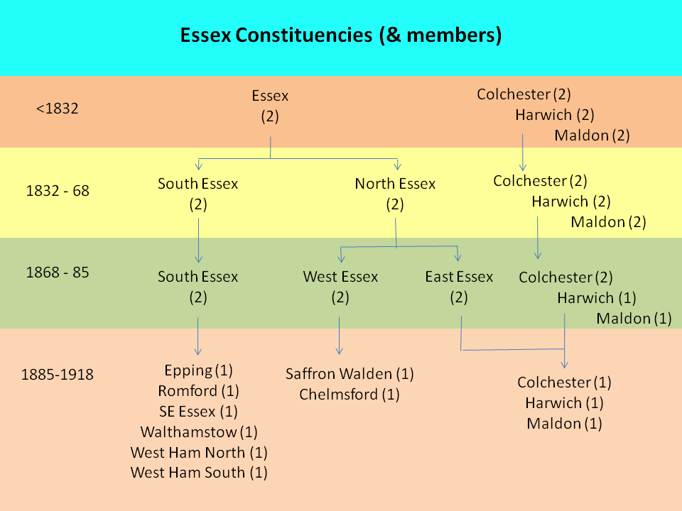
Below are maps showing the changes through the nineteenth century.
1832-1868 - two divisons, plus the three towns
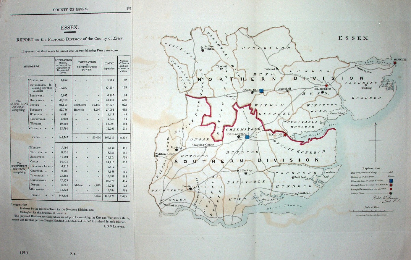
Dawson's 1834 map for the Boundary Commission (above)
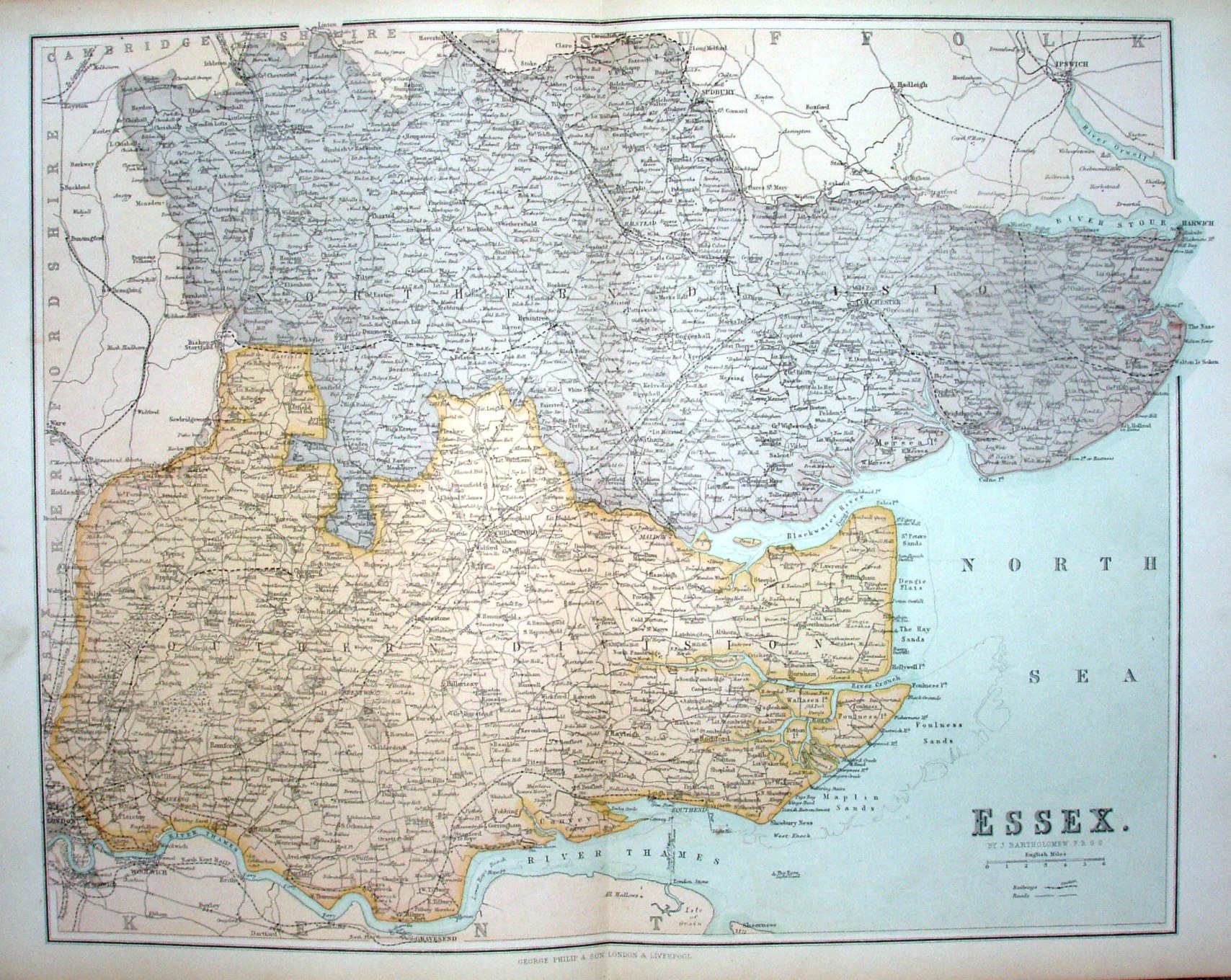
Philips' Atlas of the Counties of England, 1867 map.
1868-1885 - three divisons, plus the three towns
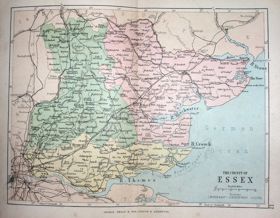
Philips' Handy Atlas of the Counties of England, 1873.
1885-1918 - many divisions
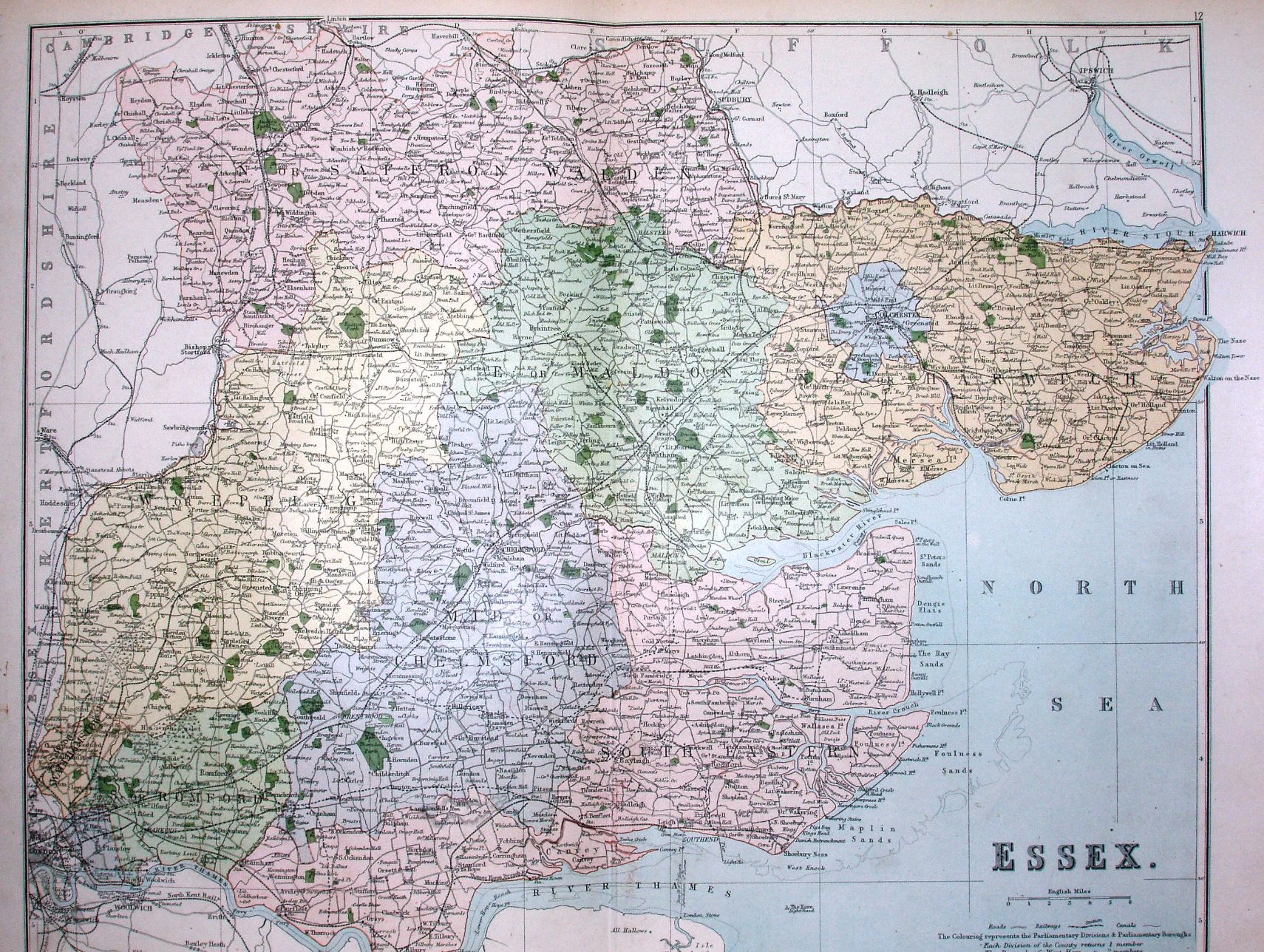
Philips' Handy Atlas of the Counties of England, 1885.
After 1918
The divisions changed again in 1918, in 1945 and in 1948. The number of seats became: 1918 - 12 Parliamentary Boroughs, plus 8 County Divisions 1945 - 13 Parliamentary Boroughs, plus 13 County Divisions 1948 - 16 Parliamentary Constituencies, plus 8 County Constituencies.