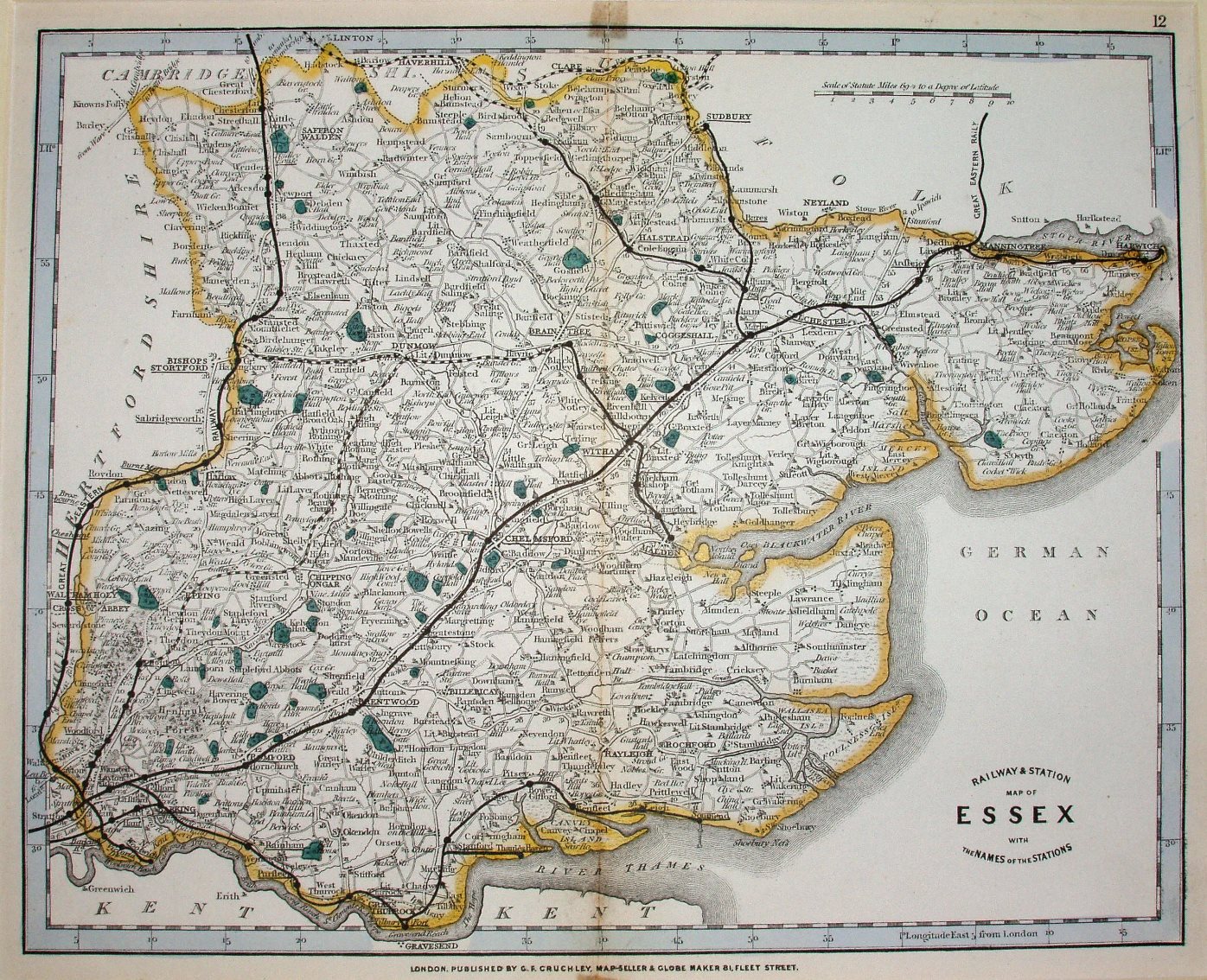
Cruchley's County Atlas of England and Wales (1863)
Cruchley had bought the old copper plates of Cary, and in this case the underlying map is from Cary's New and Correct English Atlas of 1809, with basically just railways added. His County Atlas was published in 1863, with reissues in 1868, 72 and 75, plus in 1872 as Cruchley's New Pocket Companion, or, Handmaid to Bradshaw.
Displayed scale of 10 miles = 46mm, or 5.5 miles/inch; actual scale = 5.7 miles/inch, or 1:360,000.
Railways shown include Castle Hedingham to Great Yeldham (opened 1862), plus proposed (?) lines from Great Yeldham to Haverhill (opened 1863) and Hythe to Wivenhoe (also opened 1863), plus from Bishops Stortford to Braintree (opened 1869) and Loughton to Ongar (opened 1865) - the latter extending from Ongar to Dunmow which was never built. From the lines shown as actual and proposed the date of 1863 is estimated.
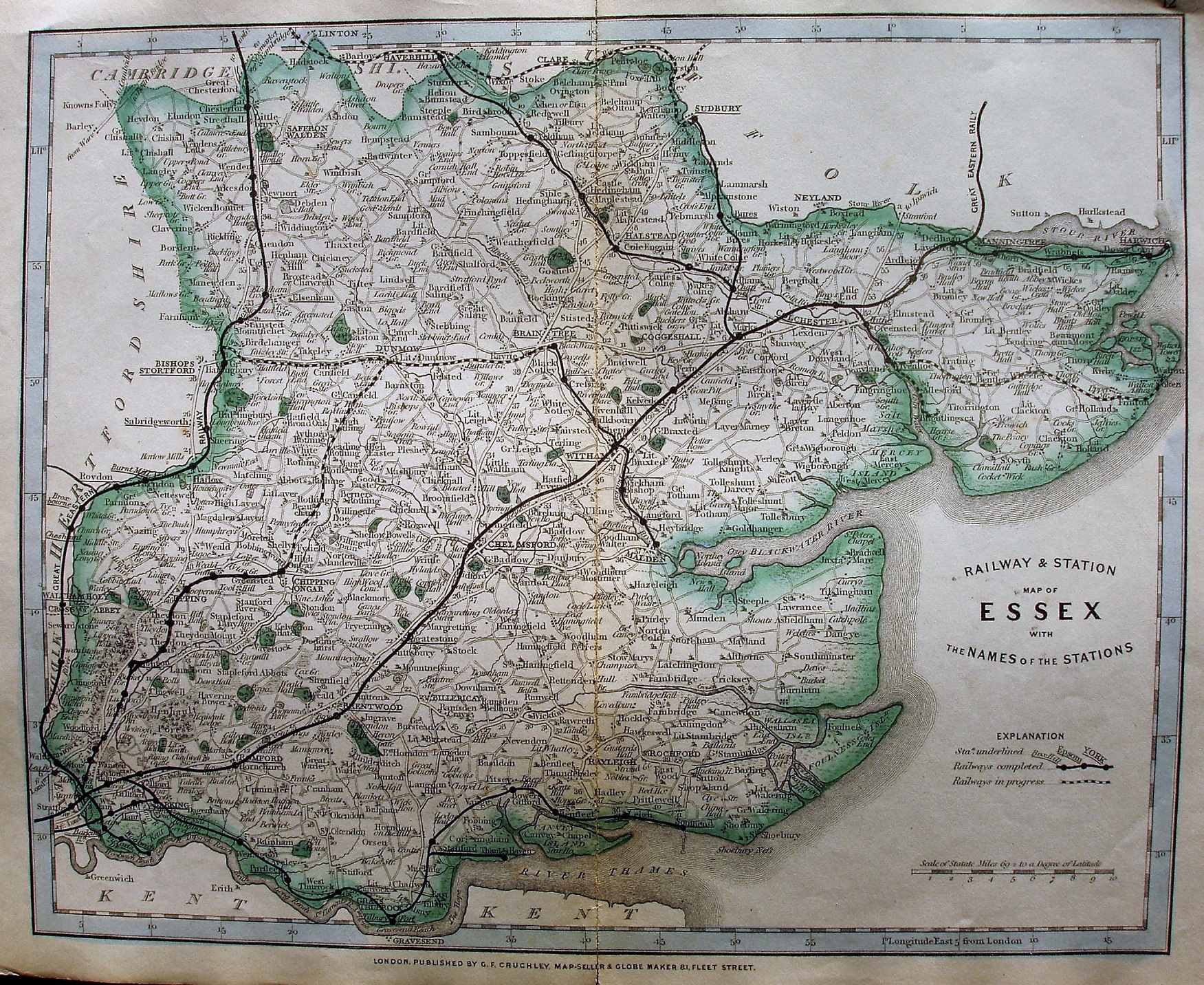
Cruchley's County Atlas of England and Wales (1864)
By 1864 the title has been re-engraved further north in the North Sea, which is no longer named. There is now an Explanation of the symbols for Railways and Railways in Progress.
See the 1875 version for how this plate changes. More details on Cruchley's maps are on the Publisher's page.
By 1864 the Yeldham to Haverhill line is now shown as open (opened 1863), and there are now proposed line from Wivenhoe to Brighlingsea (authorised 1861, opened 1866) and Wivenhoe to Walton (authorised 1864, opened 1866/67).
Displayed scale of 10 miles = 46mm, or 5.5 miles/inch; actual scale = 5.7 miles/inch, or 1:360,000.