The table below lists maps of Essex in approximately chronological order, taken from the Cruchley (and Gall & Inglis) Atlases and individual County Maps. Cruchley started in 1823, selling primarily maps of London, which were of a good quality and very popular. However, in 1844/50 he acquired the working stock of plates from the old firm of G&J Cary, and proceded to use these via lithographic transfers to produce very cheap but out of date maps of the English Counties and country, only updating them for railways (and that somewhat speculatively at times - several times adding "proposed" lines that were not built).
Cruchley retired and sold of his entire stock of plates/stones in 1877, many to Gall & Inglis of Edinburgh, who continued to use them (and Cruchley's name) for many years.
The dimensions against each cover and each map are Height x Width; for the maps, the measurements are of the outermost neat line of the map (not the size of the sheet of paper). Click on the thumbnails to get a larger picture and more information.
There were two sizes of county map; the colours on the dimensions below group maps of essentially the same size together.
The following is an approximate sequence of the county maps, based on RA Carroll's The Printed Maps of Lincolnshire 1576-1900 (1996), plus the Atlases and maps at CUL and at the BL, and my own collection of maps of Essex.
| Date | Title(s) | Approximate Dimensions |
Notes |
|---|---|---|---|
| 1855 | Railway and Telegraphic Atlas of England & Wales | 488 x 545mm | Used Cary's New English Atlas (1809). The Cruchley Atlas was re-published in 1858, 1862, 1866, 1874, 1877, 1879, 1880, 1883 & 1888 - from 1879 onwards by Gall & Inglis. |
| 1857 | Railway and Telegraphic County Map of [county] | 488 x 545mm | These were the same plates as used in the Atlas above, and included the Atlas plate numbers in their top right corners. The maps were published many times, including 1862, 1866, 1868 & 1874. |
| 1857 | Cruchley's Reduced Ordnance Map of England and Wales | 506 x 647mm | The Cary Improved Map of England and Wales (1832) at one inch to two miles' issed as sheets and as an atlas - as had Cary. |
| 1862 | Cruchley's Railroad Companion | 120 x 94mm | Used Cary's Travellers Companion (1822). When re-published in 1868 the maps were about 10mm wider. |
| 1863 | Cruchley's County Atlas | 212 x 261mm | Used Cary's New & Correct English Atlas (1809). The Cruchley Atlas was re-published in 1864 (3 times), 68, 72, 73 & 75 (twice). |
| 1863 | Cruchley's Railway and Station Map | 212 x 261mm | The single sheet map version of the County Atlas above. After 1863 it was re-published by as just Cruchley's Map of [county]. |
| 1868 | Cruchley's Railway and Station Map | 488 x 545mm | The larger map was re-published many, many times per county, with railways changing but little else. After buying Cruchley's plates in 1877 Gall & Inglis continued to publish them up to around 1913. |
| 1890 | AH Swiss Hunting maps | 769 x 983mm | Used Cary's Improved Map of England and Wales (1832). These regional maps showed the territories of each Hunt, plus a listing of its meets. There were at least 3 editions, in 1890, 1895 & 1900 (all approx). |
| 1895 | Cruchley's County maps / Gall & Inglis' County maps |
490 x 550mm | The old maps live on - even called "Cruchley's" despite him selling up in 1877 (& dying in 1881). There were several editions (or at least the cover colours changed) in the 1890s, and possibly in the 1900s too. |
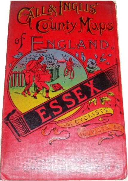
| 1910 | Gall & Inglis' County maps | 480 x 613mm | At long last the old maps are dropped and new ones are used from around 1910 (see below) until at least around 1928 (also below) - when they even changed the cover. |
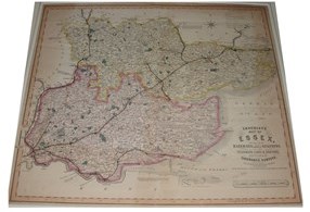
Cruchley's Railway and Station Map Cruchley's Railway and Station Map
1875 1886
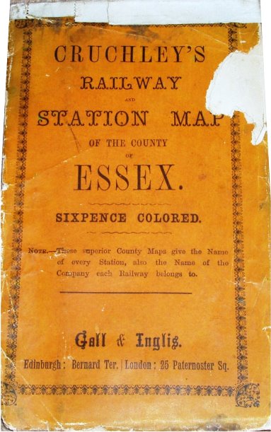
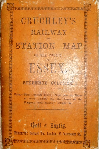
175 x 108mm for 494 x 543mm 173 x 114mm for 490 x 543mm
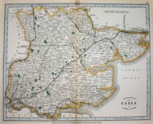
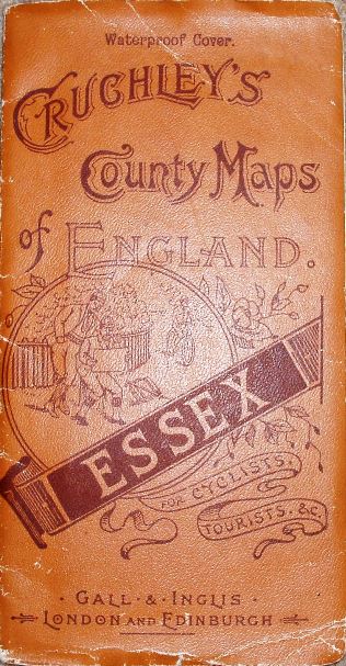
Cruchley's County Maps of England
Essex, 1893
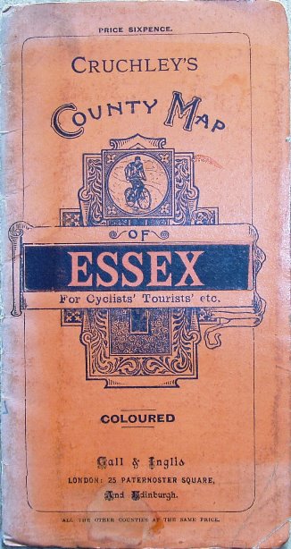
177 x 94mm for 492 x 556mm
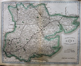
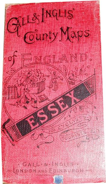
Cruchley's County Maps of England Gall & Inglis' County Maps of England Cruchley's County Maps of England
Essex, 1895 Essex, 1896 Essex, 1896
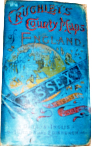
153 x 91mm for 491 x 550mm 153 x 91mm for 491 x 550mm 178 x 93mm for 489 x 551mm
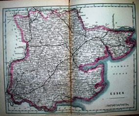
Gall & Inglis' County Maps of England Gall & Inglis' County Maps of England Gall & Inglis' County Maps of England
Essex, 1910 Essex, 1910 Essex, 1928
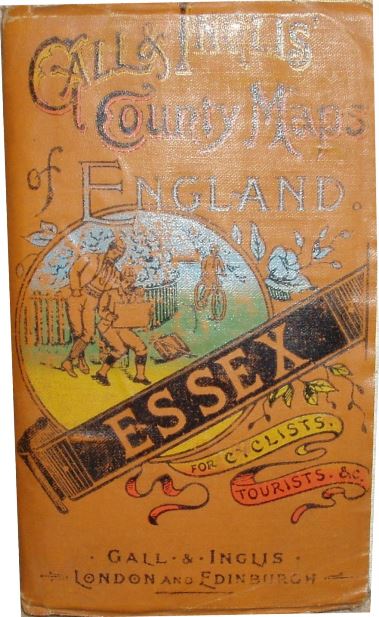
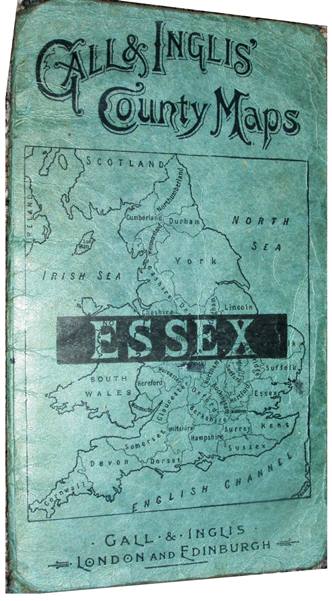
177 x 96mm for 481 x 613mm 152 x 91mm for 481 x 613mm 173 x 99mm for 478 x 612mm
Cruchley's Reduced Ordnance Map The Half Inch Map of England
1865 Sheet 27, 1900
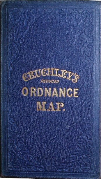
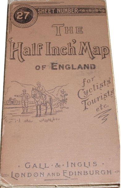
184 x 105mm for 501 x 662mm 139 x 75mm for 514 x 644mm
AH Swiss' No 12. Hunting Map
The Hertfordshire, Essex, Suffiolk and South Cambridgeshire District, 1895
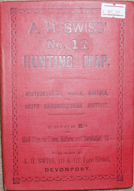
170 x 119mm for 769 x 983mm
Addresses:
1823-24 349 Oxford Street
1824-33 38 Ludgate Street
1830-76 81 Fleet Street
1877 Some plates acquired by Gall & Inglis
Taken from British Map Engravers, Worms & Baynton-Williams
Addresses:
1857-78 6 George Street, Edinburgh
. . 1857-78 13 George Street, Edinburgh, as well
. . 1872-74 30 Paternoster Row, London, as well
. . 1875-1909 25 Paternoster Square, London, as well
. . 1909-> 31 Henrietta Street, London, as well
1878 20 Bernard Terrace, Edinburgh
1924 12 Newington Road, Edinburgh
Taken from British Map Engravers, Worms & Baynton-Williams, and IMCOS Journal Issue 73, Summer 1998.
International Map Collectors' Society Journals
There have been three articles on Cruchley and Gall & Inglis in the IMCoS Journals: Issue 73 (Summer 1998), pp 7-12; Issue 93 (Summer 2003), pp 21-38; and Issue 101 (Summer 2005), pp 5-18. These can be read on the Journal page of the www.imcos.org website if you are a member of IMCoS; non-members can only read the contents pages of the Journals - a good reason to join!
Return to the Map publishers main page.