British Atlas
The Atlas was first published in 1837 (Essex is dated 1835), and then several times to 1870 (or later), as Hobson's Fox Hunting Atlas (1850 to 1880), as Walker's fox hunting atlas and as Lett's Popular Atlas (1884 & 87). The maps were also published separately, dissected on cloth and folded up between boards.
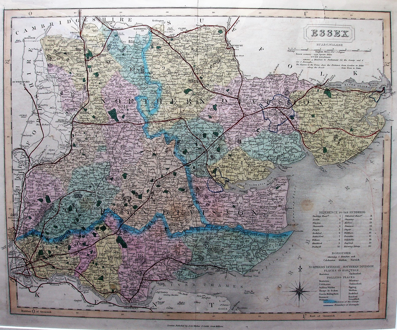
Hundreds referenced to a table, plus listing parliamentary boroughs, places of election and polling places. Hundreds colour washed (but not edge-coloured), with Colchester, Harwich & Maldon Boroughs all blue-lined. Seven Polling Places in North, 7 in the South. The three Divisions are thickly edge-coloured, but the names of the two old Divisions (Northern and Southern) are still printed across the face of the map (it had changed from two to three Divisions in 1868). Major roads have a thicker line on one side; all roads uncoloured.
"By J & C Walker", and along bottom "London Published by J&C Walker 9 Castle Street Holburn."
Scale correct at 1+12 miles = 83mm, or 4.0 miles/inch, ie 1:255,000.
The black quad line from north Colchester to Hythe now continues down to Wivenhoe (authorised 1859; opened 1863) and Brightlingsea (1861; 1866), all with an overlaid red line; there is also a red line (with no underlying black lines) from Wivenhoe to Walton (1864; 1867). There is a black triple line from Loughton to High Ongar (1859; 1865), with a red overlay. Loughton station now appears as a siding marked by a black quad line, with no red.
There is a black quad line from St Margarets to Buntingford (1858; 1863), with red overlay. The railway from Wendons Ambo via Saffron Walden (1861; 1865) to Bartlow (1863; 1867) is shown solely as a red line. The railway "From Shelford" to Haverhill and Clare (1860; 1865) is marked by a black quad line with red overlay, as is the railway from Chapel to Halstead to Haverhill (1859; 1863). The red line from Marks Tey to Sudbury (1846; 1849) now goes into and out of Sudbury correctly, whilst the old black quad line (incorrect) is still present. There is a black triple line from Bishops Stortford through Dunmow to Braintree (1861; 1869), with red overlay. The Walthamstow branch (1864; 1870) is not shown.
There is no date on the map, but from the red lines I estimate it was sold in c.1869.
Many J&C Walker maps are shown on the Walker's Map Publisher page.