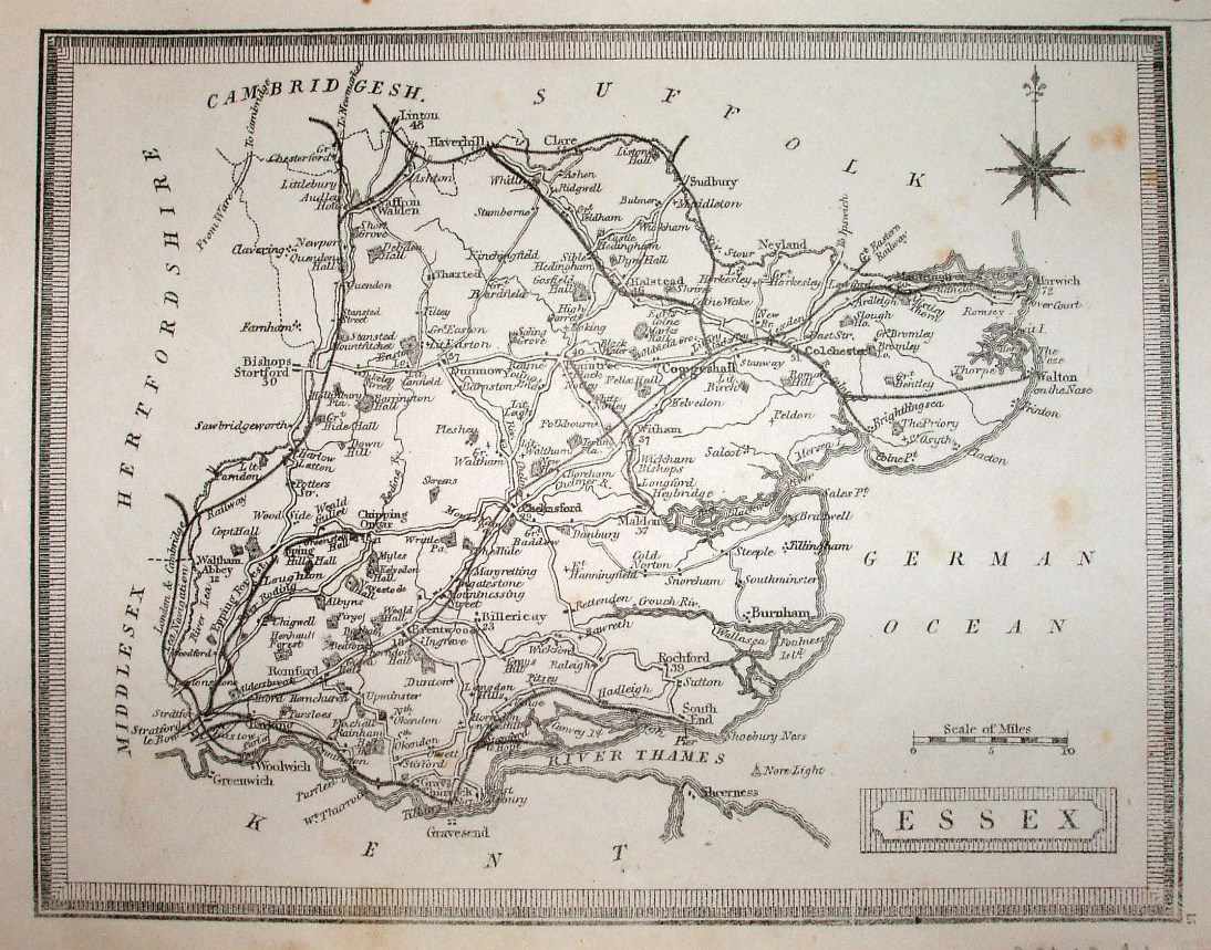
Heywood's County Atlas of England and Wales
The same underlying map as for Heywood 1858, ie Teesdale's 1830 A New Travelling Atlas, but now with many added railways.
Displayed scale of 10 miles = 25.8mm, or 9.8 miles/inch; actual scale 10.1 miles/inch, or 1:640,000.
The lines to Walton-on-the-Naze and Saffron Walden to Bartlow are both shown (opened 1867), but not Bishops Stortford to Braintree (opened 1869).