A Complete County Atlas of England & Wales
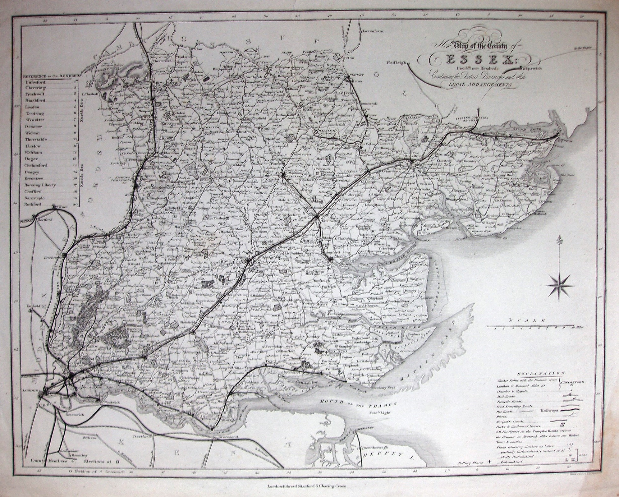
Essentially the same map as Duncan 1833 and Duncan 1845, but now with more railways, including Chapel to Halstead (opened 1860).- The Explanation table now has Railways (in a different font and size from other legends).
Scale correct at 10 miles = 65mm, or 3.9 miles/inch, ie 1:250,000.
The map's date is estimated from the railways.
Gibson's Flora of Essex
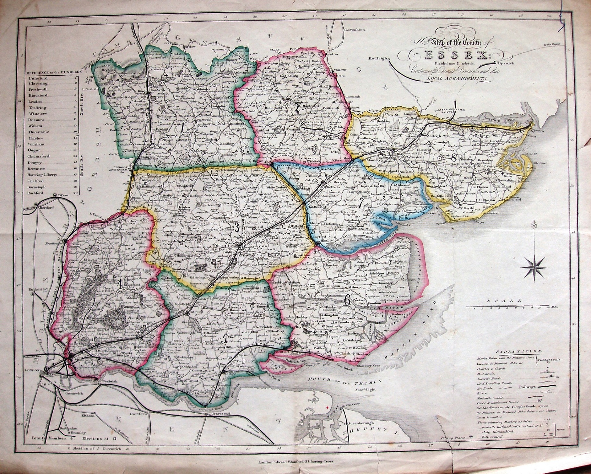
The Ebden/Duncan map as above, but as used in Gibson's Flora of Essex (1862). The county is divided into 8 edge-coloured areas, which are prominently numbered and used for Botanical Districts; the same map is also in the Victoria History of Essex.
Scale correct at 10 miles = 65mm, or 3.9 miles/inch, ie 1:250,000.
The map is dated from the Flora publication, but it is the same underlying map as the 1860 above.