Seller's Supplement to the Antiquities of England and Wales
This "Supplement" formed volumes 5 & 6 to the slightly earlier four volume topographical work by Grosse called the Antiquities of England and Wales. A new issue in 1787 puts the Supplement in volume 7. The plates had been used before.
There were further issues in 1788, 89, 92 97 & 1809, but in all of them the maps are those issued by Seller, starting with his Anglia Contracta in 1694 (& in Seller's subsequent publications).
Whether Grosse deliberately used old maps to complement his Antiquities, or simply because cheap plates were available, is not known.
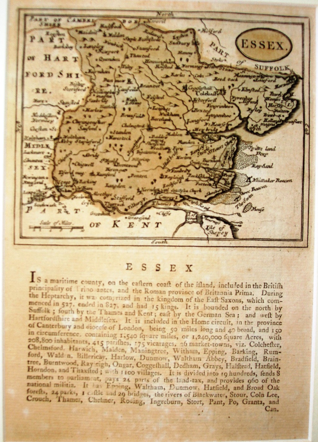
Displayed scale of 10 miles = 26mm, or 9.8 miles/inch; actual scale = 12.2 miles/inch, or 1:775,000.