The two 1910 maps are dealt with on this page, as they are essentially identical. Below is the 1910 red cover version (the 1st of the 2 covers)
as this is the clearer copy.
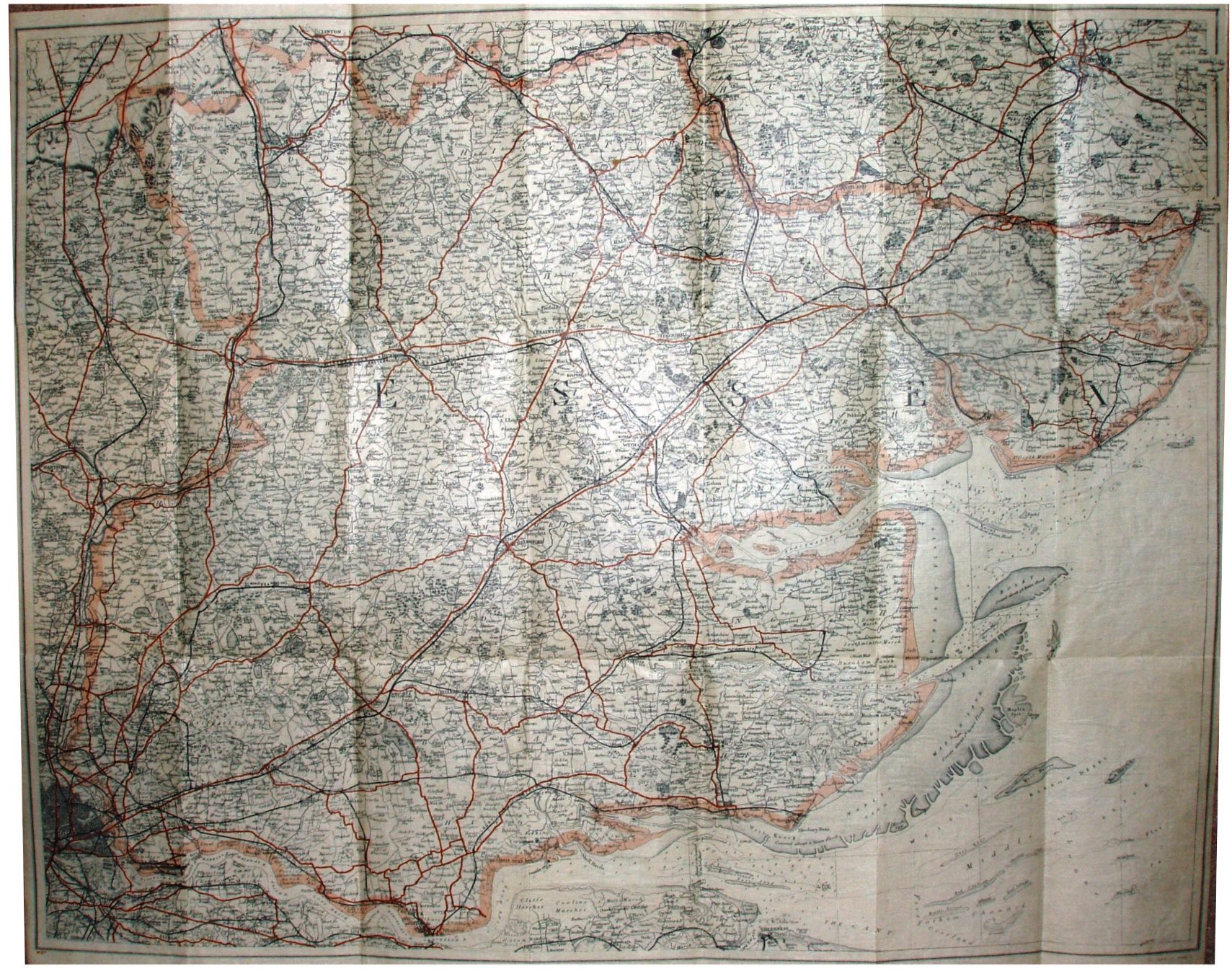
Gall & Inglis' County Maps of England, for Cyclists, Tourists, &c. Essex
The two maps have the same cover design as on the 1895 maps above, using the same two cover sizes as before, but with new maps; the differences between the two maps are:
1. Red, tall cover - Code M3x - paper on cloth
2. Dun, short cover - Code M3x - paper on cloth
There is no panel regarding elevation (as used in 1896) on either map. The Parliamentary Divisions are no longer shown - and, most differently, the details of the map go to the edge of the paper sheet, not stopping at the county border (which is edge-coloured).
Scale correct at 10 miles = 105mm, or 2.4 miles/inch, ie 1:155,000(about 10% bigger than before).
By now the name of "Cruchley" no longer appears on the cover or on the map. In fact there is no title on the map at all; the "German Ocean" in the North Sea has also gone. The map is no longer based on the same Cary plates as for the earlier folding maps.
On the railways there is the branch line down to Tollesbury Pier (opened 1907), but not the Elsenham to Thaxted light (opened 1913). My dating is based on these two dates - although as they don't show the Thaxted railway on their "1928" map either (the next map), this date could be wrong by several years.