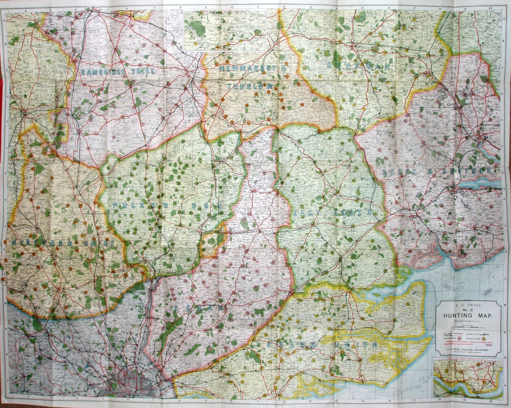
AH Swiss No. 12 Hunting Map
Paper on cloth map, folded between hard red boards, with a booklet listing the Hunts and their Meets. The Foxhound Hunts covered are: The Cambridgeshire; The Essex; The East Essex; The Essex Union; The Essex and Suffolk; The Hertfordshire; The Newmarket and Thurlow; The Puckeridge and the Suffolk; it also covers the The Essex Staghounds, and Mr Greene's Staghounds. The Meets are indivated on the maps, plus the territories of the Hunts edge-colured (for the foxhound hunts, not for the staghound hunts which overlap the former.)
Displayed scale of 5 miles = 63.5mm, or 2.0 miles,inch, ie 1:127,000.
There were at least three editions of this map, and from this one plus the 3rd edition one held at CUL I believe this is a second edition map from c.1895. Main roads are in red, and railway lines in black.
This map is based on a lithographic transfer from Cary's Improved Map of England and Wales (1832).
On the railways the line from Forest Gate to Tottenham is present (opened 1894), but not the Corringham light (opened 1901) or the Chigwell loop line (opened 1903).