Hobson's Fox Hunting Atlas : Essex
The Atlas was first published in 1837 (Essex is dated 1835), and then several times to 1870 (or later), as Hobson's Fox Hunting Atlas (1850 to 1880), as Walker's fox hunting atlas and as Lett's Popular Atlas (1884 & 87). The maps were also published separately, dissected on cloth and folded up between boards.
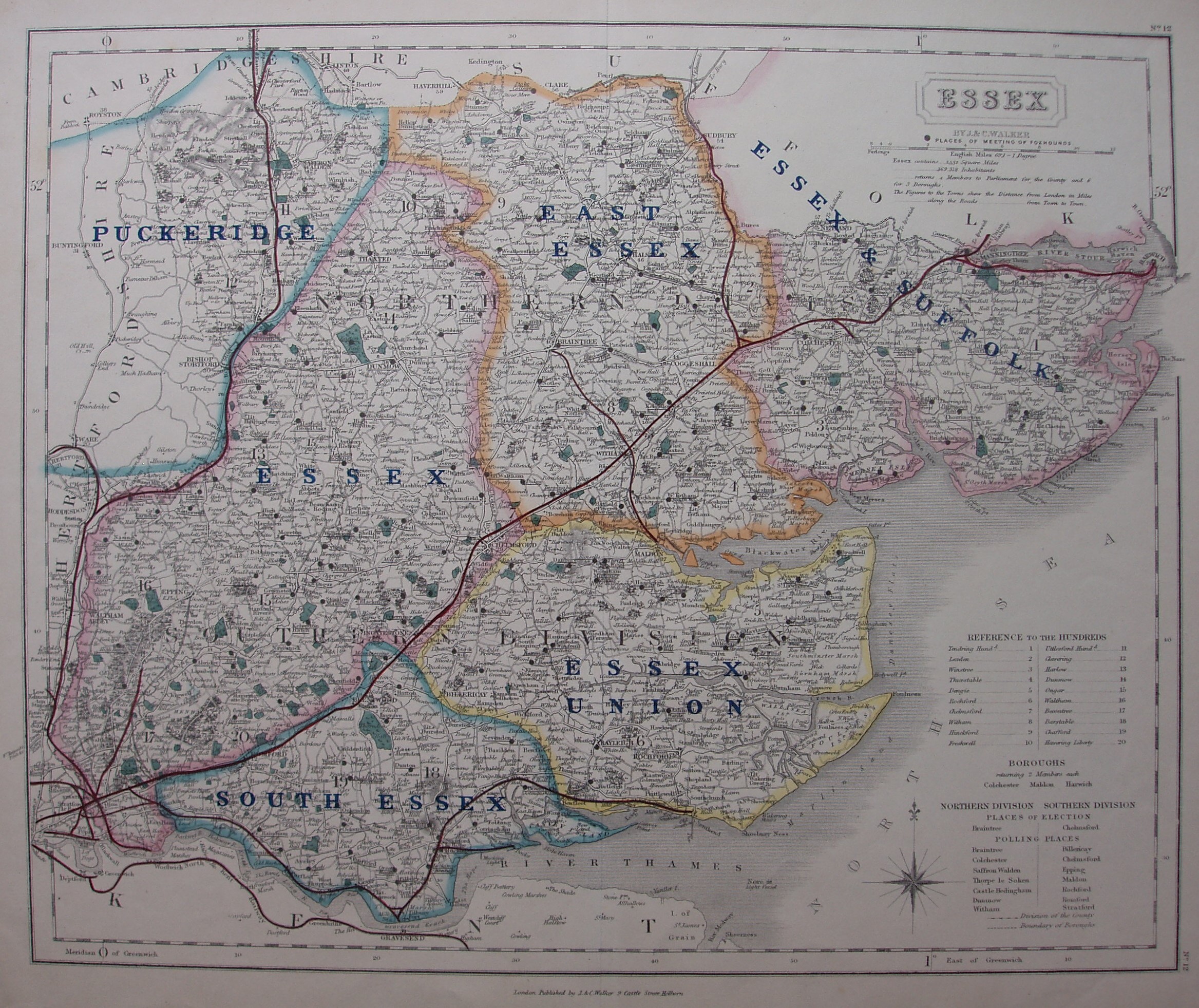
Being Hunt maps, no Hundreds or Parliamentary Boroughs or Divisions are shown, although the Hundreds' names are still present in a table as well as the listings of parliamentary boroughs, places of election and polling places (7 north and 7 south). The Divisions are still named on the map, but are uncoloured with just a faint dashed line for the boundary. Major roads have a thicker line on one side but all roads uncoloured.
The Compass rose is in the North Sea, just west of list of Polling Places. No. 12 in small font at top right and bottom right outside the border.
A new black Triple line runs from Barking to Stepney (authorised 1856; opened 1858). There is no line from St Margarets to Buntingford (1858; 1863). The railways shown include the Barking via Tilbury to Southend (1852; 1856) and Chapel to Halsted (1856; 1860) in black only. The Gt Chesterford to Newmarket line (opened 1848 but closed 1852 and the track removed by 1856) is also shown, but the Hythe to Wivenhoe line (1859; 1863) is not.
"By J & C Walker", and along bottom "London Published by J&C Walker 9 Castle Street Holburn." There is no date on the map, but from the red lines I estimate it was sold in c.1859.
Scale of 1+12 miles = 83mm, or 4.0 miles/inch; actual scale = 3.9 miles/inch, or 1:250,000.