British Atlas
The Atlas was first published in 1837 (Essex is dated 1835), and then several times to 1870 (or later), as Hobson's Fox Hunting Atlas (1850 to 1880), as Walker's fox hunting atlas and as Lett's Popular Atlas (1884 & 87). The maps were also published separately, dissected on cloth and folded up between boards.
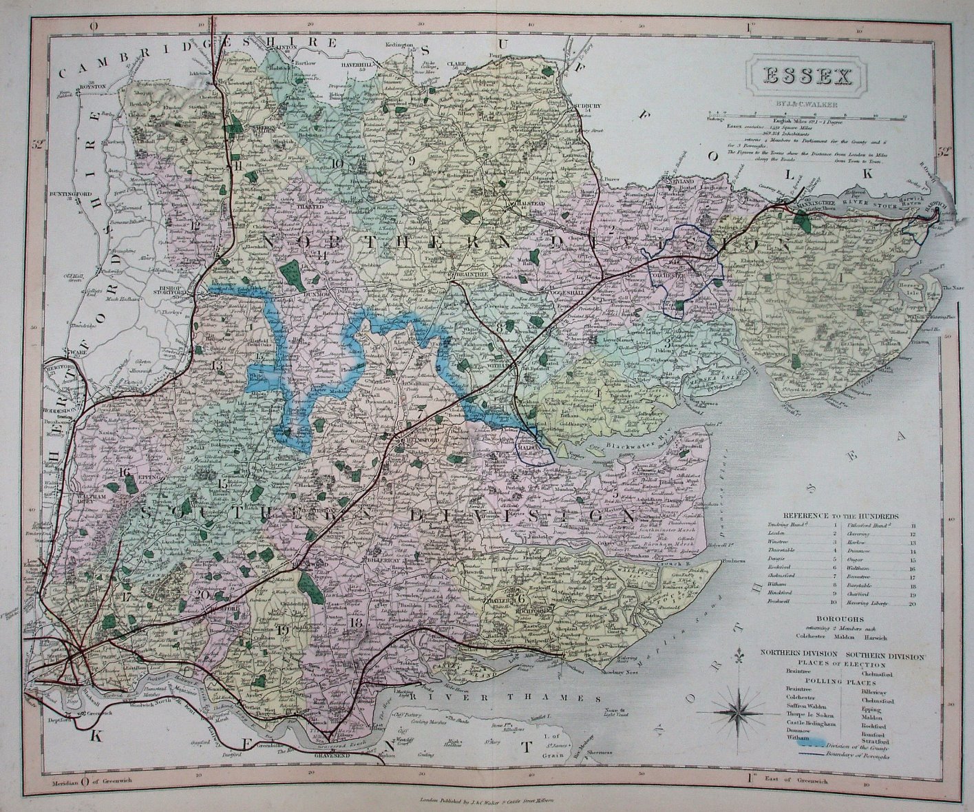
Hundreds referenced to a table, plus listing parliamentary boroughs, places of election and polling places. Hundreds colour washed (but not edge-coloured), with Colchester, Harwich & Maldon Boroughs all blue-lined (although the one for Maldon is missing its northern arc). Seven Polling Places in North, 7 in the South. Divisions thickly edge-coloured. Major roads have a thicker line on one side; all roads uncoloured. The compass rose is in the North Sea.
I also have a another absolutely identical copy of this map which I was told came from a "Wyld's Atlas" of 1877. I have not found any other references to such an atlas.
Scale correct at 1+12 miles = 82mm, or 4.0 miles/inch, ie 1:250,000.
The black "quad line" from Manningtree to Harwich (authorised 1847; opened 1854) now has a red line over it. There is a black quad line from Epping Lower Forest to Tilbury and Mucking (1852; 1854), Pitsea (1852; 1855) and Southend (1852; 1856), with a branch from Mucking to Thames Haven Docks (1853; 1855) - all with red overlay. There is a black quad line from Stratford to the middle of the old Blackwall Rail (1845; 1849), and black quad lines from both Stratford and West Ham curving north westwards and then west (opened 1850) - all with red overlay.
There are black quad lines from Grosvenor House to Red House and from Ilford to Red House (both authorised 1846 but never built) but with no red overlay; there is a black quad line with red overlay from West Ham through Red House to Loughton (1853; 1856). There is also a black quad line with red overlay from Gt Chesterford heading towards Newmarket; this line opened in 1848 but closed in 1852 - and the track removed by 1856. The north Kent line (1837; 1849) now has the quad black lines under the red.
"By J & C Walker", and along bottom "London Published by J&C Walker 9 Castle Street Holburn." There is no date on the map, but from the red lines I estimate it was sold in c.1856.