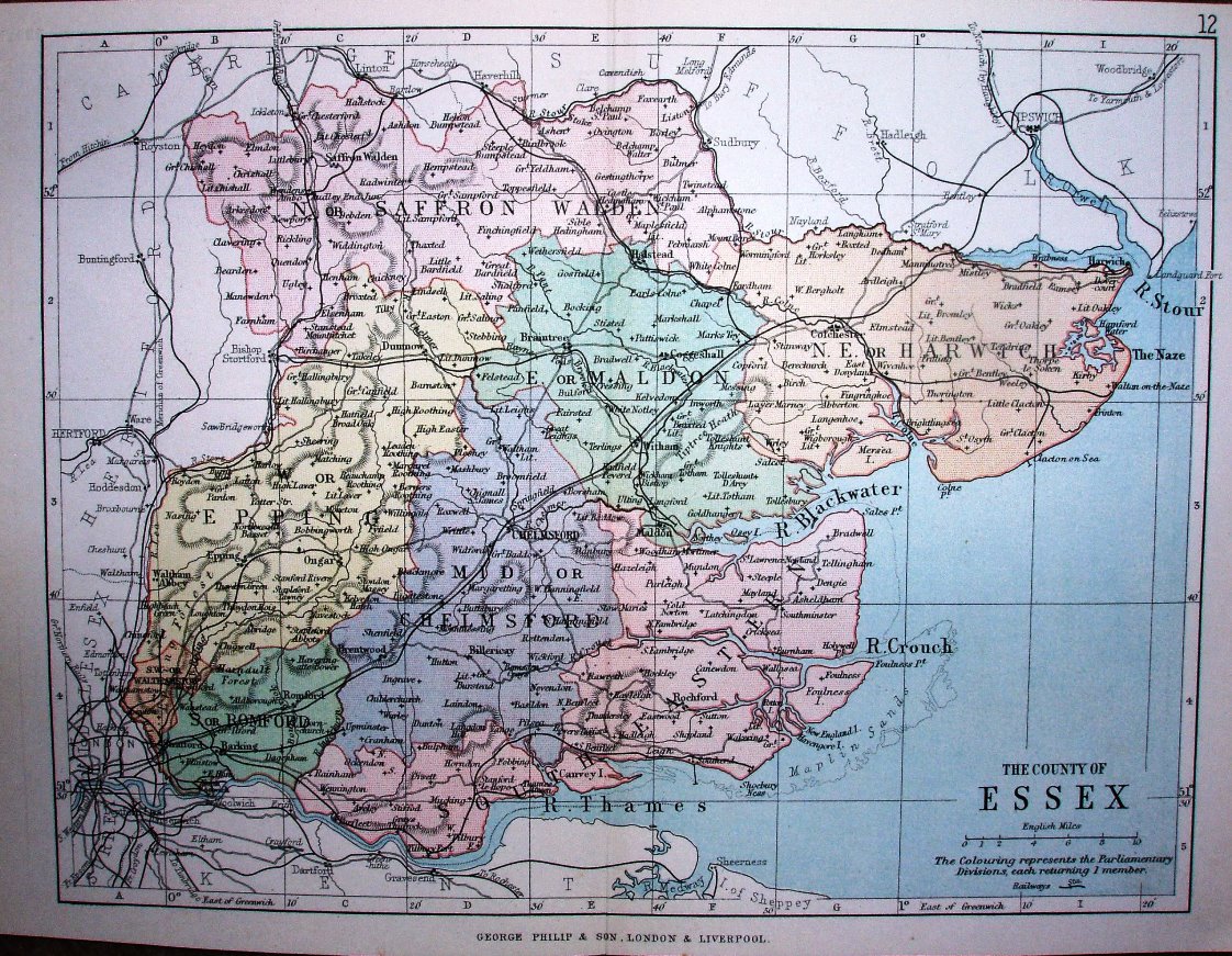
Philips' Handy Atlas of the Counties of England
The new Parliamentary Divisons of 1885 are separately coloured, but without the green parks/estates of the (much larger) 1885 Philips map. Other examples of this map are 1873, 1882, 1890 and 1895
Scale correct at 10 miles = 30.3mm, or 8.4 miles/inch, ie 1:530,000.
The railway is shown as far out as Upminster (opened 1885), but not continuing on to Laindon (opened 1886).