Bacon's County Map & Guide Essex
Folding map with booklet, aimed at cyclists, with much text on Essex (political, physical, geological, industrial, antiquities and places of interest) and principal towns, plus 1891 populations.
The man and woman are now standing next to their machines (as in the 1901 edition, the next map), with the label under the woman's bike "The Rover Cycles"; across the top of the cover is "Showing Danger Hills". The "G" in Guide is the same style as in the 1896 copy. Price: Cloth case 6d, On Cloth 1s. Advert for Fry's Cocoa on back cover.
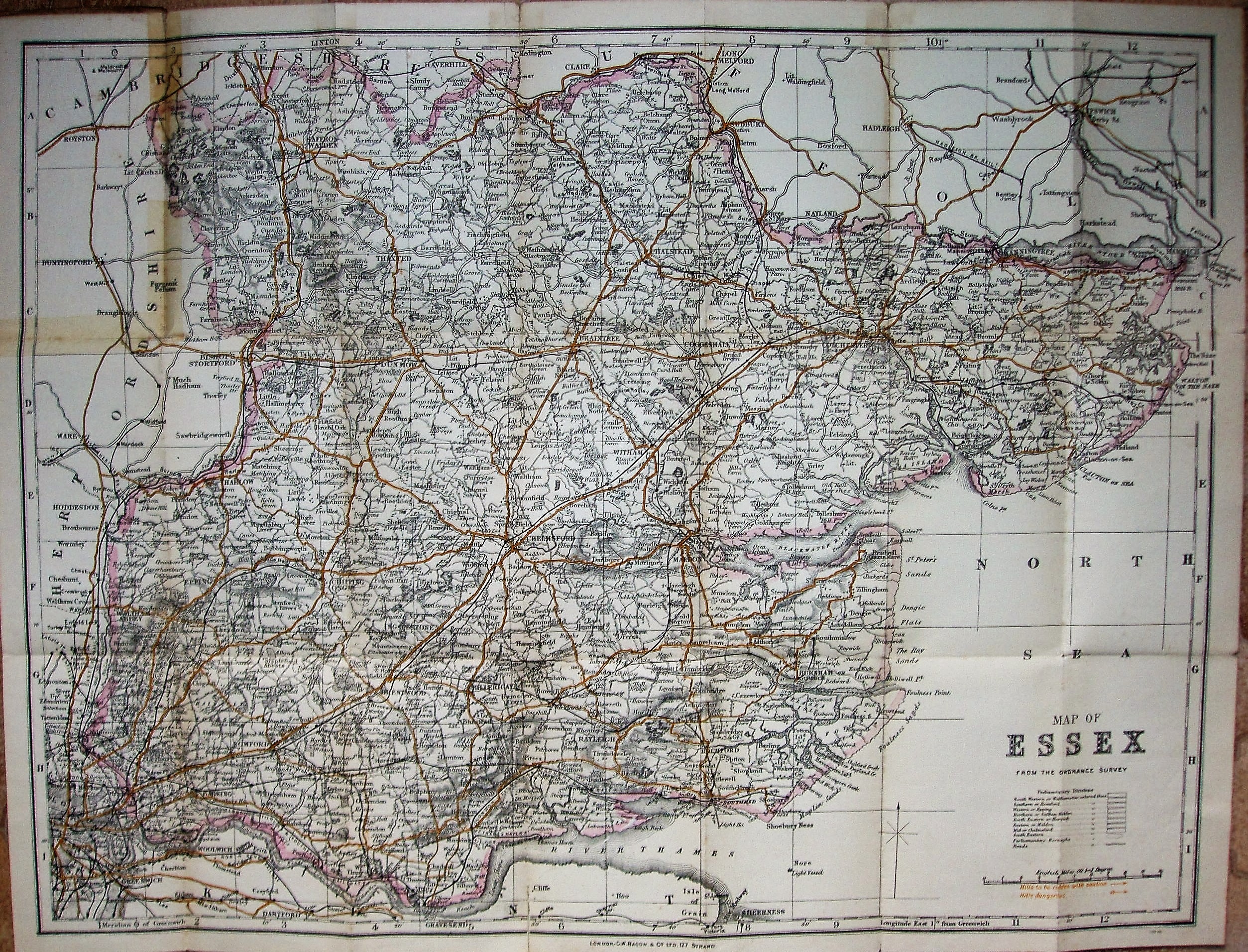
Displayed scale of 10 miles = 94.5mm, or 2.7 miles/inch; actual scale of 2.6 miles/inch, or 1:165,000.
The Parliamentray Divisions are not shown, but it still has the table listing them - albeit without colours. Has code 68G30 at bottom right corner outside border, plus warning of Hills that are Dangerous or to be ridden with caution - shown by orange arrows on the map.
Has the Forest gate to Tottenham railway line (opened 1894), but not the Corringham light (1901 - but not shown on later Bacon maps either) or Chigwell loop (1903).