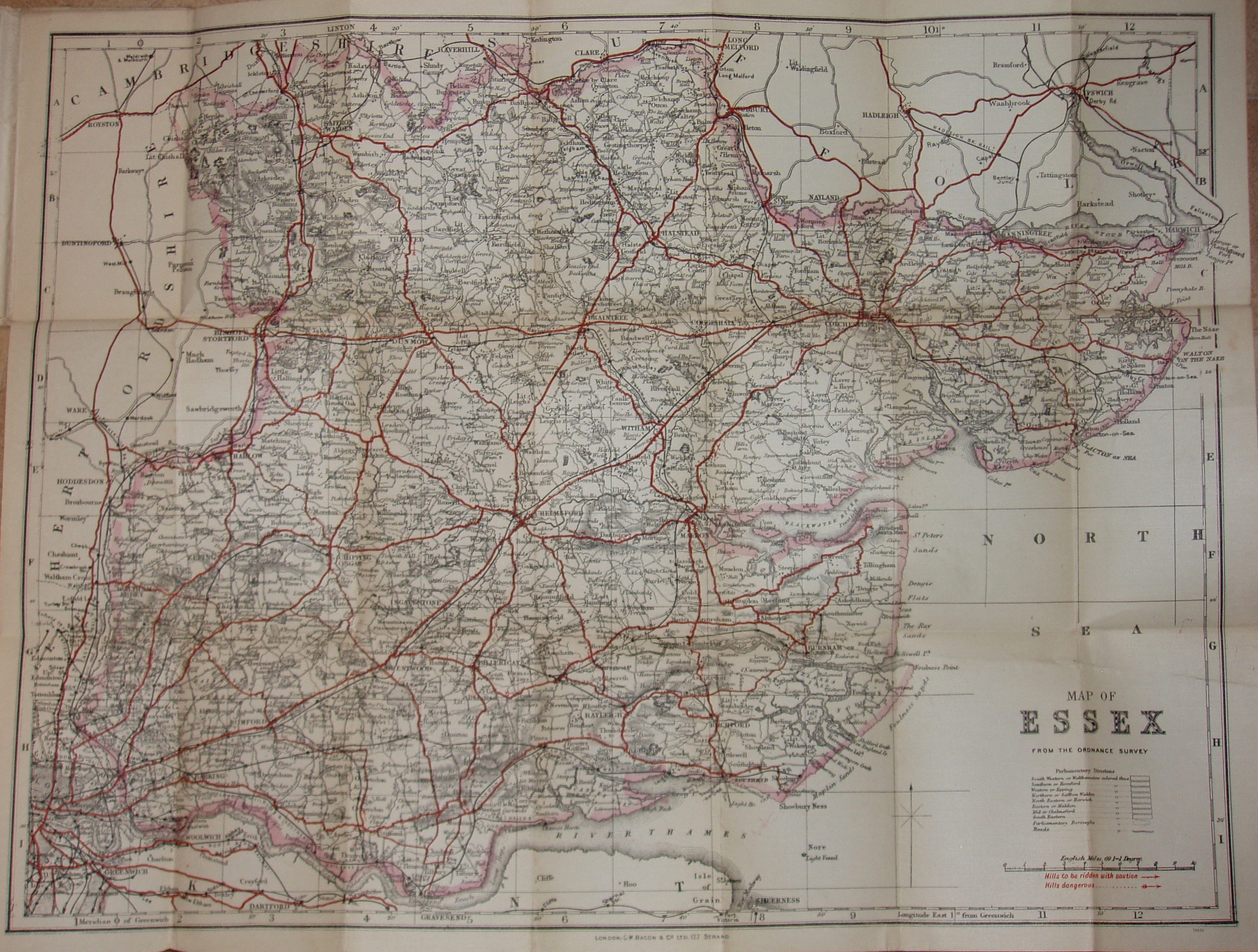
Bacon's County Map & Guide Essex
Folding map with booklet, aimed at cyclists, with much text on Essex (political, physical, geological, industrial, antiquities and places of interest) and principal towns, plus 1891 populations.
The man and woman stand next to their machines (as in the 1899 edition), with the label under the woman's bike "The Rover Cycles". Has "Showing Dangerous Hills" across top of front cover. Has less ornate style of G (for Guide) than in 1899. No advert back cover. Monochrome on dun cover, except Essex & man's jacket in red (not the blouse).
Displayed scale of 10 miles = 94.5mm, or 2.7 miles/inch; actual scale of 2.6 miles/inch, or 1:165,000.
The Parliamentray Divisions are not shown, but it still has the table listing them - albeit without colours.
Has the Forest gate to Tottenham railway line (opened 1894), but not the Corringham light (1901 - but not shown on later Bacon maps either) or Chigwell loop (1903). This map must lie between the 1899 and 1906 versions, but no later than 1901.