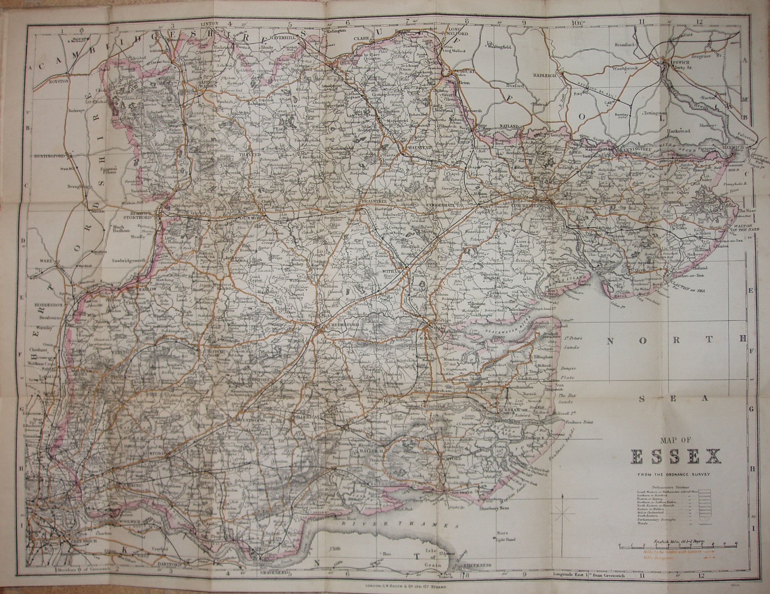
Bacon's County Map & Guide Essex
Folding map with booklet, aimed at cyclists, with much text on Essex (political, physical, geological, industrial, antiquities and places of interest) and principal towns, plus 1891 populations.
Have a man and a woman both with drop-handlebars, and the man's cycle labelled as "The Rover". In Cloth In Case 1/-.
Displayed scale of 10 miles = 94.5mm, or 2.7 miles/inch; actual scale of 2.6 miles/inch, or 1:165,000.
The Parliamentray Divisions are not shown, but it still has the table listing them for the colours shown on the 1892 map. Code of 68G30 at bottom right corner outside border, plus warning of Hills that are Dangerous or to be ridden with caution - shown by orange arrows on the map.
Has the Forest gate to Tottenham railway line (opened 1894), but not the Corringham light (1901 - but not shown on later Bacon maps either) or Chigwell loop (1903).