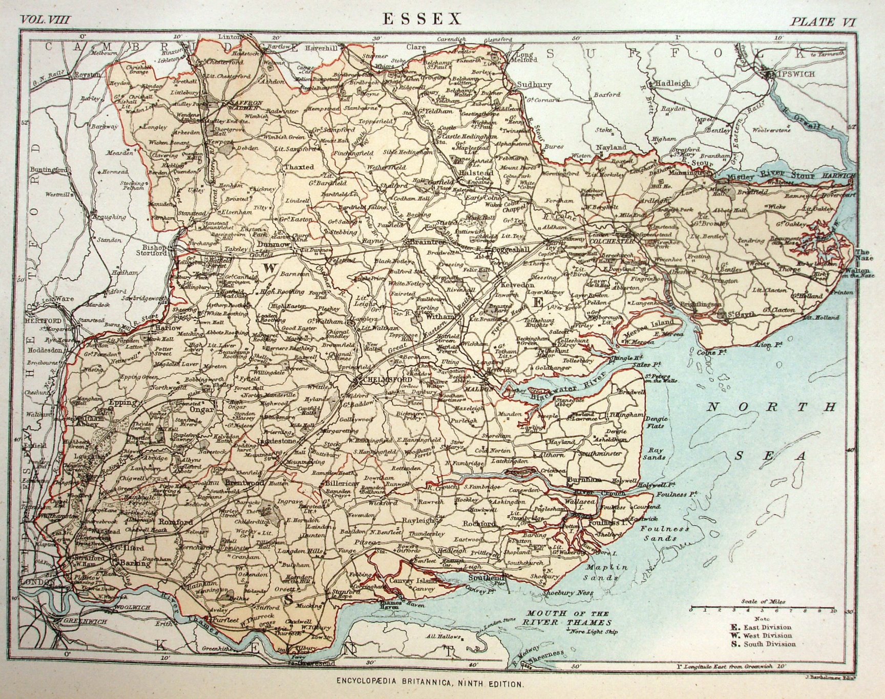
Encyclopaedia Britannica - Essex
Taken from the 9th Edition of Britannia, before the Americans started pirating. The 1868 - 1885 Parliamentary Divisions are shown within the county, with a list of them below the scale bar. Around the edges are "Vol VIII", "Plate VI", and "Encyclopaedia Britannica Ninth Edition", and "J Bartholomew". Bright red lines delineate the Divisions and the county boundary, with a yellow/orange colour wash for the county.
Scale correct at 10 miles = 36.5mm, or 7.0 miles/inch, ie 1:440,000.
The (original) map was revised slightly for the W & AK Johnston reprint in 1892.
The railways include Walthamstow to Chingford (opened 1873) but not Thorpe-le-Soken to Clacton (1882); can't tell if Liverpool Street is present (1875).
The story of the American piracy of Encyclopaedia Britannica is described on a separate page.