Universal Geography
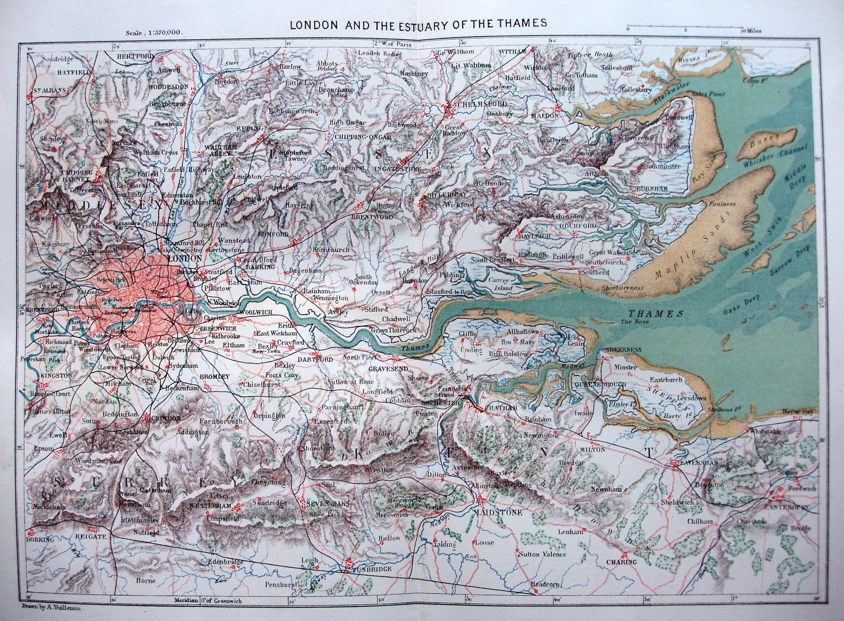
Universal Geography was published in 38 volumes from 1878 to 1894. This map shows London and the Estuary of the Thames, with coloured sea, sand, rivers, towns & major roads. It runs NW to Hertford, NE to Mersea island, SE to Canterbury, and SW to Dorking.
Scale of 10 miles = 41.8mm, or c6 miles/inch, ie 1:370,000.
No line to Shoeburyness (opened 1884), but has Liverpool St (1874/75), & hence the estimated date.