The Panorama, or Traveller's Instructive Guide
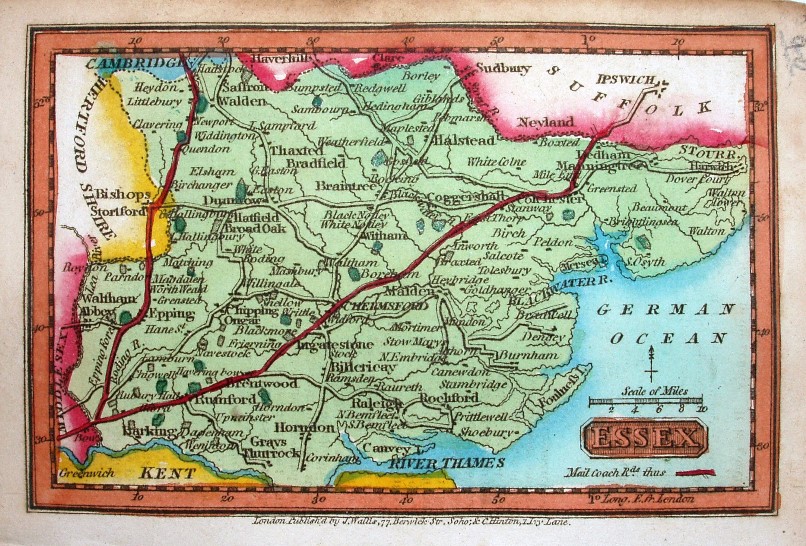
A very small map, but shows major villages as well as towns, with feint rivers but prominent roads, especially for mail coaches from London to Cambridge and to Ipswich.
Scale correct at 10 miles = 16mm, or 15.9 miles/inch, ie 1:1,000,000.
Published with WH Reid. The maps from Miller's New Miniature Atlas of 1810 re-issued in this atlas (as well as in Darton's Miniature Atlas, the next map chronologically). They then were in a re-issue of this atlas in 1825 (by Hinton), and in Rueben Ramble's Travels through the Counties of England in 1825 et seq.