New Pocket Atlas of England and Wales
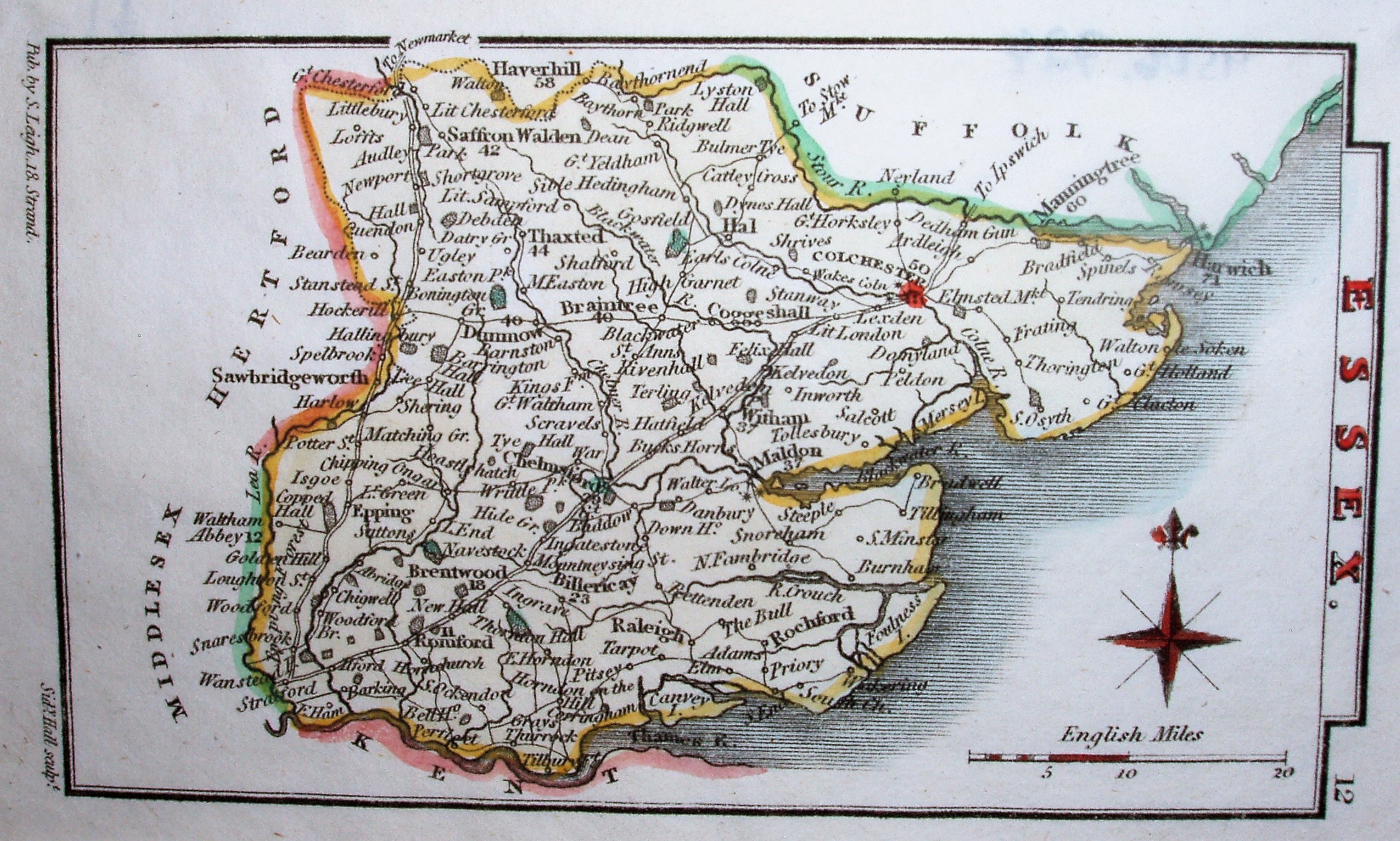
This could be from the New Pocket Atlas or from the "Picture" work - it is the same map. See Hall's Map Publisher page. There is a "12" in the top right corner alongside Essex - if you hold the map up in portrait fashion, which is how it was in the atlases. Major places have distances from London noted against them on the map, but they look pretty approximate.
On this copy county borders are edge-coloured (different colour per county), and a few parks are painted green. Colchester has a red mark, and Chelmsford a very small blue mark. Other copies just have a county edge-colouring and no other colouring.
Major roads (turnpikes?) are shown by a double line, whereas minor roads are shown by a single line; both have superimposed small circles to mark places. These look rather like railway lines, but they are only roads.
Across the base is: Pub by S. Leigh, 18 Strand and Sidy Hall sculpt.
Scale correct at 20 miles = 29mm, or 17.5 miles/inch, ie 1:1,100,000.