A Direction for the English Traveller
A tiny map with letters to mark towns.
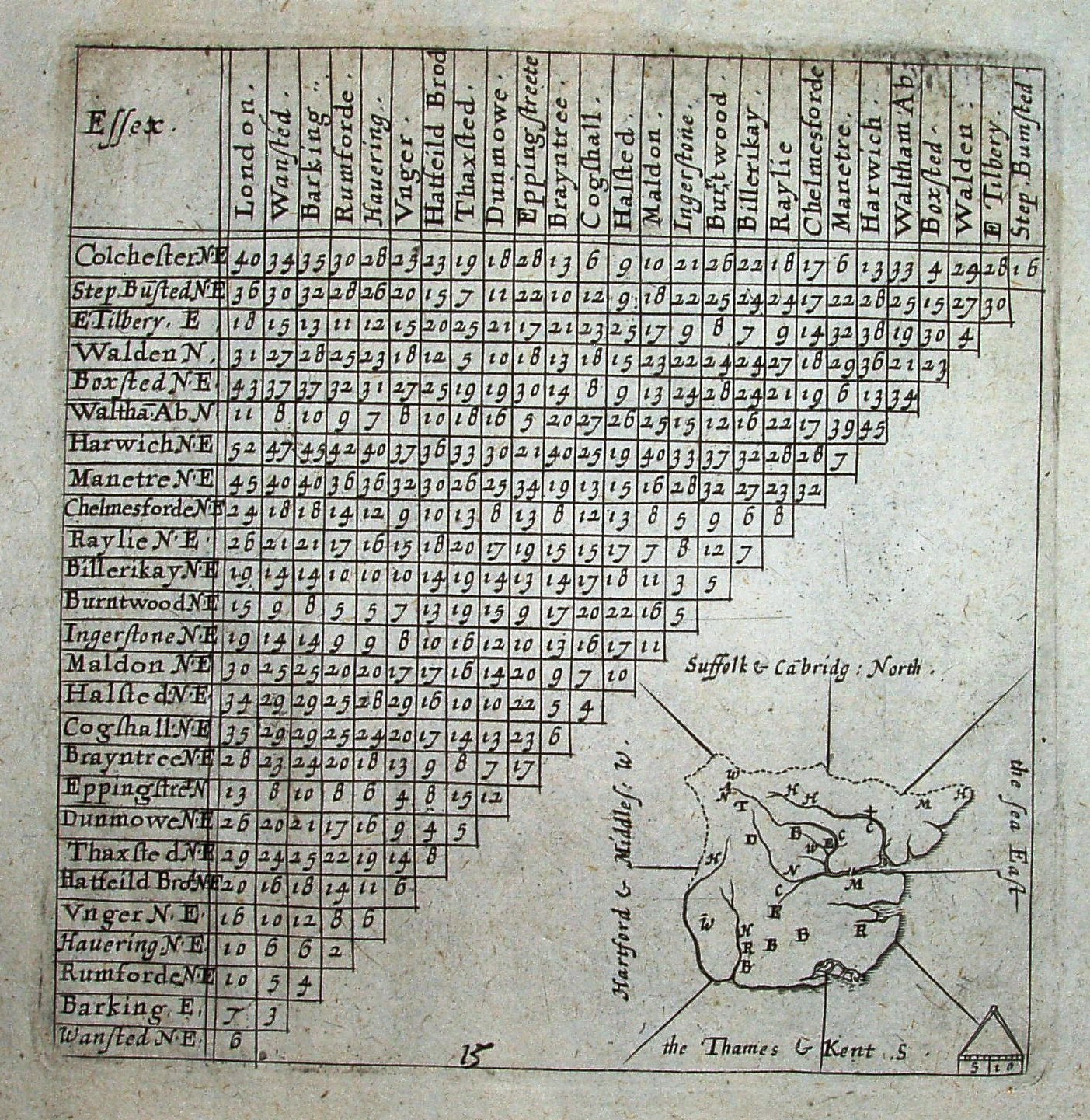
The distance table is taken from Norden's 1625 Intended Guyde, and the map engraved by Van Langeren. The page is quite small; the map on it is tiny.
Displayed scale of 10 miles = 6.2mm, or 41 miles/inch; actual scale = 51 miles/inch, or 1:3,250,000.
First published in 1635 it was re-published in 1636 (twice), and then in revised form by Jenner in 1643.