pre Atlas Novus
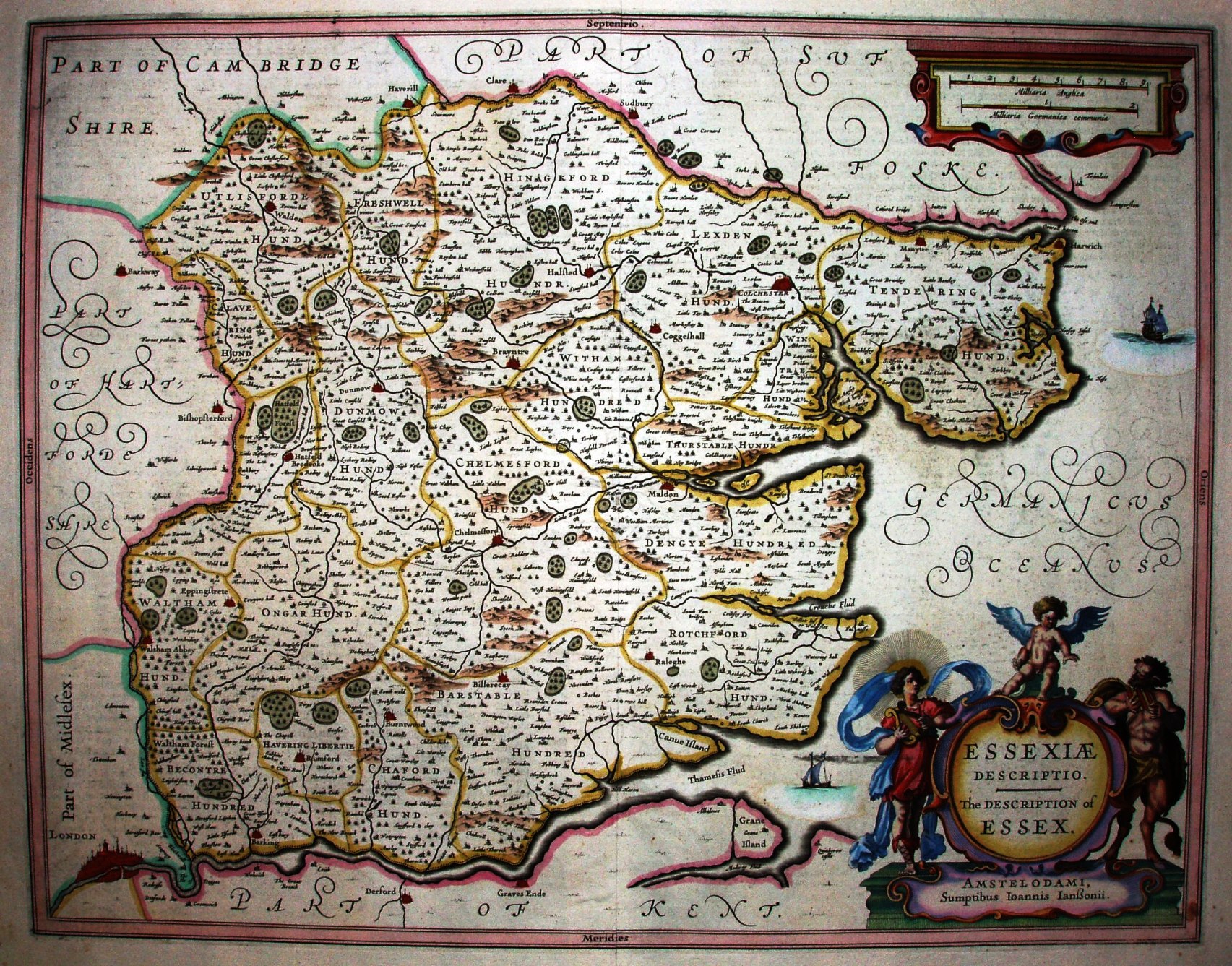
Jansson, as successor to the Mercator-Hondius publishing house, was assembling English county maps ready for his Atlas Novus; the Essex one was created in 1636.
There are no shields and there are two scales, but otherwise it is identical to the 1646 version used in the Atlas Novus.
Displayed scale of 9 Milliaria Anglica = 82.8mm, or 2.8 miles/inch (and also 2 Milliaria Germanica = 74mm); scale actual = 3.6 miles/inch, or 1:225,000.
The map is derived from Saxton, and hence has the same errors (Audley End wrong, Newport wrong, etc) In addition there is the extra river tributary added on the Speed 1611 map, running westwards to pass on the southern side of Newport to join the Cam. This does not exist, and there may well be other spurious changes.