The RAC Road Map and Gazetteer - Essex
The map of Essex is a fold-out large sheet at the back of the gazetteer.
The book has 36 pages - c. 20 being the gazetteer, and 8 pages of "Hotels, Garages and Other Useful Addresses" - ie adverts; the "3 pages" of circular routes are on the reverse of the map. This is the 2nd edition of volume 7 of 28 that cover most of England and parts of Wales, Scotland & Northern Ireland, published for the RAC by Ed J Burrows & Co Ltd, of Cheltenham, and 125 Strand, London. Price 1/6 Net.
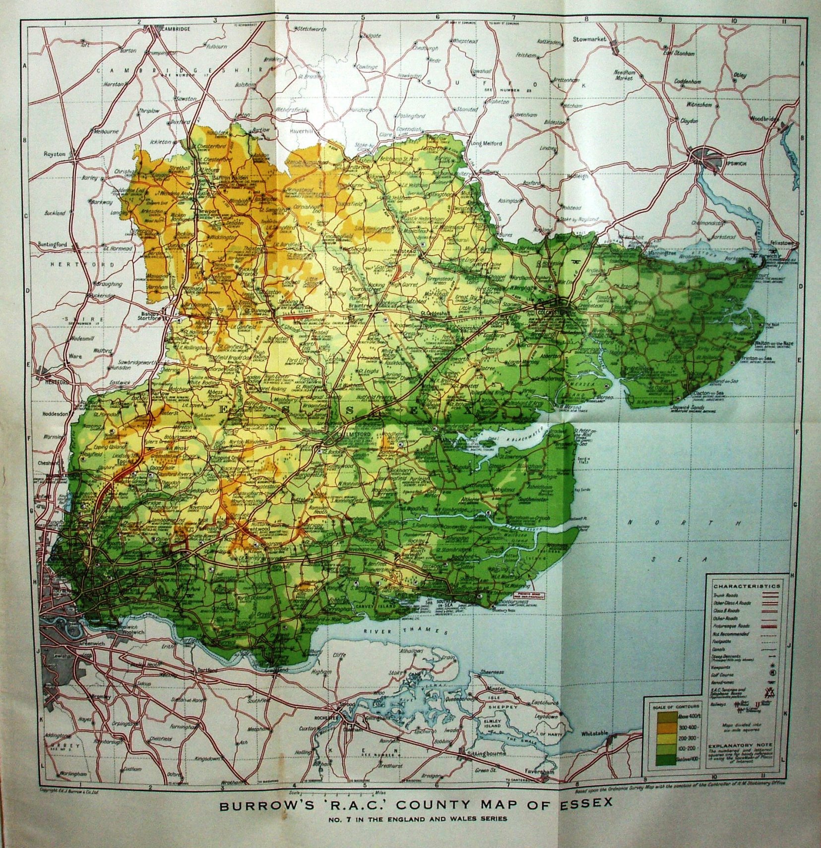
Scale correct at 6 miles = 38mm, or 4.0 miles/inch, ie 1:255,000.
The quarter inch maps have six mile square grid with columns numbered and rows lettered for the references in the gazetteer. Roads are characterised as being Trunk Roads, Other A Class Roads, Class B Roads and Other Roads (Class B Roads being a subset of the "Other Roads" in 1930).
No railways are shown - presumably deemed irrelevant for a motoring map. The A127 Southend Arterial is present, and Stanford-le-Hope is now bypassed (opened c.1932).