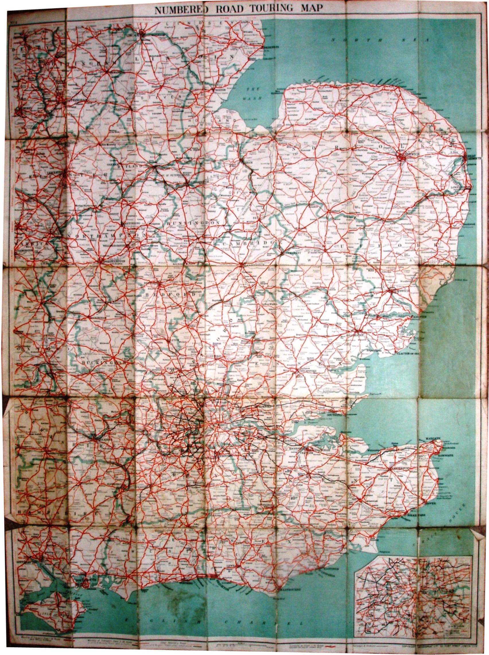
Numbered Road Touring Map, No 1 South Eastern Counties Map
Dark blue cover of the same design as for the 2 mile and 3 mile maps, with stuck-on labels for the title and the sketch map; cover pages stuck to front and back folds of the cloth. On Cloth Price 3/6 Net, On Cloth Dissected 5/- Net.
The map goes north to Chesterfield, north-east to Skegness, south-east to Dover and south-west to the Isle of Wight. Counties edge-bordered.
Scale correct at 15 miles = 76.8mm, or 5.0 miles/inch, ie 1:315,000.
Key of symbols across the base of the map, with major roads in red, plus bypasses and Arterials in black. Sea flat blue. Also has an inset map of London at 1:210,000.
The map is published by Geographia Ltd, 55 Fleet Street on the map and on the cover. Code of CU.MR = December 1936.