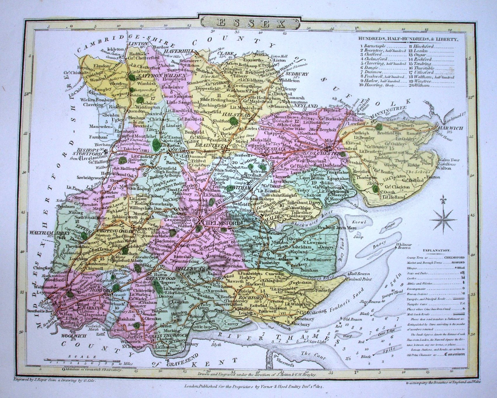
Two copies, both 1810, just coloured very differently.
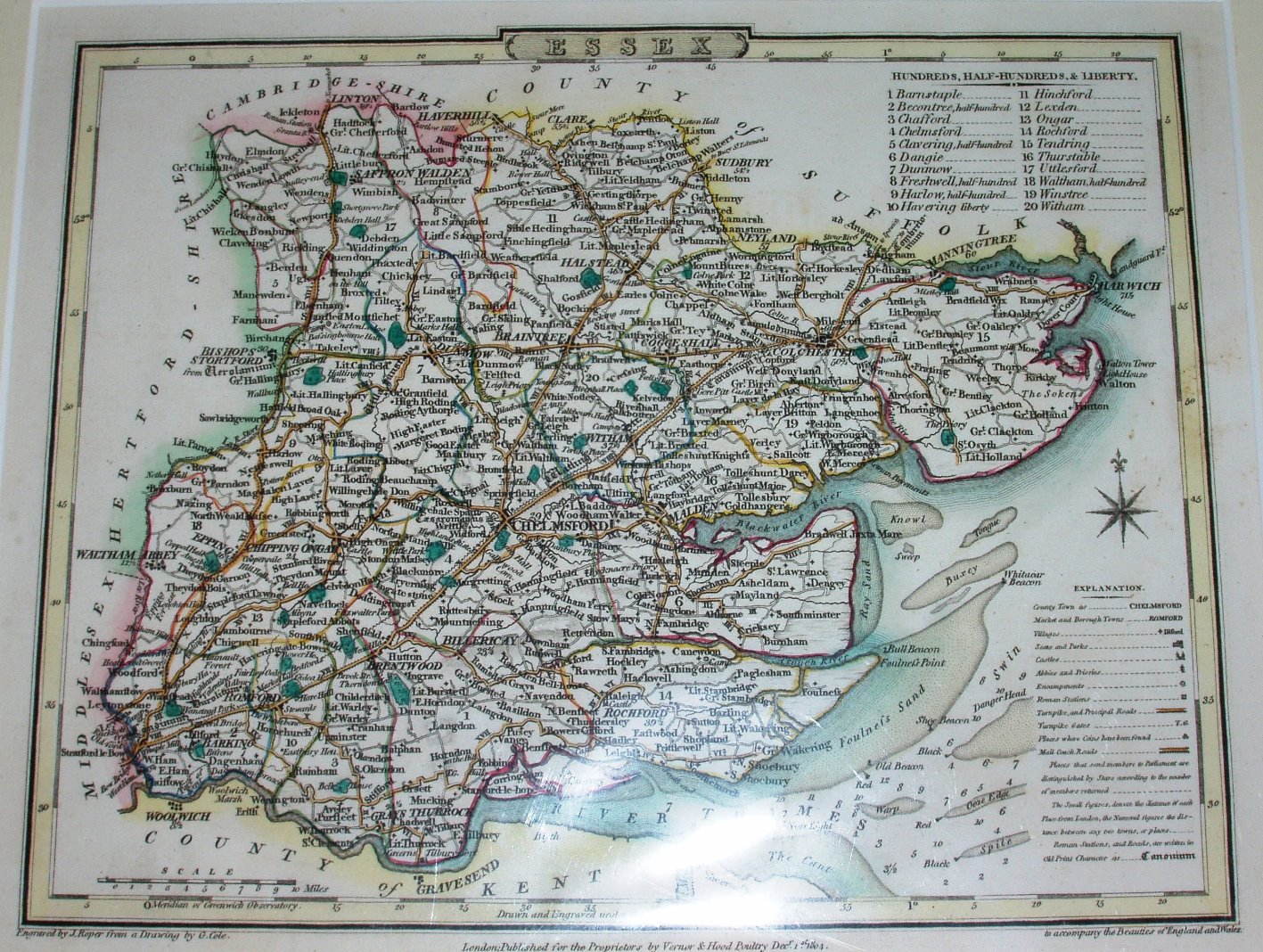
Two copies, both 1810, just coloured very differently.
The British Atlas
"Engraved by J Roper from a Drawing by by G Cole. London: Published for the Proprietor by Verner & Hood, Poultry Decr 1st 1804. to accompany the Beauties of England and Wales".
Displayed scale of 10 miles = 33.8mm, or 7.5 miles/inch; actual scale 7.8 miles/inch, or 1:495,000.
The plates were originally engraved for The Beauties of England and Wales by EW Brayley and J Britton, but were used unchanged (with their original individual map dates) in Cole & Roper's The British Atlas in 1810; they were then re-used in Joseph Nightingale's English Topography (1816, re-issued 1818 and 1820), and in the first edition of Dugdale's Curiosities of Great Britain, England & Wales Delineated 1835 (later editions used maps by Archer). The maps were then used via a lithographic transfer in Collins' Railway & Pedestrian Atlas of England, 1858.