Dugdale's Curiosities of Great Britain, England & Wales Delineated
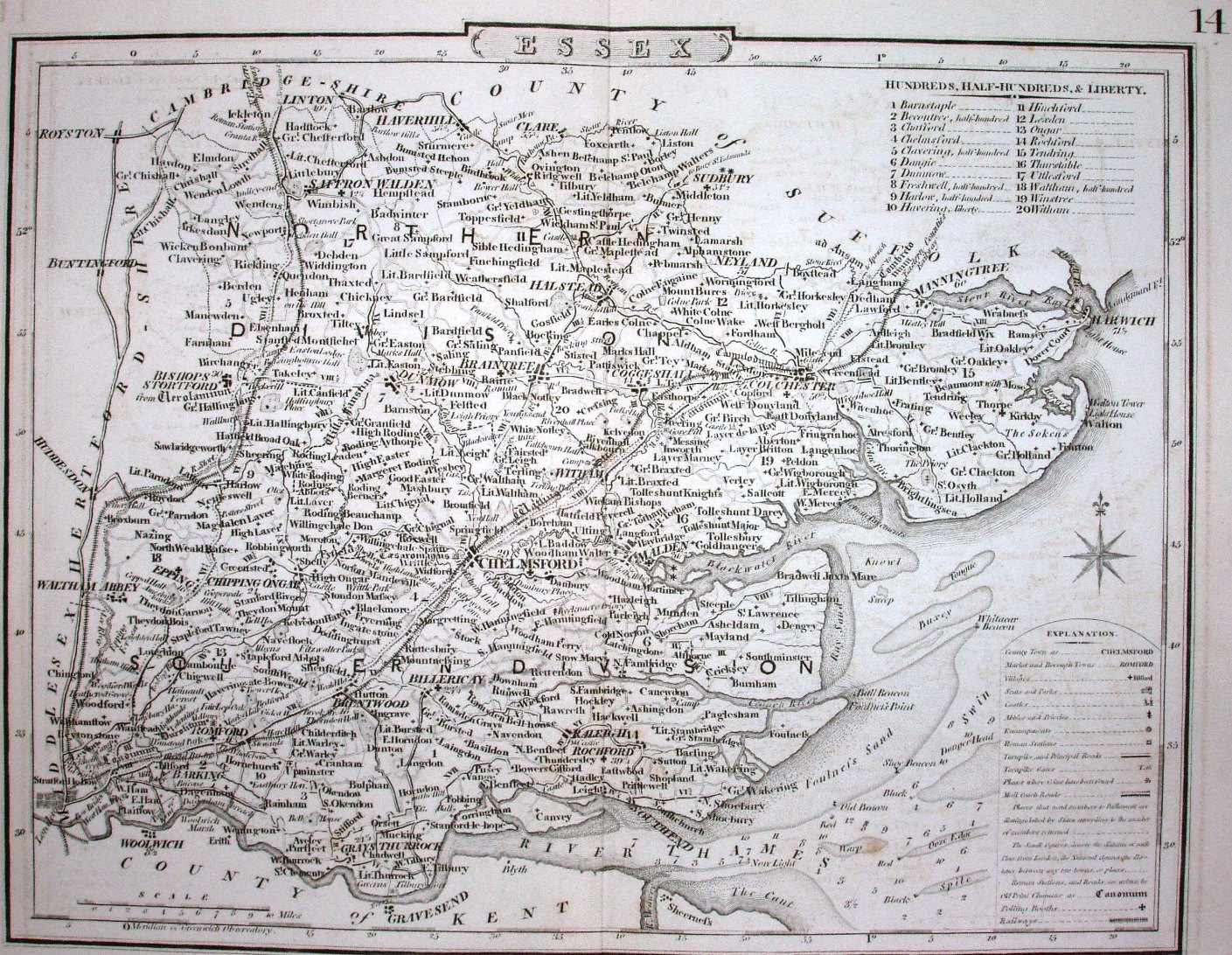
Dugdale's Curiosities of Great Britain, England & Wales Delineated when first published in 1835 (1836 on the title pages) used the old Cole & Roper maps - but with no imprints across the bottom (not even of Dugdale) and a large 14 in the top right; it has added Polling Booths to the Explanation (which now has a thin line around it with a curved top) and Maltese crosses marking the Polling places on the map.
Displayed scale of 10 miles = 34mm, or 7.5 miles/inch; actual scale = 7.7 miles/inch, or 1:485,000.
The existence of the Maltese crosses proves this as a map in the Dugdale publication, as when previously published in English Topography there were no Polling Booths marked - which were introduced in the 1832 Great Reform Act.
The railway goes north towards Cambridge and north east from Colchester into Suffolk. Although these didn't open until 1845 and 1846 respectively, the Acts promoting them were passed in 1836, and this map jumped the gun on their existence.