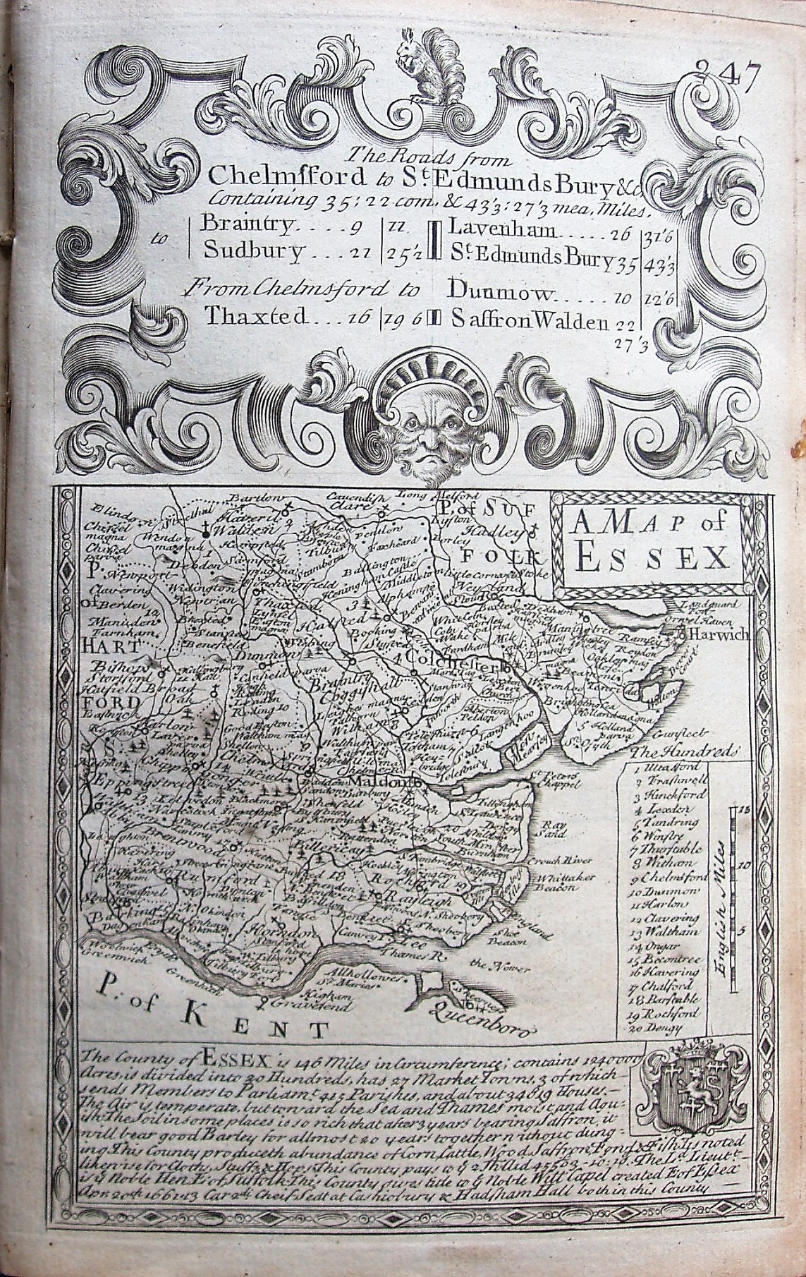
Britannia Depicta
Rivers, roads, hundreds and lots of towns, so very crowded. Text on Essex, plus some road distances. Reverse shows road strip map Chelmsford to Sudbury & beyond, with descriptions of Sudbury, Braintree & Halstead.
The road strip maps are descibed in the Road Maps section.
Page 247 of 273pp volume, based on Morden's small map (Warburton that they used for later county maps of Essex was not published until 1724).
No Latitude, Longitude or grid. Scale of 15mls = 29.2mm, ie a displayed scale of 13.1ml/in; actual scale = 15.4ml/in, or 1:975,000.