Britannia Depicta, or Ogilby Improv'd: Being a Correct Copy of Mr Ogilby's Actual Survey of all ye Direct and Principal Cross Roads in England and Wales
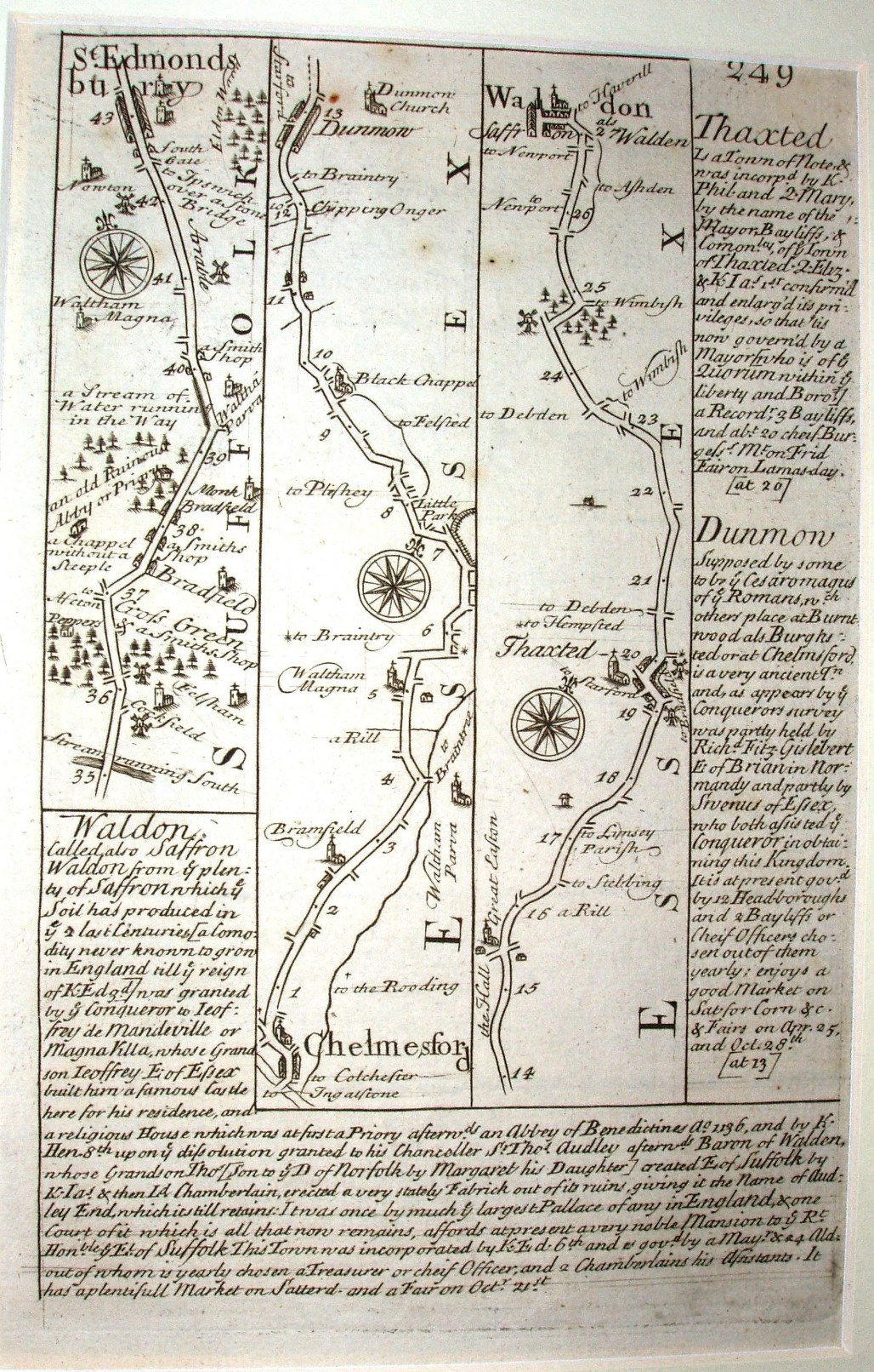
The road maps have been directly copied from Ogilby's Britannia, but on separate pages, with 3 or 4 strips to a page and a separate number for each page. Above is page 249, showing the road from Chelmsford to Saffron Walden, the same as the right hand side of the Ogilby, Gardner and Senex plate 92s. The strips are of varies length, as around them are inserted a lot of information about the towns you pass through.
The scale of the road maps is 1:134,000 (ie 2.12 miles to an inch, unlike Ogilby's 1 mile to an inch (but fractionally larger than Senex and Gardner).
You also get maps of each county (based on Morden's maps), plus general county information.
Britannia Depicta was very successful, being re-published 3 times in 1720 alone, plus at least 3 more times without changes up to 1736, and then in 1753 with some changes in details on some plates, and with further minor changes in 1759 and in Carrington Bowles' edition of 1764. The full Britannia Depicta is not very large in area, but is about 29mm thick, as it has around 280 pages. It is far, far more portable than the original Ogilby, and has far more information than the Gardner and Senex copies - factors that no doubt contributed to its long life.