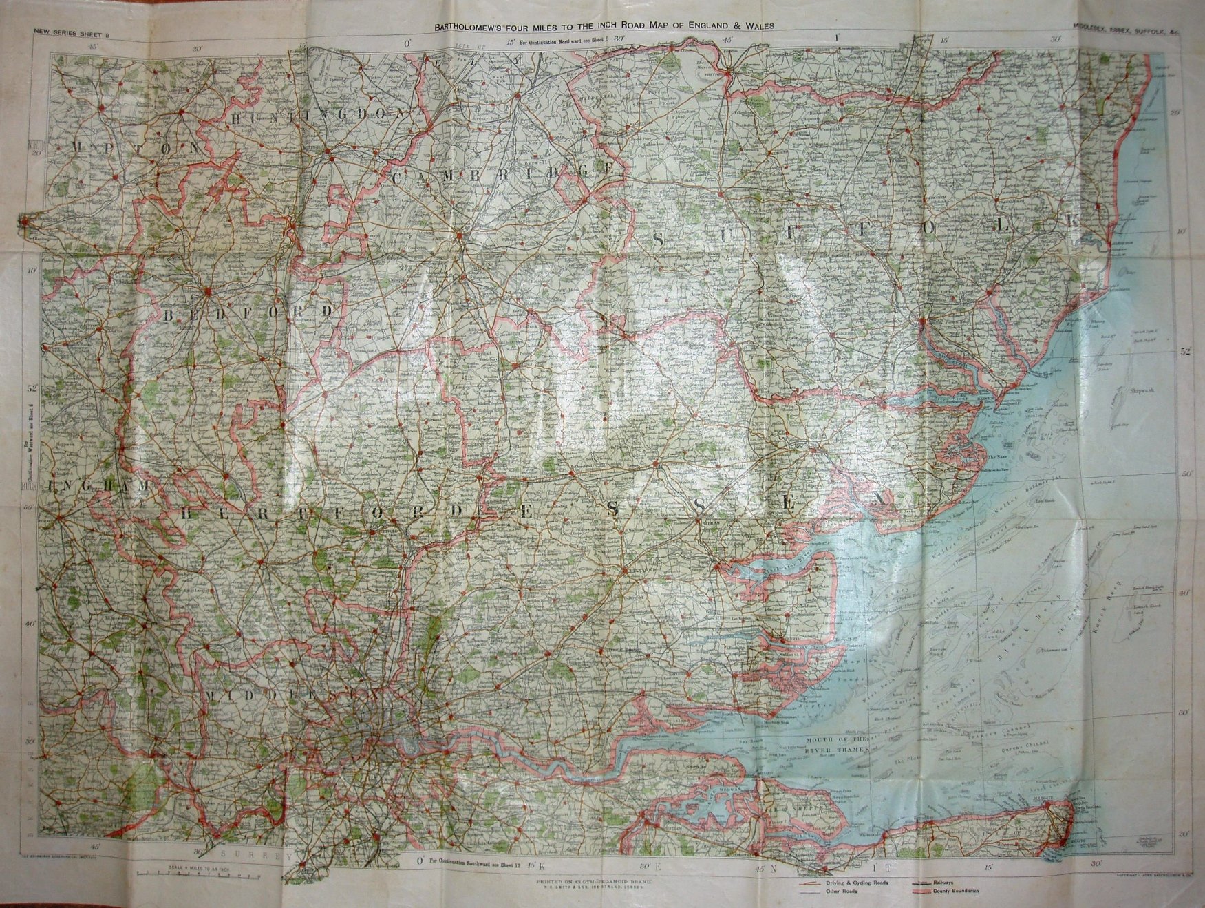
New Series Sheet 9 Bartholomew's "Four Miles to the Inch" Road Map of England and Wales Middlesex, Essex, Suffolk, &c.
New, larger sheets than in 1898 - the "New Series". Counties' edge-colouring.
There is now a key to the symbols.
Railway lines include Forest Gate to Tottenham (opened 1894), but no Chigwell loop (1903) or Corringham light (1901 - but maybe too small to show at this scale).
Scale correct at 12 miles = 75.2mm, or 4.0 miles/inch, ie 1:255,000.
Printed on cloth "Pergamoid Brand", WH Smith & Sons, 186 Strand, London. Copyright John Bartholomew, Edinr.
The new series was first published in 1897, but as it is presumably later than the 1898 WH Smith map (that used old series sheets), a date of 1899 is assigned to this one.