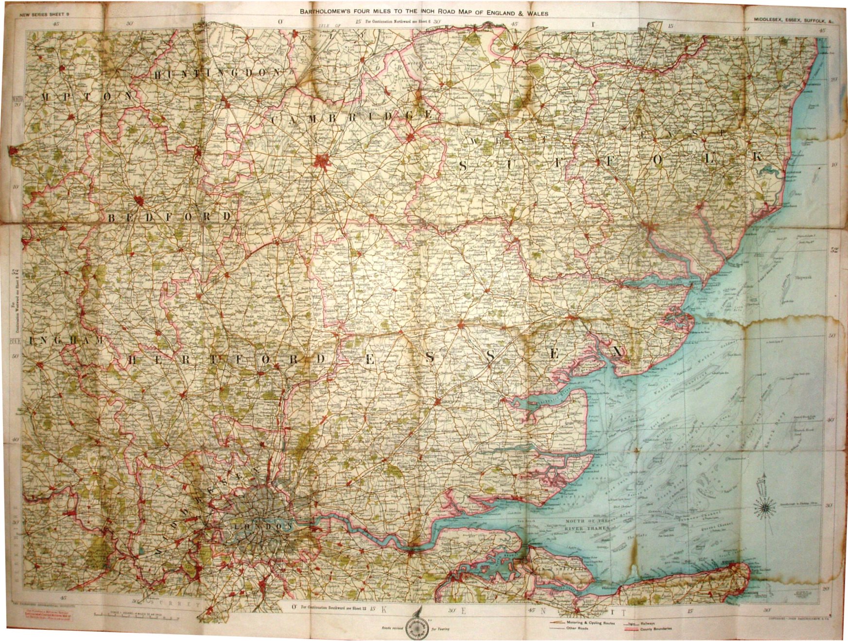
New Series Sheet 9 - Bartholomew's Four Miles to the Inch Road Map of England & Wales - Middlesex, Essex, Suffolk, &c.
Folding map in booklet, covering Essex, Suffolk, Middlesex, Hertfordshire and Cambridgeshire. Code B13, ie printed second half of 1913.
Roads revised for Touring Cyclists. Copyright - John Bartholomew & Co. The railway lines include the Thaxted branch - only opened 1913, so up-to-date.
Scale correct at 12 miles = 75.5mm, or 4.0 miles/inch, ie 1:255,000.
The first blue cover is a separate cloth wrapper that has been attached to the cloth map, with yellow advertising sheets stuck inside. The reverse of cover has advert for Bartholomew's The Survey Gazetteer of the British Isles. Price Two shillings net.
The second blue cover is a paper sheet that has been stuck to the cloth map. The reverse of cover has advert for Bartholomew's 4 Miles to the Inch Road Map of England & Wales, and from their prices it suggests this could have been published as late as 1918. Price One Shilling Net.
The third blue cover is hard boards stuck to the cloth map, being sold by Forster Groom. Price 2/6 Net.