Popular Pocket Edition Map of Essex
Blue text on pink & white background cover, with an England & Wales outline map. Inside the front cover are adverts for Barnett's Street Maps of 54 Essex Towns, 8 Road Maps and 5 River & District Maps. Back cover has advert for Reynold's Ford Service.
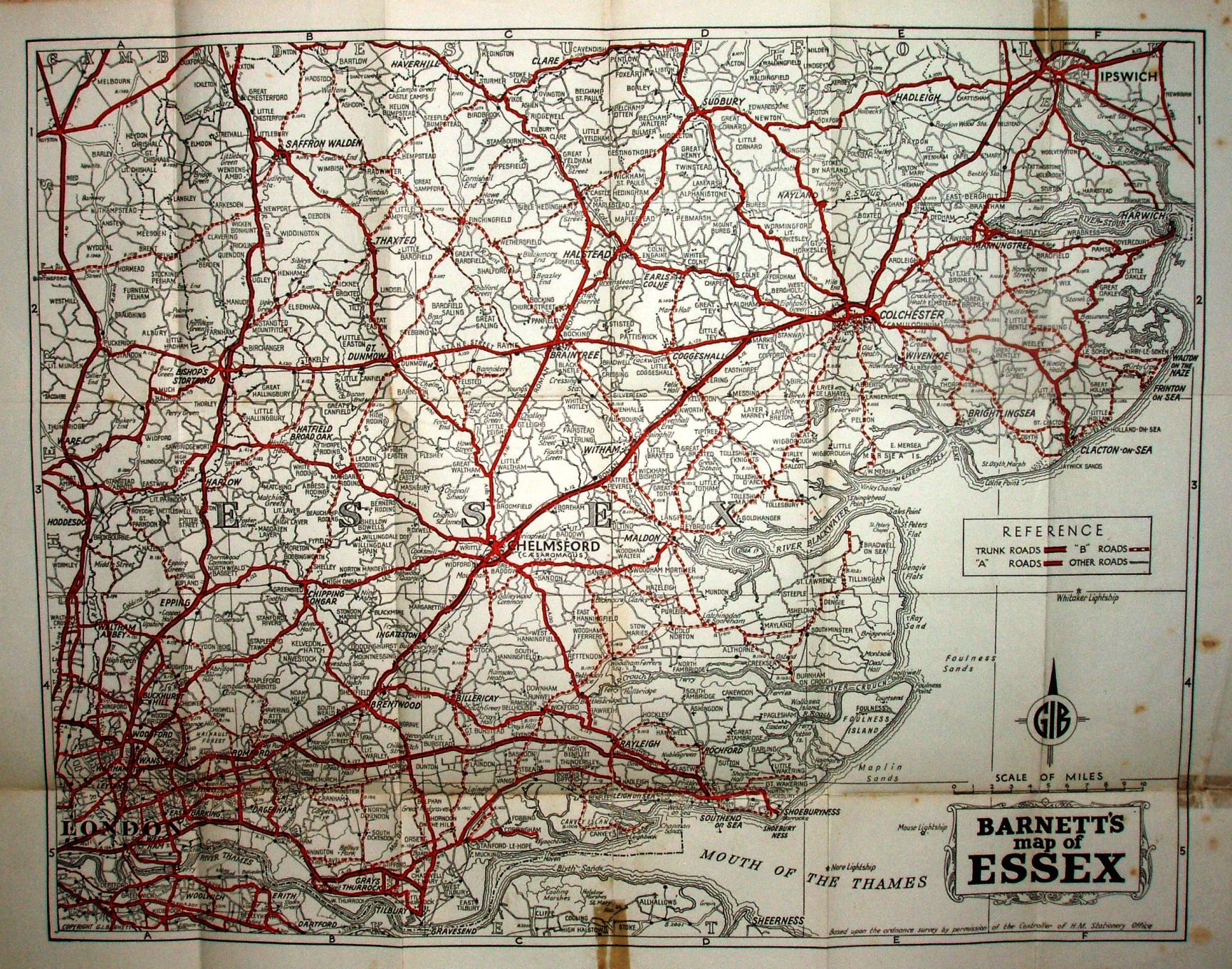
Lettered columns columns and numbered rows ford a grid, but there is no Index. Copyright GI Barnett. Based on the ordnance survey (sic!) by the permission of the Controllerv of HM Stationery Office.
Scale correct at 10 miles = 86mm, or 3.0 miles/inch, ie 1:185,000.
Trunk roads in thick cased red, A roads in cased red, B roads in cased dashed red, and double black lines for Other roads. Shows railway line to Tollesbury Pier (swept away by floods in 1953); includes railways in Kent.
Address on the cover is 19 Temple Avenue, Beacontree Heath, but on the map itself it is: The Map Centre, 33 Green Lane, Ilford, Essex, Tel Ilf 1263. I assume the latter is their original retail site, from which the Publisher grew. No code or date, and assume from appearance to be 1951, the start date of their publication.