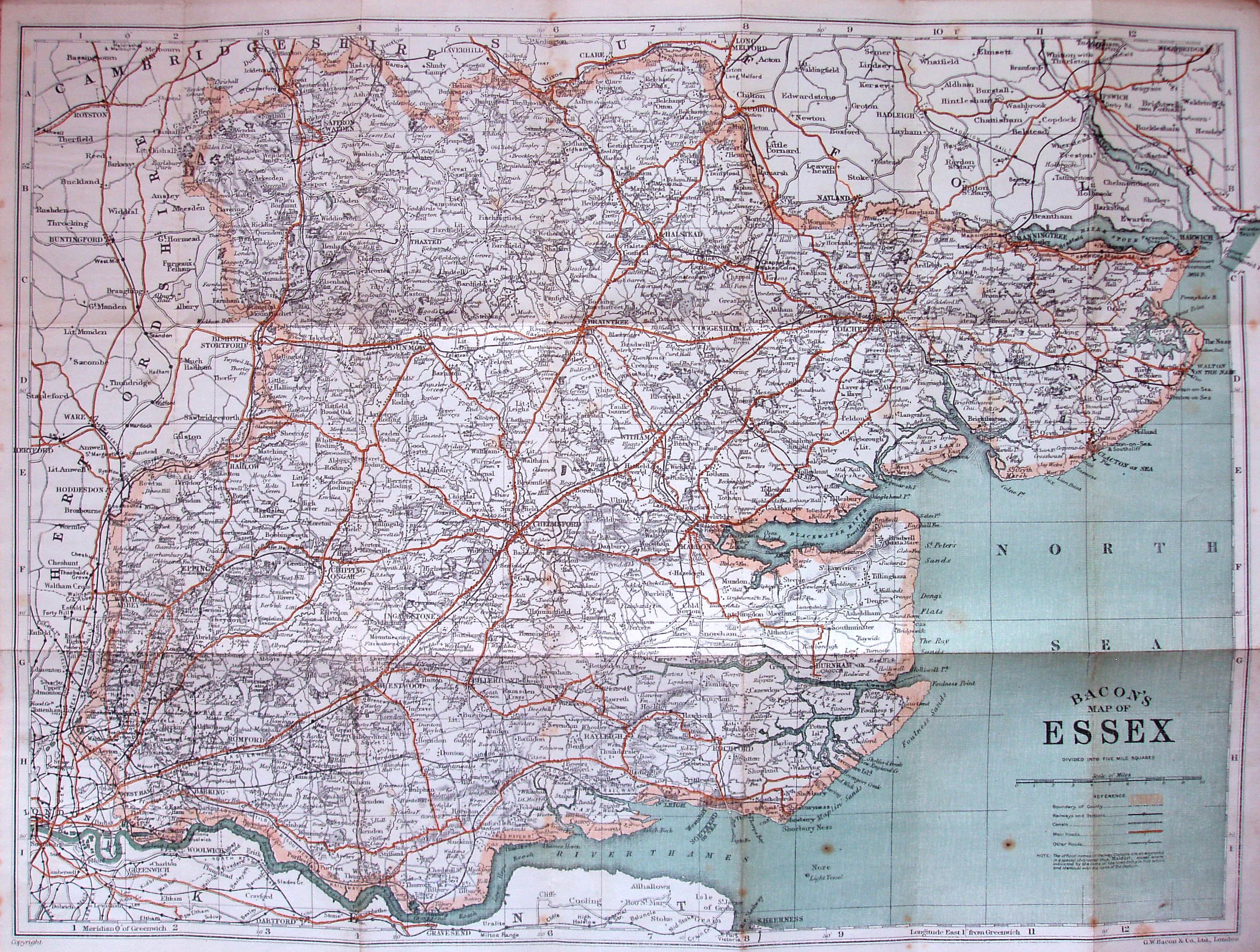
Bacon's County Map and Guide of Essex
Folding map with booklet that only has the "Alphabetical Index of Towns, Villages, &c", excluding populations.
Dismounted woman consulting map by a milestone whilst car passes. Dun monochrome cover. Main roads in brown, and county edge-coloured in bright pink. Has "Bacon's Map of Essex" on cover spine. Advert on back cover listing (county) maps - but no Rollers option. Cover prices are a stuck on label: price 1s Net, Cloth 2s net. Address still 127 Strand, so pre-1919 with price raised for the war.
Scale correct at 10 miles = 94mm, or 2.7 miles/inch, ie 1:170,000.
The reference table has the same 5 symbols as in 1914 version. The railway lines include the Thaxted branch (opened 1913), with no projected extensions. The sea is back to being blue.
In the bottom left corner there is a clear "Copyright", but there are no codes.