[Unknown]
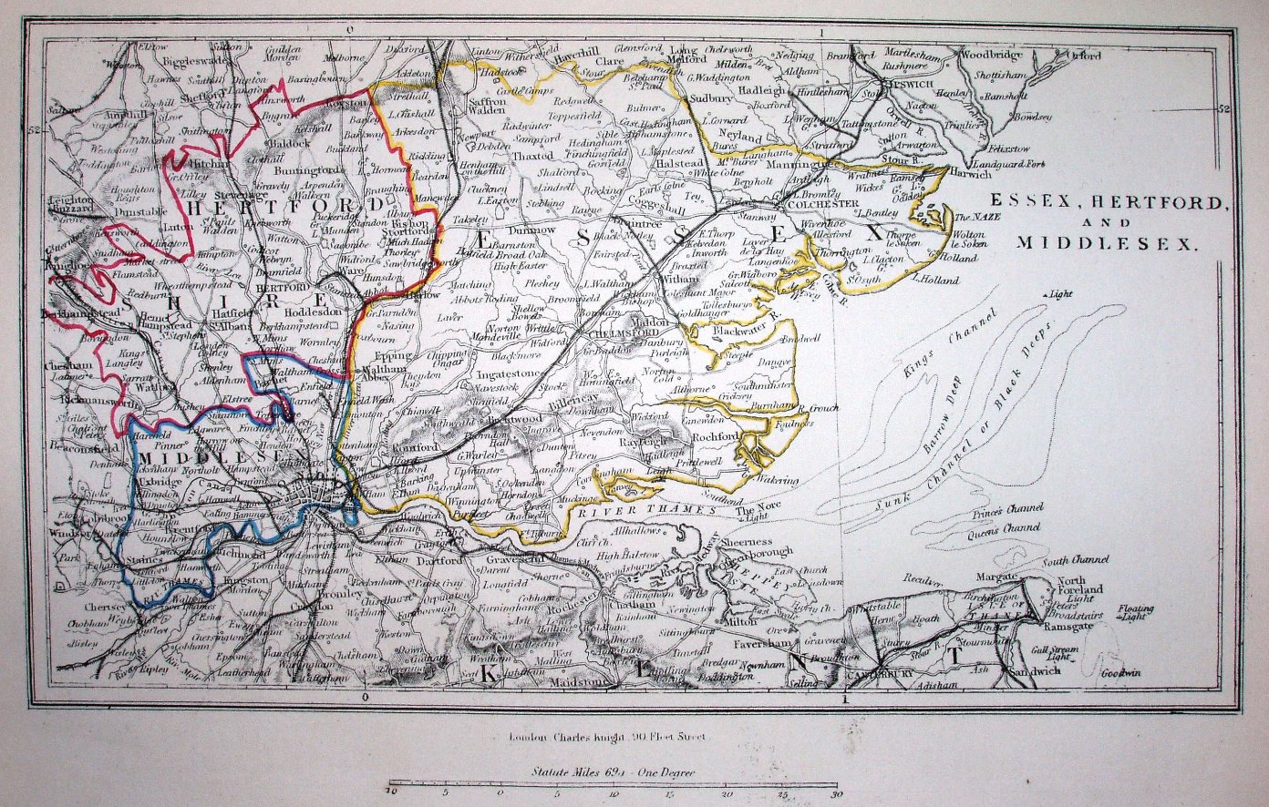
"Essex, Hertford and Middlesex" from unknown source, but dating to about 1852. Coloured outline to counties; towns and large villages; major roads and railways.
Displayed scale of 40 miles = 84.4mm, or 12.0 miles/inch; actual scale = 12.4 miles/inch, or 1:785,000.
The railway lines are shown from Marks Tey to Sudbury (opened 1849) and Great Chesterford to Newmarket (opened 1849 and closed 1851, but tracks still present until 1856), but not Manningtree to Harwich (opened 1854) or Barking to Tilbury (also opened 1854).