The British Gazetteer
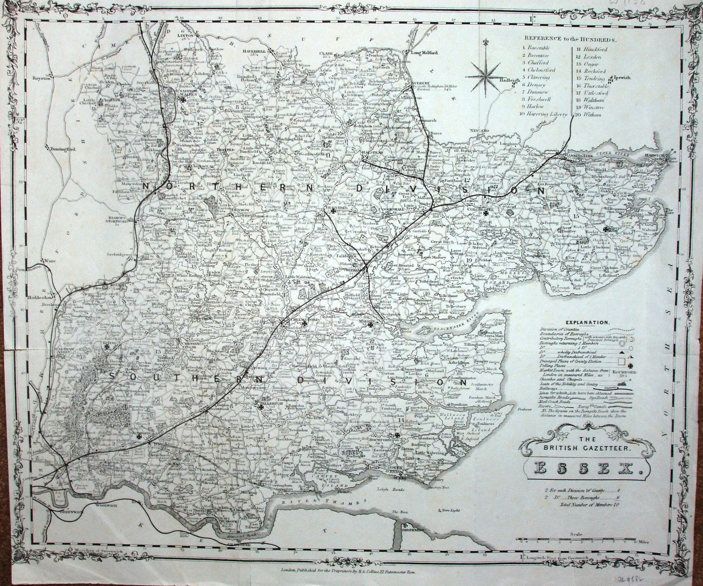
The Gazetteer was first published as the New British Atlas in 1849, and republished as the Gazetteer in 1852, and as Collins' County Atlas of England & Wales in 1857. There is a lot of detail, but essentially it is the Teesdale map of 1829 (which was copied from Rowe 1811).
Scale correct at 10 miles = 68mm, or 3.8 miles/inch, ie 1:240,000.
The railways shown include the Witham to Braintree and Maldon lines (opened 1848), the Gt Chesterford to Newmarket line (opened 1848 and closed 1851, although stayed on maps a lot longer), the Marks Tey to Sudbury (opened 1849) and Chapel to Halsted (opened 1860), but not shown are Manningtree to Harwich (opened 1854) or Barking to Tilbury to Mucking (also opened 1854).
The really weird aspect though is the presence of an open canal from Bishops Stortford to Cambridge - an idea that was proposed from 1780 onwards, and finally killed off in c.1820. This was not on the Teesdale 1829 map, but it was on the Coltman 1828 map (a reissue of an 1807 map).