Reynold's Travelling Atlas of England
This Atlas was first published in 1848, with reissues in 1854 & 56, then published as Reynold's geological Atlas of Great Britain in 1860 (reissued 1864 & 69) and as the Portable Atlas of England and Wales, and as Stanford's geological atlas of Great Britain in 1904 (reissued 1907, 13 and 14!).
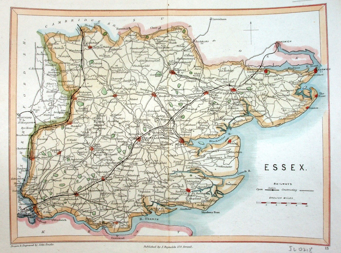
Scale correct at 10 miles = 37mm, or 6.8 miles/inch, ie 1:430,000.
"Drawn and engraved by John Emslie." "Published by J Reynolds 174 Strand". The railways go north to Cambridge (opened 1845), past Colchester to Ipswich (opened 1846) and out to North Woolwich (opened 1847). The mythical line to Thameshaven is shown as "constructing".