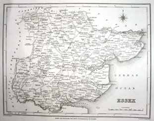
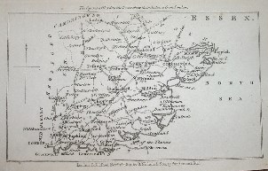
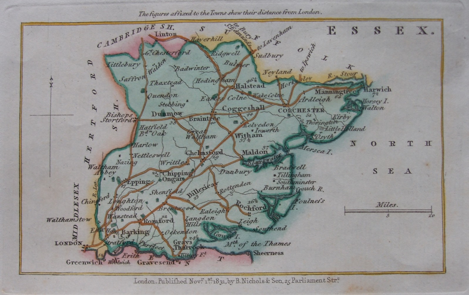
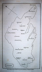
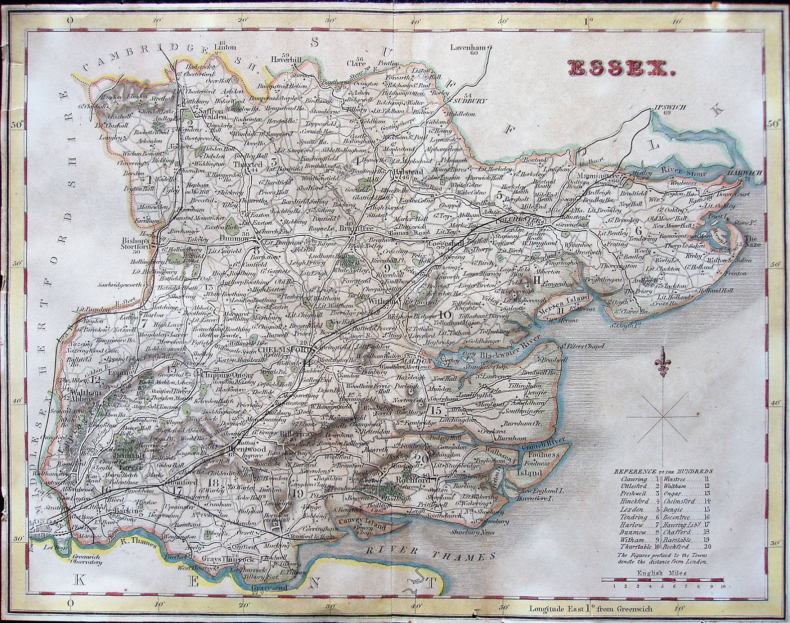
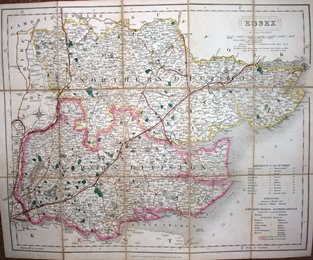
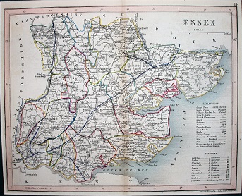
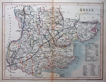
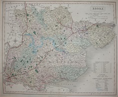
The table below lists flat maps of Essex in approximately chronological order; these are taken from Atlases, or in a few cases were published as maps of Essex alone. There is a link from each entry to a large picture.
Shown against items are reference books refs -
C401 means atlas 401 from the Chubb refence book listed on the Books page
The dimensions against each map are Height x Width, and as Essex is a little wider than it is tall the width is usually greater - assuming the map has north at the top. The measurements are of the outermost neat line of the map (not the size of the sheet of paper).
| Thumbnail maps |
Mapmakers, their Atlases and Maps |
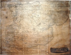 |
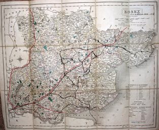
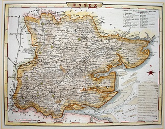
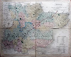
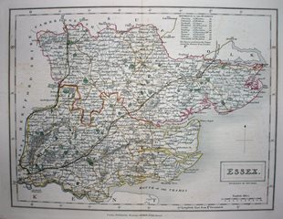
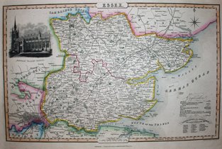
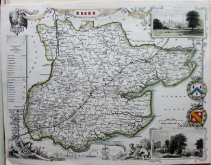
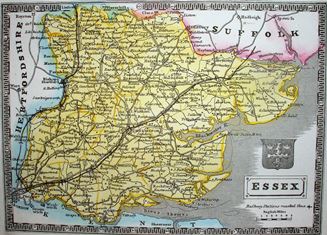
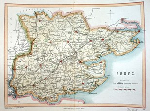
C&J Greenwood
Essex
1825 1,310mm x 1,560mm
Last private surveyor of the whole county. |
 |
Nathaniel Coltman
A New Map of the County of Essex
1828 523mm x 677mm
A reissue of the 1807 map, featuring the non-existent canal. |
 |
John Cary
Travellers' Companion
1828 130mm x 93mm
The plate re-cut again as 1806 replacement the original had worn out. |
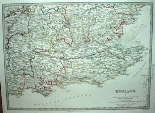 |
Society for the Diffusion of Useful Knowledge (SDUK)
England V
1830 268mm x 370mm
A regional map, with coloured county borders. |
 |
Teesdale
New British Atlas
1830 343mm x416mm
Looks as classy as a Cary or a Smith. |
 |
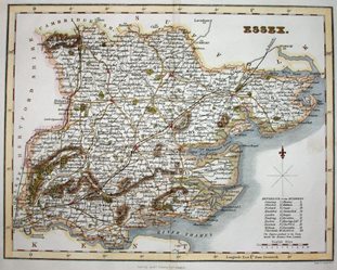
Hall
A Topographical Dictionary of Great Britain & Ireland
1830 186mm x 247mm
The first showing of a map published in atlases very many times. |
 |
Murray
An Atlas of the English Counties
1830 353mm x 457mm
The first to show the 1832 Reform Act changes. |
 |
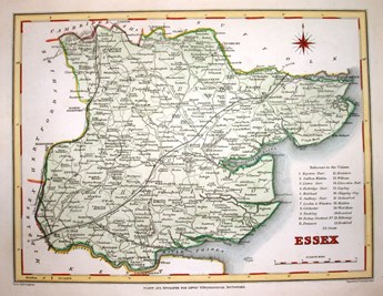
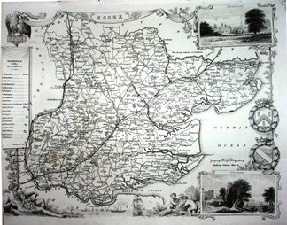
C&J Greenwood
Atlas of the Counties of England
1831 609mm x 704mm
Reduced scale version of 1825 map. |
 |
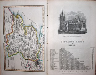
J Bingley
The History & Topography of the County of Essex (by T Wright)
1831 371mm x 402mm
Issued in Wright's books on Essex. |
 |
Lewis
Lewis's Topographical Dictionary
1831 178mm x 230mm
You will see several of these in the next 10 years. |
 |
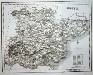
Nichols
The Family Topographer
1831 77mm x 131mm
Lot of places for a very small map. |
 |
Nichols
The Family Topographer
1832 78mm x 130mm
Same very small map, but with scale added - inaccurately. |
 |
T Cobbett
A Geographical Dictionary of England & Wales
1832 172mm x 102mm
The most inaccurately drawn map of Essex of all time. |
 |
Pigot
Pigot & Co's London & Provincial New Directory, 5th Edition
1832 224mm x 352mm
Elegant map for a Directory. |
 |
Duncan
A Complete County Atlas of England & Wales
1833 346mm x 434mm
Map updated with Reformed Parliamentary Boroughs. |
 |
Hall
A New British Atlas
1833 186mm x 247mm
An earlier map appearing in its second guise. |
 |
Hall
Essex
1833 190mm x 249mm
Same as Hall 1833 above, but as a separate map. |
 |
Pinnock
Pinnock's Guide to Knowledge
1833 162mm x 227mm
Someone tried going backwards 300 years. |
 |
Lewis
Lewis's Topographical Dictionary
1833 185mm x 240mm
Lewis with Reform Act Polling Places and Divisions. |
 |
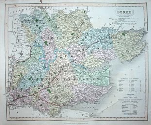
Dawson
Essex
1834 235mm x 300mm
Official maps of the Reform Act Polling Places and Divisions. |
 |
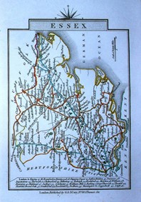
Leigh
Leigh's New Atlas of England & Wales
1834 71mm x 121mm
Tiny map lives on. |
 |
Cole & Roper
Dugdale's England & Wales Delineated
1835 177mm x 228mm
The first issue of Dugdale's gazetteer, but using old maps. |
 |
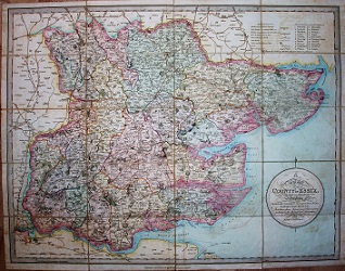
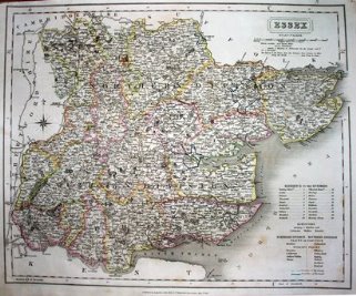
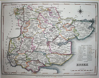
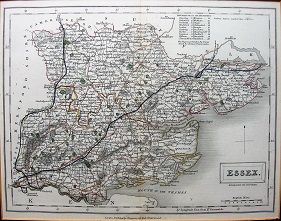
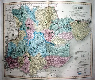
J&C Walker
Walkers' Essex
1835 323mm x 398mm
Extremely early version of the map, in folding form, but with later annotations; sold c.1836. |
 |
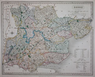
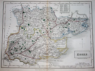
J&C Walker
This British Atlas
1835 321mm x 392mm
Very early version of the map, with no railways; sold c.1835. |
 |
J&C Walker
This British Atlas
1835 318mm x 395mm
First version of how J&C Walker maps show open railways; sold c.1836. |
 |
Fullarton
A New & Comprehensive Gazetteer of England & Wales
1836 187mm x 240mm
Darkly shaded incomplete hills. |
 |
Leigh
Leigh's New Atlas of England & Wales
1837 73mm x 121mm
Tiny map gains one real railway and one false on. |
 |
T Moule
The English Counties Delineated
1837 213mm x 266mm
First edition Moule - pre-railways. |
 |
Pigot
Pigot & Co's London & Provincial New Directory, unknown Edition
1837 224mm x 352mm
Added schematic railways. |
 |
Pinnock
Pinnock's Guide to Knowledge
1838 162mm x 227mm
It's still very ugly. |
 |
Dugdale
Curiosities of Great Britain, England and Wales Delineated
1838 173mm x 226mm
A new issue of Dugdale's gazetteer starts to add (proposed) railways. |
 |
Lewis
Lewis's Topographical Dictionary
1838 174mm x 232mm
Back to just the conventional map. |
 |
Pigot
Pigot & Co's Pocket Atlas, Topography and Gazetteer of England. No 14 Essex.
1839 104mm x 164mm
Map with notes and Gazetteer. |
 |
J&C Walker
This British Atlas
1839 321mm x 393mm
The railways grow a little, but the colouring is terrible; sold c.1839. |
 |
J&C Walker
This British Atlas
1840 317mm x 394mm
Details increase on the map, especially in the south west; sold c.1840. |
 |
Lewis
Lewis's Topographical Dictionary
1840 178mm x 230mm
Now with Poor Law Union boundaries. |
 |
Dugdale
England and Wales Delineated
1840 179mm x 235mm
A new issue of Dugdale's gazetteer changes to the Archer maps. |
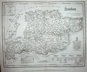 |
Archer
The Monthly Magazine and Monthly Register of Religious and Ecclesiastical Information.
1841 177mm x 224mm
Map of London Diocese |
 |
Hall
A Travelling County Atlas
1842 186mm x 247mm
Railways added to Hall's 1833 map. |
 |
J&C Walker
This British Atlas
1842 321mm x 390mm
Railway lines now more accurate; sold c.1843. |
 |
Dugdale
England and Wales Delineated
1842 179mm x 233mm
Dugdale's gazetteer gets a very small change from the 1840 version. |
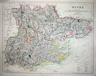 |
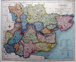
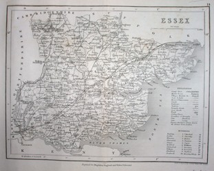
Fisher
Fisher's County Atlas of England and Wales (Part 15)
1844 270mm x 345mm
Lots of hatchuring, plus lurid boundaries. |
 |
Lewis
Lewis's Topographical Dictionary
1845 174mm x 231mm
Still with Poor Law Union boundaries, but railways change. |
 |
Duncan
A Complete County Atlas of England & Wales
1845 340mm x 439mm
Old map with added railways. |
 |
Reuben Ramble
Reuben Ramble's Travels through the Counties of England
1845 69mm x 107mm
Old maps for a children's text book. |
 |
J&C Walker
This British Atlas
1845 323mm x 398mm
The railways continue to grow; sold c.1846. |
 |
Fullarton
Parliamentary Gazetteer of England & Wales
1845 187mm x 241mm
Darkly shaded incomplete hills. |
 |
Fullarton
Parliamentary Gazetteer of England & Wales
1846 186mm x 239mm
Same hills, but a change to the railway. |
 |
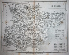
I Slater
New British Atlas
1846 223mm x 357mm
Pigot maps taken over by Slater. |
 |
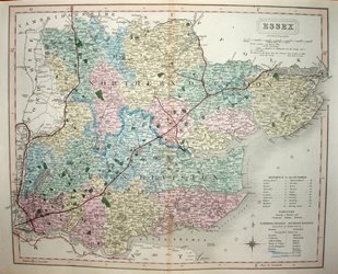
J&C Walker
Walkers' Essex
1846 323mm x 398mm
A folded version of the above Walker, with later date; sold c.1847. |
 |
T Moule
A Complete & Universal English Dictionary
1846 201mm x 264mm
The Moule has now added some railways. |
 |
Archer
Dugdale's Curiosities of Great Britain
1846 177mm x 232mm
Dugdale's gazetteer continues with the Archer maps, and adds a very erratic selection of railways. |
 |
Archer
Dugdale's Curiosities of Great Britain
1847 175mm x 231mm
Dugdale's gazetteer continues with the Archer maps, with a different erratic selection of railways. |
 |
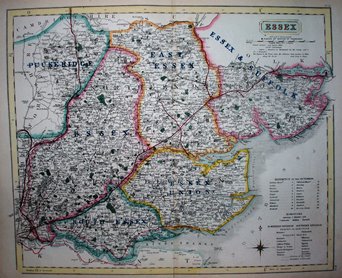
J&C Walker
Walkers' Essex
1847 323mm x 398mm
Back to flat maps, and one sold far later than printing, c.1862. |
 |
Johnson
Johnson's Atlas of England
1847 162mm x 224mm
The horrible Pinnocks now improved. |
 |
Hall
A Travelling County Atlas
1847 183mm x 246mm
More railways compared to Hall's 1842. |
 |
Hall
A Travelling County Atlas
1848 183mm x 246mm
Yet more railways added. |
 |
T Moule
A Complete & Universal English Dictionary
1848 213mm x 266mm
The Moule has now added some more railways. |
 |
Reynolds
Reynold's Travelling Atlas of England
1848 175mm x 236mm
Railways improved (mostly). |
 |
J&C Walker
This British Atlas
1849 320mm x 388mm
Another Walker, this time from an atlas, with more railways; sold c.1849. |
 |
J&C Walker
This British Atlas
1849 320mm x 389mm
A folded Walker map, with changes from one above, but also sold c.1849. |
 |
J&C Walker
Hobson's Fox Hunting Atlas
1849 323mm x 394mm
Four different early Hobson Fox Hunting maps. |
