A Complete & Universal English Dictionary (possibly)
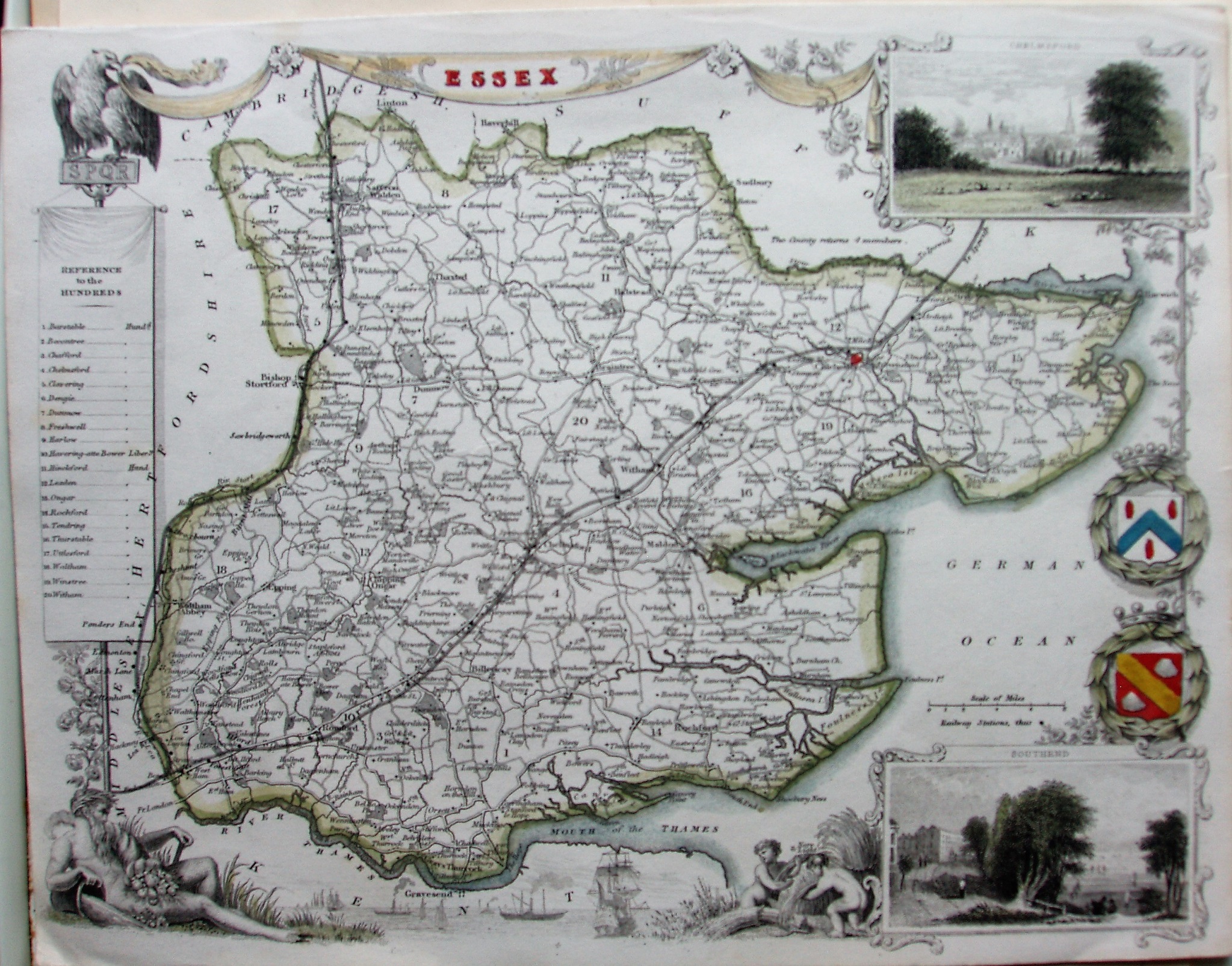
First issued as a part work from 1830 to 1836, the "Moule" maps were then used in The English Counties Delineated in 1836 (re-issued 1837 & 38) and in Barclay's Complete & Universal Dictionary (or A Complete & Universal English Dictionary) in 1841 to 1852 (with a [plate] "42" added in 1852), and in Hall's Pocket County Maps (1847) and The History of England by Hall and Smollett in 1849. Examples also shown from 1837 and 1848.
Scale correct at 8 miles = 30.5mm, or 6.6 miles/inch, ie 1:410,000.
The florid styled map hasn't changed since before, apart from the addition of some railways - it has the line from Stratford out "To Cambridge" (opened 1845), and from London to Colchester and beyond "To Ipswich" (opened 1846); hence, an estimate of 1846.