A Travelling County Atlas
Another issue of A Travelling County Atlas. See Hall's Map Publisher page. There is no plate number.
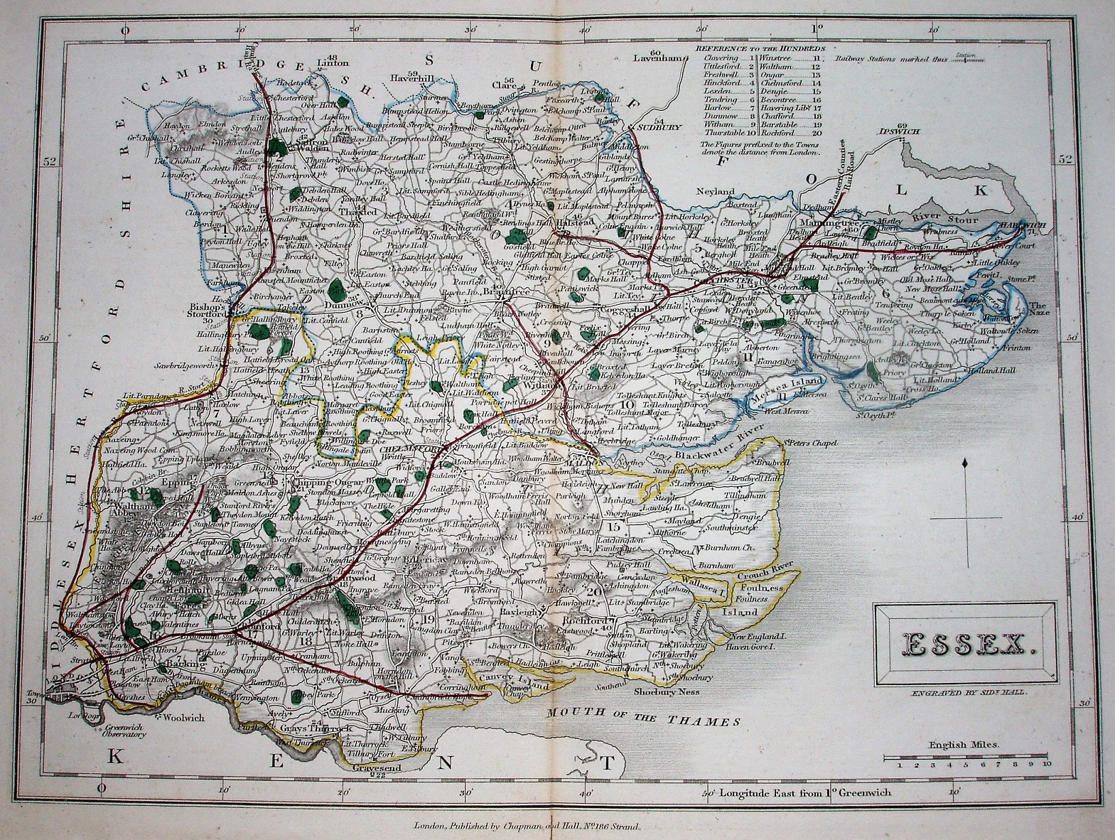
There is a table of Hundreds, with their numbers printed on the map; in this case the individual Hundreds are not coloured, and all roads are uncoloured. The title appears in a rectangular cartouche, with underneath it Engraved by Sidy Hall.
Latitude and longitude (noted as being from Greewich) are inscribed around the border, with 2 minute bars and numbers every 10 minutes. The Northern and Southern Divisions (unnamed) are edge-coloured.
Across the bottom is "London. Published by Chapman and Hall, No 186 Strand."
All railways are now shown as red lines, probably overlaying the double parallel black lines with closely spaced cross bars as used earlier (the red is too dark to tell if all have the black lines). Red lines are thus shown from London through Stratford, Chelmsford, Colchester and into Suffolk (labelled Eastern Counties Railroad), and from Stratford through Bishops Stortford past Saffron Walden and into Cambridgeshire (labelled Cambridge Rail Rd); these opened in 1846 and 1845 respectively. There are also red lines for routes from Romford to the unnamed Thames Haven (authorised 1836 but never built), Braintree via Witham to Maldon (authorised 1846, opened 1848), Colchester line to Harwich (very inaccurately; authorised 1847, opened 1854), Marks Tey to Sudbury (authorised 1846, opened 1849) and Chapel to Halstead (authorised initially 1846, then in 1856, opened 1860). It also has red lines for routes from Ilford to Ray House, and Layton Stn via Ray House to Epping (not Loughton; authorised 1846, but not built).
Displayed scale of 10 miles = 37mm, or 6.9 miles/inch; actual scale = 6.6 miles/inch, or 1:420,000.