Camden's Britannia
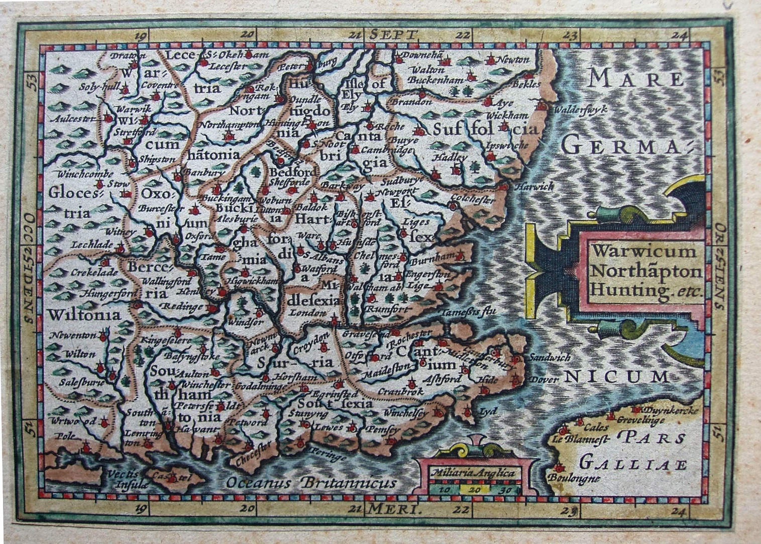
The 1639 reprint of Bertius's maps, in Regner Vitellius's abridged Camden's Britannia. First published by Hondius the younger in Petri Bertii Tabularum geographicarum contractarum libri septem in 1616 - the 3rd edition of the Latin version of a Dutch atlas Caert-thresoor 1st published 1598 - being reduced size plates based on the Mercator-Hondius 1607 Atlas Minor ones. This was reprinted in Latin and French in 1618, and in the Camden's Britannia published by Blaue in 1639. The list of counties is now just "Warwicum Northapton Hunting etc".
The first Atlas Minor was published by Jodocus Hondius the elder in association with Jan Jansson the elder in 1607; after Hondius died in 1612 it was published by Jodocus Hondius the younger in association with Jan Jansson the elder from 1612 to 1621. From 1607 to 1621 there were editions of Atlas Minor in Latin (5), French (3) and German (1).
The seas have a faint shot silk ornamentation, and are entitled Oceanus Germanicum in the North Sea and Oceanus Brittannicum in the Channel. There are far fewer places named than on the large Mercator maps, and the selection of which to keep and which to omit is rather erratic; for instance, the (largish) town of Walden is omitted but the nearby (small) village of Newport is included. There are very few places named along the coast, but all the rivers are still shown, so these appear more prominent. The county boundaries are marked by dotted lines, with an overdrawn brown line.
London is at 20o45' east, and there is a scale of Miliaria Anglica 30 = 17.5mm, or about 1:2,666,000, c.42 miles to the inch. Looks very similar design to Van Der Keere (could be the engraver?).