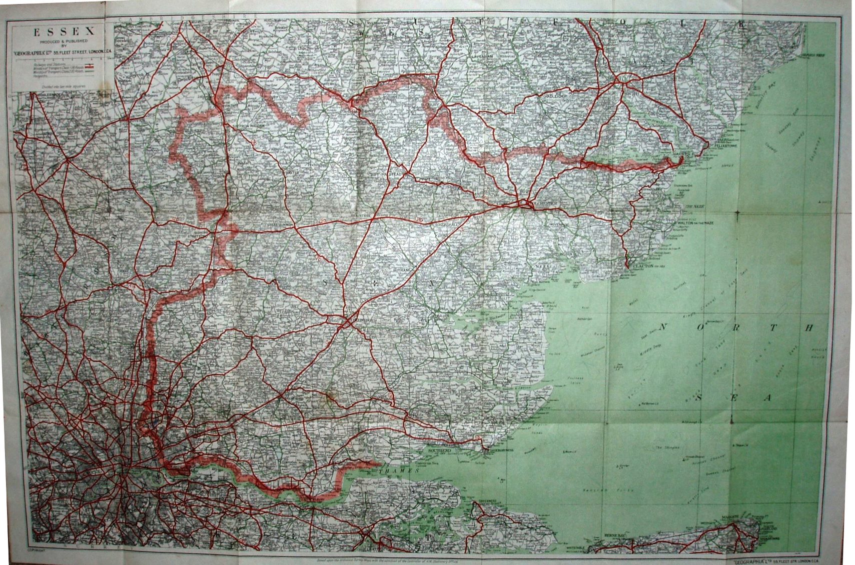
Large Scale Road Map of Essex
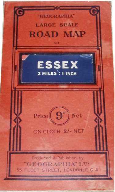
Paper on cloth; brick red card covers stuck to front and back of cloth; Price 9d Net (Cloth 2/- Net). Label stuck to generic cover saying: Essex 3 Miles : 1 Inch. Advert on the back cover for Geographia's Up-to-date Plans, Maps and Guides, Paper 1/6 or 2/-, Cloth 3/6 or 4/6, and Disssected 5/- or 6/-.
Allhallows (Kent) railway line is shown (opened 1932).
Scale correct at 10 miles = 84mm, or 3.0 miles/inch, ie 1:190,000.
Ministry of Transport class 1 (A) roads are in red; Ministry of Transport class 2 (B) roads are in green. The sea is very green (done by faint green lines) and the land is white. The Stanford-le-Hope bypass (opened c1932) and Chelmsford bypass (1933) are present; the Woodbridge bypass road is shown (opened 1933) but the A12 is coloured through the town.
The map is published by Geographia Ltd, 55 Fleet Street on the cover and on the map; code of CU.ML = December 1937.
More details on Geographia's maps are on the Publisher's page.