Royal Atlas of England and Wales
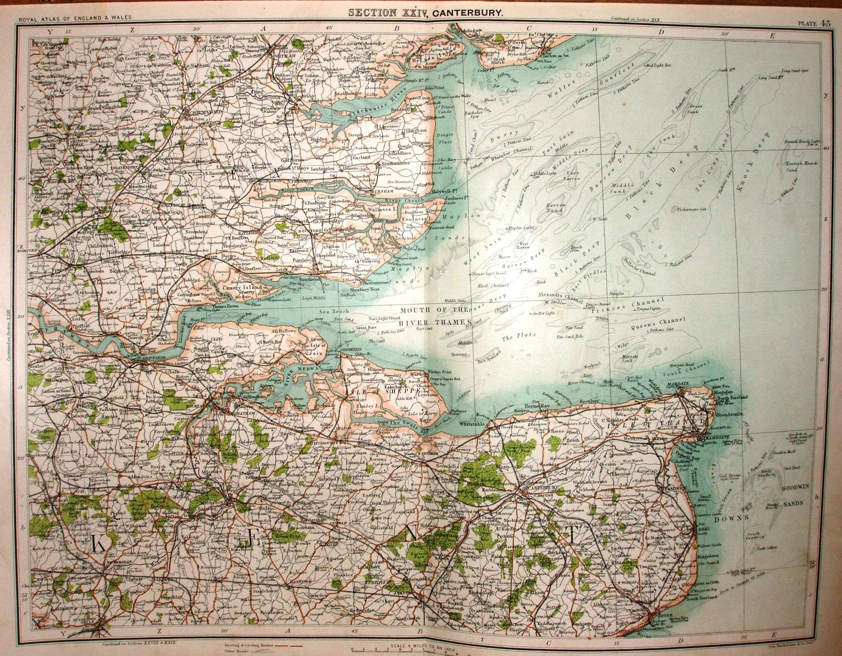
Plate 43, being Section XXIV, Canterbury, from the Atlas, showing south Essex and north Kent.
More details on Bartholomew's maps are on the Publisher's page.
Displayed scale of 12 miles = 75mm, or 4.0 miles/inch, ie 1:255,000 (& being Bartholomew it's probably accurate).
The map is at 4 miles to the inch, so would have used the underlying maps used in Bartholomew's Quarter Inch folding maps.