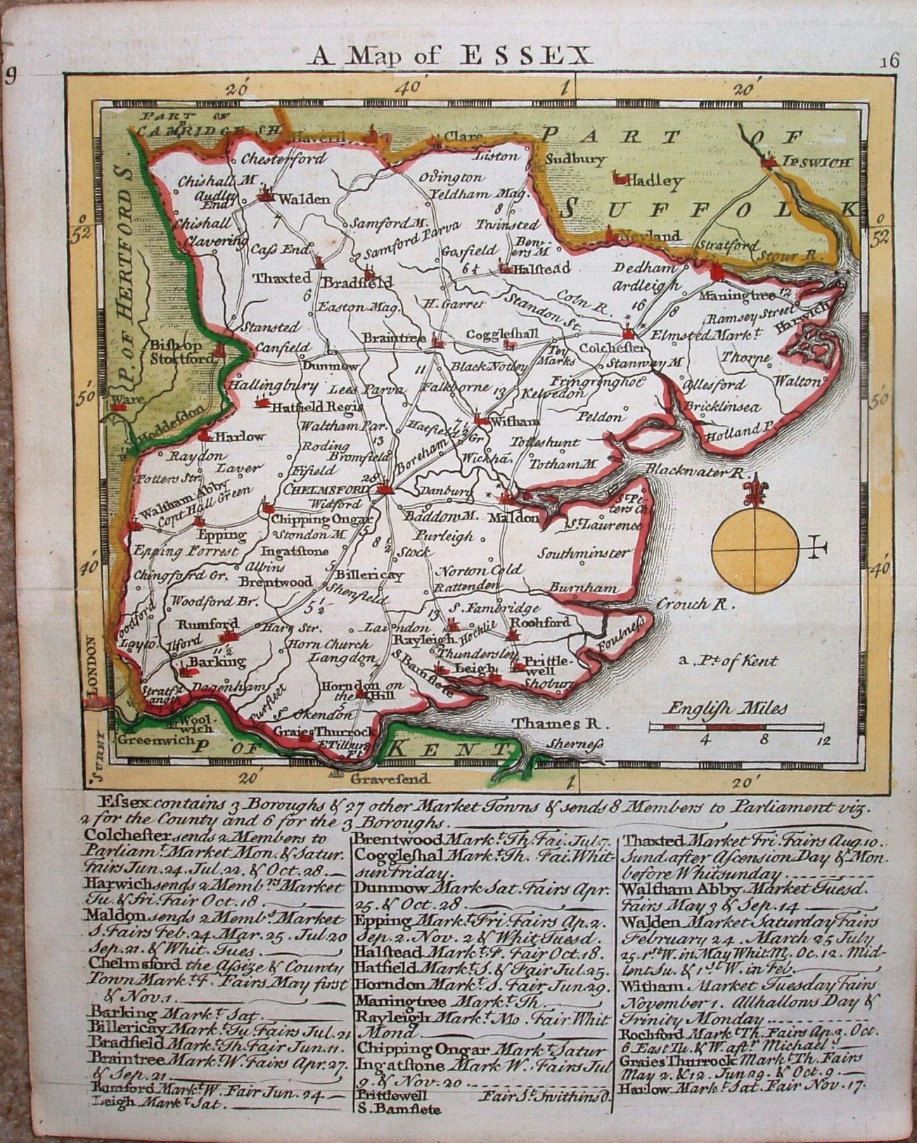
Small English Atlas
Issued initially as a weekly part work from November 1748 onwards, the Essex map was first issued in late January 1748/49.
The complete Atlas was published in 1751, with plate numbers added to the maps.
Below the map are listed notes on towns, representatiion and the weekly market days plus dates of annual fairs for 28 towns, starting with the Parliamentary Boroughs.
Displayed scale of 12 miles = 29mm, or 10.5 miles/inch; scale actual = 11.8 miles/inch, or 1:745,000.