Histora Mundi, or Mercator's Atlas
Hondius published Atlas Minor Gerardi Mercatoris a J. Hondio ... auctus atque illustratus in 1607, copying but reducing the plates from the Mercator Atlas. The plates have a heading, plus the full text from the original Atlas (taking more pages as these are smaller).
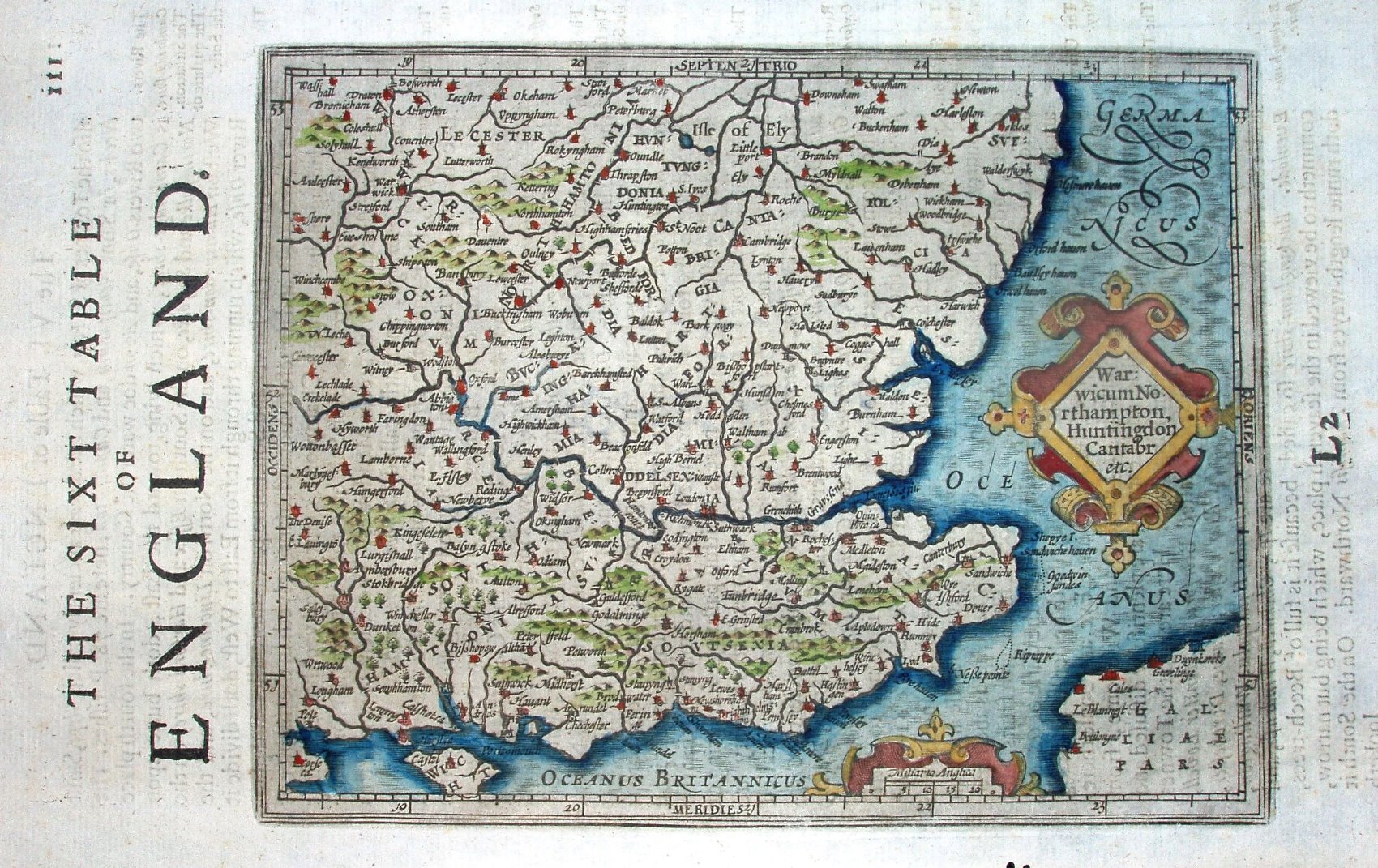
The eastern England plate is entitled The Sixt Table of England, on pages 110 to 115 - 4 1/2 pages of text plus 1 page map. The list of counties is now abbreviated to Warwicum, Northamptonia, Huntingdon, Cantabr etc. in an ornamental diamond shaped cartouche in North Sea.
The seas have a faint shot silk ornamentation, and are entitled Oceanus Germanicus in the North Sea and Mare Brittannicum in the Channel. There are far fewer places named than on the large Mercator maps, and the selection of which to keep and which to omit is rather erratic; for instance, the (largish) town of Walden is omitted but the nearby (small) village of Newport is included. There are very few places named along the coast, but all the rivers are still shown, so these appear more prominent. There are no county
borders, and the county names are hard to read.
The first Atlas Minor was published by Jodocus Hondius the elder in association with Jan Jansson the elder in 1607; after Hondius died in 1612 it was published by Jodocus Hondius the younger in association with Jan Jansson the elder from 1612 to 1621. From 1607 to 1621 there were editions of Atlas Minor in Latin (5), French (3) and German (1).
After 1621 the plates were acquired by London booksellers, and were used as illustrations in Purchas his Pilgrimes (William Stansby for Henry Featherstone, 1625) and again in Historia Mundi, or Mercator's Atlas (Thomas Cotes for Michael Sparke and Thomas Cartwright 1635; re-issued 1637 & 1639) with an English translation of the folio text of the Mercator-Hondius Atlas (ie not of the Atlas Minor text). The plates were also included unchanged in Robert's Atlas Portatif, Universel et Militaire, published in 1748.
London is at 20o45' east, and there is a scale of Miliaria Anglica 20 = 17mm, or about 1:2,100,000; his "mile" is about 1.11 statute miles.