Large Scale Road Map of Essex
Paper on cloth; dark blue card covers stuck to front and back of cloth; Price Net 2/- on Cloth. Label stuck to generic cover saying: Essex 3 Miles : 1 Inch. Advert on the back cover for Geographia's Up-to-date Plans, Maps and Guides, Paper 1/6 or 2/-, Cloth 3/6 or 4/6, and Disssected 5/- or 6/-.
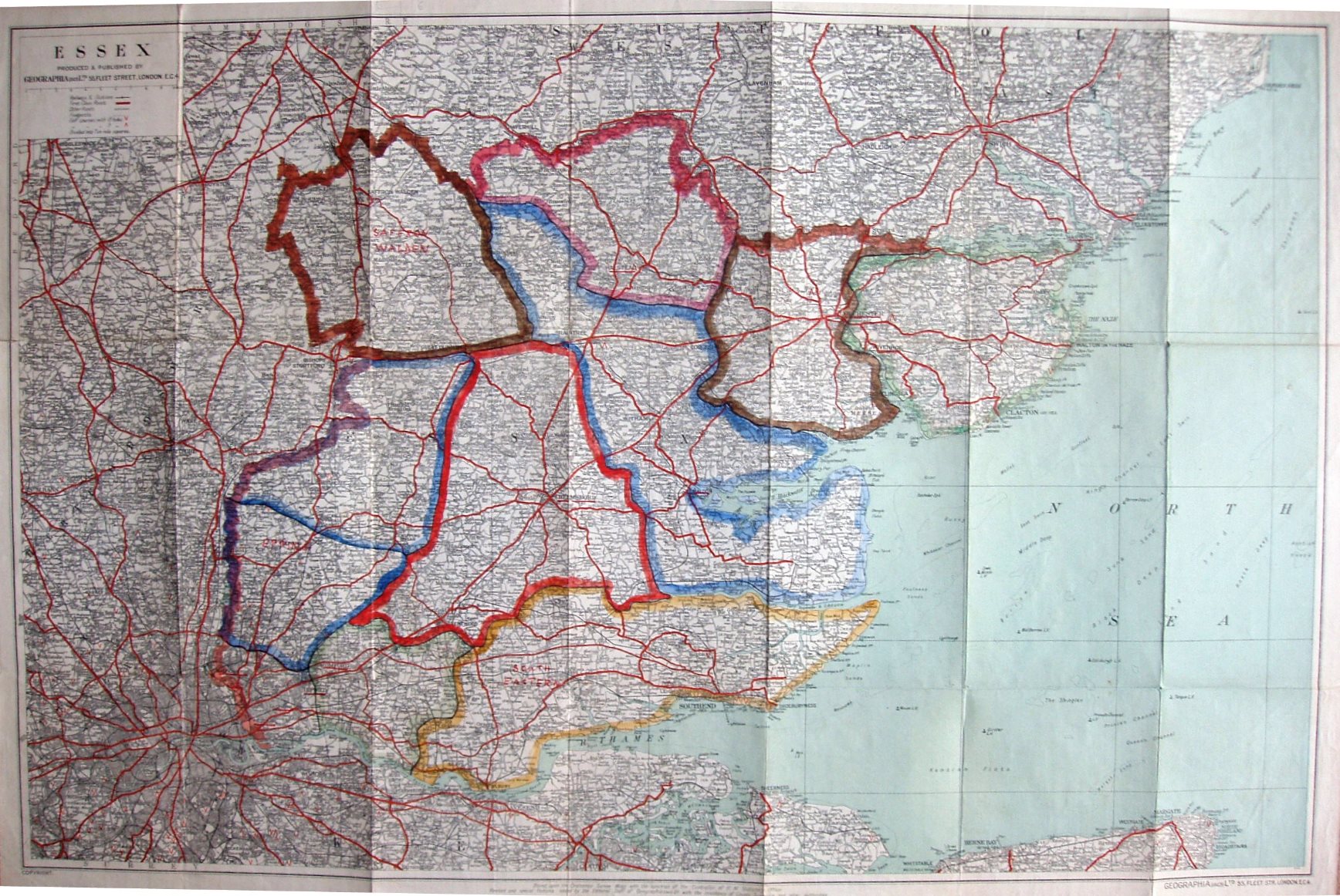
Scale correct at 10 miles = 86mm, or 3.0 miles/inch, ie 1:190,000.
First class roads are in red; the sea is (slightly greeny-) blue and the land is white; there are very prominent edge-coloured boundaries that have been added manually, that may be for Parliamentary or other districts. The Southend Arterial (opened 1925) and the East Ham & Barking bypass (1928) are present, but not the Stanford-le-Hope bypass (c.1932).
The map is published by Geographia (1923) Ltd, 55 Fleet Street on the cover and on the map; code of E.UE = May 1925.