There had been a lot of dissatisfaction with just how slow the OS was to publish a one inch map after the ground had been surveyed, culminating in the 1892 Dorrington Committee recommending that the one inch map should be revised separately from the larger (6 and indeed 25 inch) scales. One inch revision commenced in 1893 and the first Revsied New Series maps appeared in 1895 (in monochrome).
These new maps also included several changes in the symbols used - churches gained towers/steeples for the first time, single and multiple railway lines were distinguished, and roads were divided into three classes.
Revising existing one inch informatiion was highly effective, so that the whole of England and Wales was covered by 1899 - a few New Series maps never being published as the Revised New Series maps were ready first.
After a lot of debate, it was eventually agreed that the OS should produce one inch maps in colour, and these started appearing in 1897. These used the underlying engraved plates, with separate transfers for the initially 5 then (from 1901) 6 colours.
At the same time a new wide border with two inch sections was introduced, numbered west to east and lettered north to south (to form a grid on each map, but the grid lines do not go across the face of the map). The symbols for railways were also changed from the monochrome version
The monochrome and coloured maps overlapped in publication, and continued up to the Third Edition (of the New Series) maps.
The monochrome sheets that covered Essex were the same as for the New Series, and for the Colour sheets the only change was combining sheets 224 and 225:
| Sheet | Name | Notes |
|---|---|---|
| 205 | Saffron Walden | Only a little of Essex, from Saffron Walden northwards |
| 206 | Sudbury | Just a sliver of Essex south of Sudbury |
| 222 | Great Dunmow | Almost all in Essex |
| 223 | Braintree | Almost all in Essex |
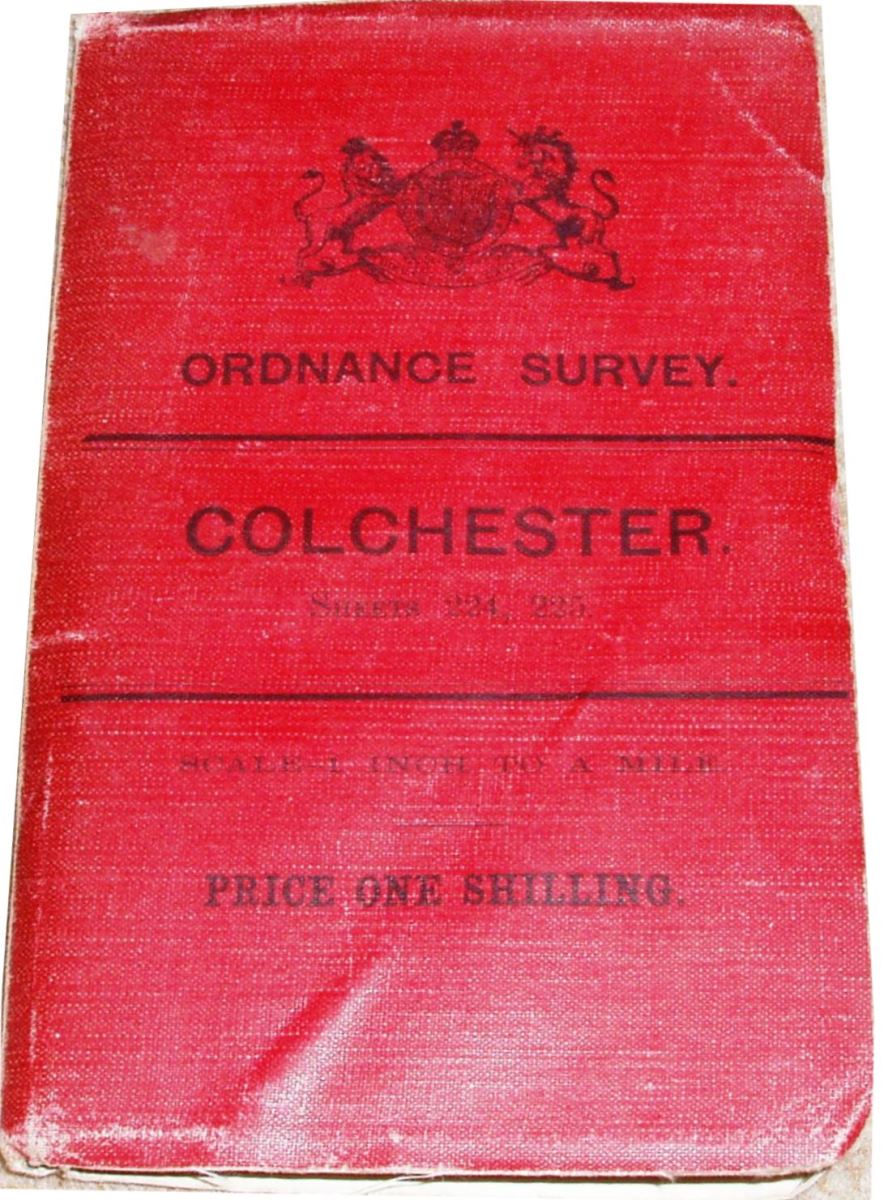
| 224/225 | Colchester | Mostly Essex, plus Suffolk north of the Stour, but extending eastwards to cover the coast |
| 240 | Epping | Mainly Essex |
| 241 | Chelmsford | All in Essex |
| 242 | Brightlingsea | All in Essex, but a lot of sea too |
| 256 | North London | South west Essex, but mainly NE London |
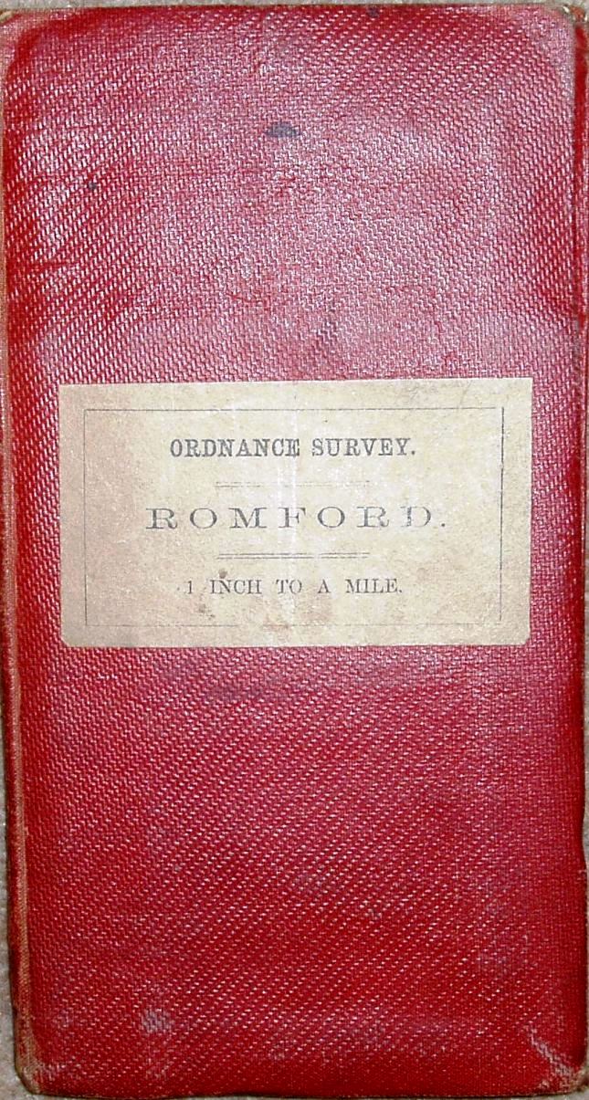
| 257 | Romford | All in Essex |
| 258 | Shoeburyness | All in Essex, plus Thames Estuary; southern part also included in a sheet 258/272 |
| 259 | Foulness | Bit of Essex, but mostly North Sea |
| 271 | Dartford | Sliver of Essex north of the Thames |
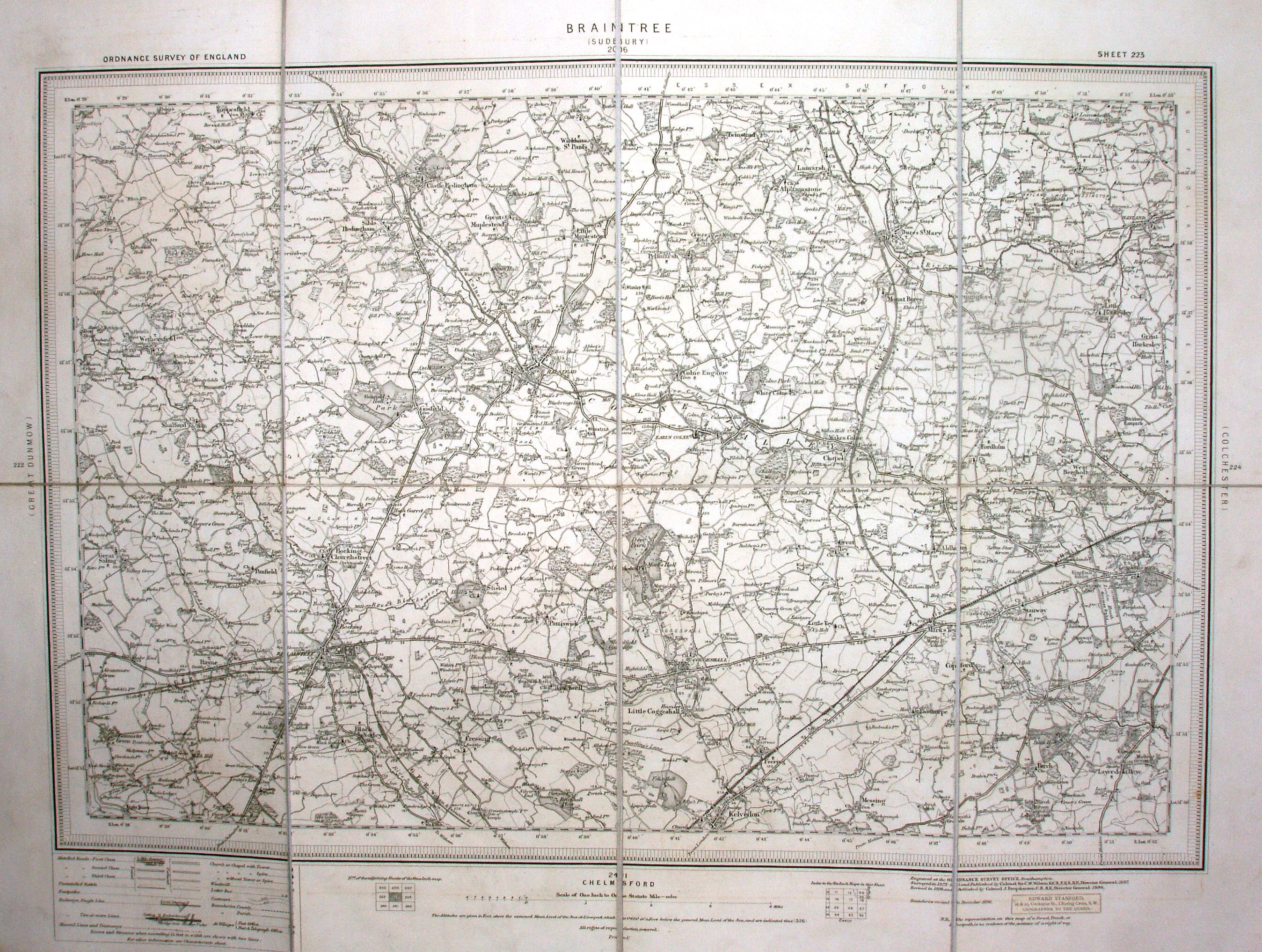
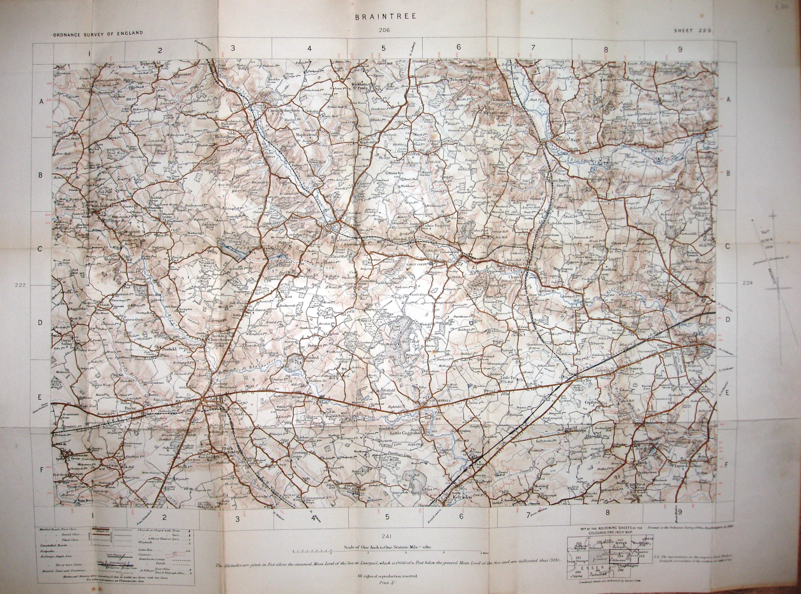
Above are two Revised New Series maps, both Sheet 223 Braintree. The first is the monochrome map, the second the "In Colour" map - both were published in 1898.
The information on the map is the same, but the surrounds are very different, and the railways are shown with different symbols.
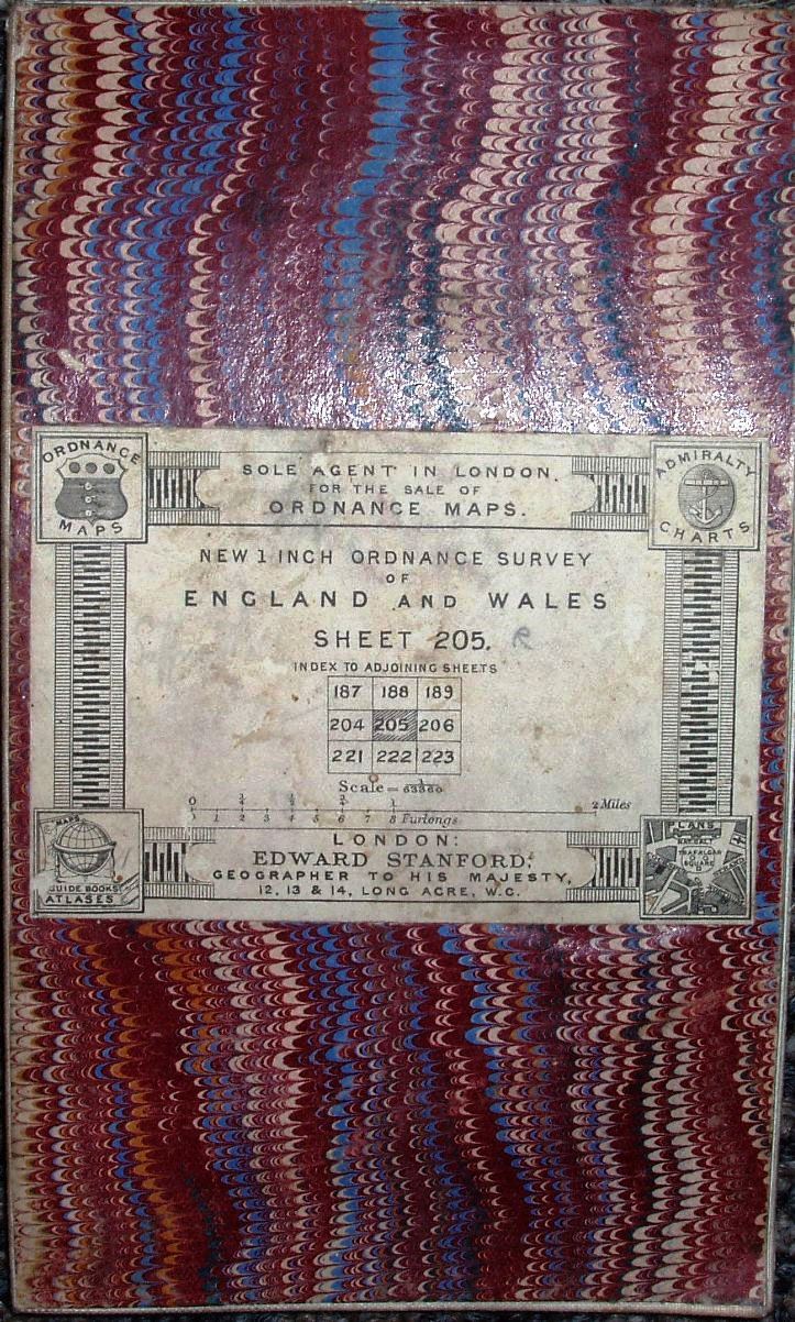
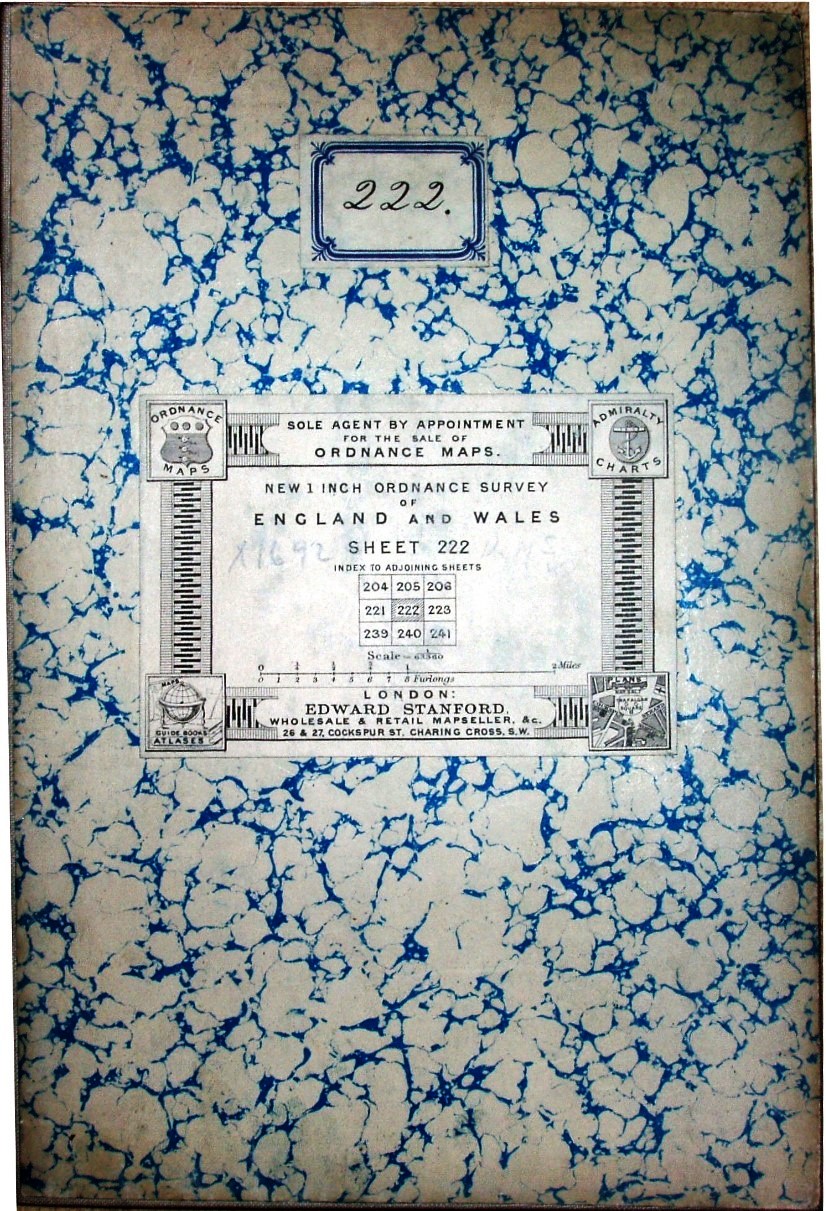
The Revised New Series map (monochrome) sheets were the same size as the New Series ones, and agents continued to add their own covers.
Here are two covers from Stanfords, their 1895 Sheet 205 and their 1898 Sheet 222. The covers are about 168mm x 98mm and 210mm x 141mm.
The Revised New Series map sheets in colour were the same size as the initial monochrome Revised New Series ones, but for the first time the OS started putting its own covers on them.
These started plain with a stuck-on label, but then developed into a bit more detail. The covers are about 183mm x 96mm and 159mm x 104mm.

One-inch engraved maps of the Ordnance Survey from 1847, Roger Hellyer and Richard Oliver, The Charles Close Society, 2009, £50. 714 + vi pages, A4 hardback. ISBN 978 1 870598 27 9
The Revised New Series colour printed one-inch map of England and Wales 1897-1914, by Dr Tim Nicholson, £10. 95 pages, B5 27 black and white figures, colour plates softback, ISBN 978 1 870598 19 4
Old Series to Explorer A field guide to the Ordnance map, Chris Higley, 2011, £12, pp vi, 154, with 42 pages in colour, 179x249 mm paperback, ISBN 978-1-870598-30-9
All available from the Charles Close Society (CCS).