The Old Series was surveyed from 1784 to 1869, and resulted in 110 sheets covering England and Wales (only) .
The first maps of the Board of Ordnance were of Kent, but these were engraved and published by Faden; the first maps where the OS surveyed, drew, engraved and published themselves were of Essex. These were published in 1805, available as four separate sheets (numbers 47 [the NW quarter], 48 [NE], 1 [SW] & 2 [SE]) and as a single sheet covering the whole county.
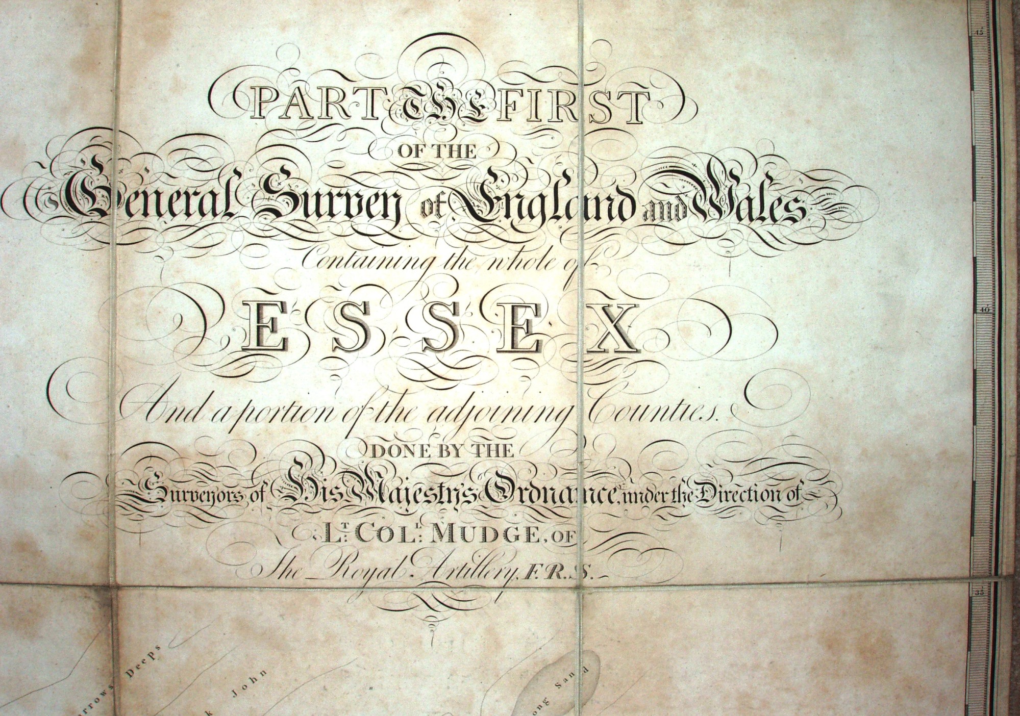
The Old Series initially published its maps as County Sets (Essex, Devon then Cornwall), very much following the historic approach to county mapping of the preceding 130 years. The Essex sheet is entitled Part the First of The General Survey of England and Wales, Containing the whole of Essex, And a portion of adjoining counties. Done by the Surveyors of His Majesty's Ordnance, under the Direction of Lt Col Mudge, of The Royal Artillery, FRS.
(The above appears in the North Sea, off Foulness.) After 1813 the body was called the Ordnance Survey of Great Britain (the term "Ordnance Survey" first appearing on the 1810 map of the Isle of Wight).
The Essex sheets 1 and 48 later became available as Quarter Sheets, with NW, NE, SE and SW suffixes; sheets 2 and 47 were
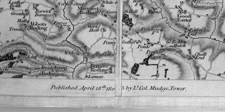
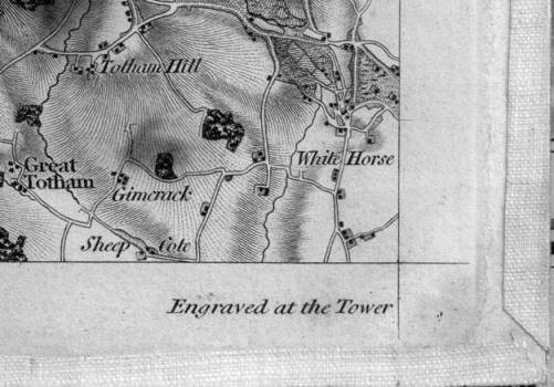
not subdivided. The Essex sheets were constructed using the Greenwich Meridian, and had a one inch "piano key" style border around the outer edge of the combined county map. The four sheets are each about 600mm by 900mm, with an official publication date across the bottom - initially Published April 18th 1805 by Lt Col Mudge, Tower. and Engraved at the Tower.
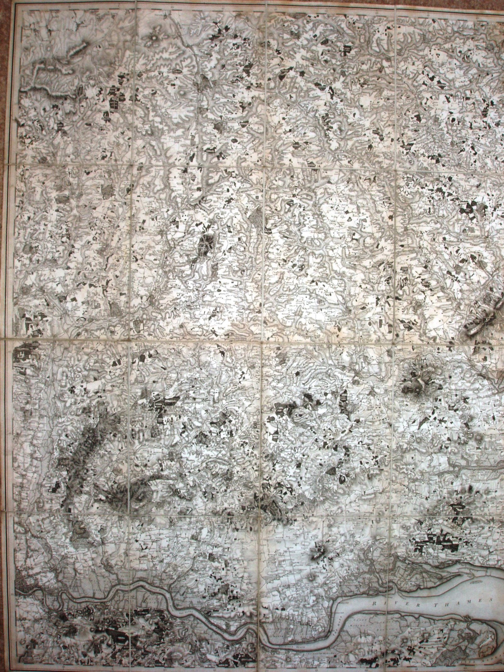
The above is the combined sheets 47 plus 1, ie the western half of Essex. Below is a close up of the Saffron Walden area.
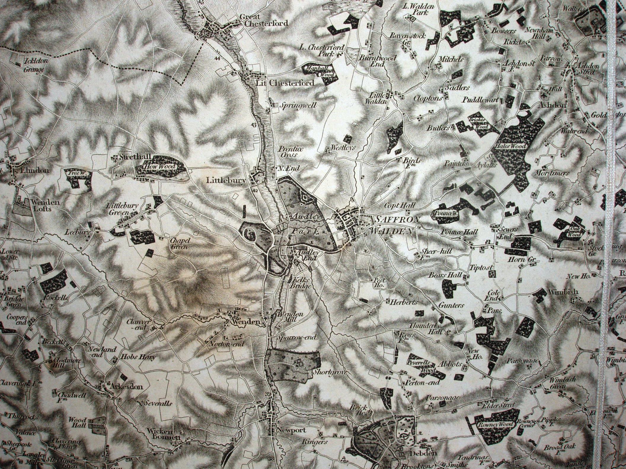
As you can see the map is printed in monochrome, uses hatchuring to show slope rather than contours and has very few symbols. There was no
key to explain the few symbols it does have - as the military personnel would be trained in how to use the maps. There isn't even a scale bar!
The Old Series maps were re-published many times. In rural areas there were not in practice many changes, with the exception of the railways that first came to Essex in 1839.
| Sheet | First Published | Further states | Last Published |
|---|---|---|---|
| 1 | 1805 | 6 | 1839 |
| 1 NE | 1844 | 10 | 1889 |
| 1 NW | 1844 | 10 | 1885 |
| 1 SE | 1843 | 8 | 1884(?) |
| 1 SW | 1844 | 12 | 1892 |
| Sheet | First Published | Further states | Last Published |
|---|---|---|---|
| 2 (state 1) | 1805 | 5 | 1839(?) |
| 2 (state 2) | 1840 | 12 | 1889 |
| 47 | 1805 | 19 | 1891 |
| 48 | 1805 | 5 | 1838(?) |
| 48 NE | 1838 | 11 | 1883+ |
| 48 NW | 1838 | 8 | 1891 |
| 48 SE | 1838 | 8 | 1884 |
| 48 SW | 1838 | 10 | 1892 |
The data in the table above is extracted from The Sheet Histories of the Ordnance Survey One Inch Old Series Maps of Essex and Kent, A Cartobibliographic Account by Guy Messenger,Charles
Close Society, London, 1991 - which has a lot more detailed information in it.
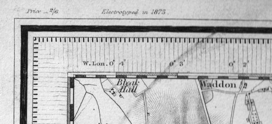
From the mid 19th century the OS started putting more information regarding dates and prices.
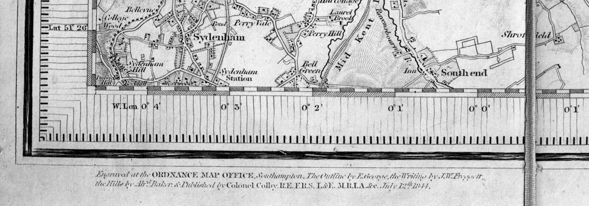
Below are two closeups of the area around Saffron Walden on Sheet 47, from the 1805 and 1873 editions.
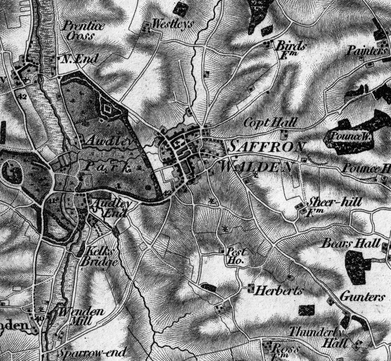
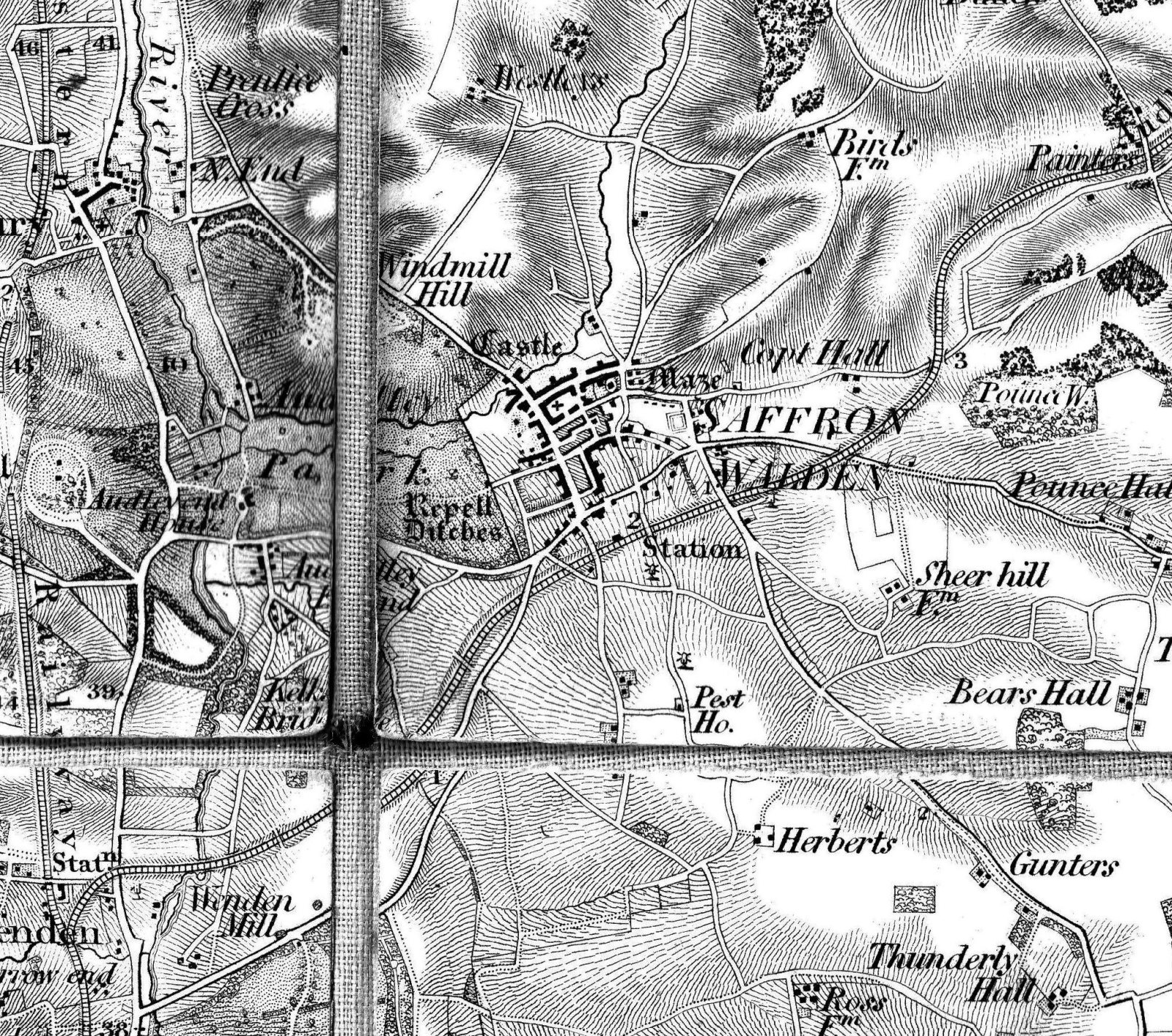
There is now a railway, with stations - which are labelled as stations but have no symbol - and a simple cross for a church (no "with steeple"
symbol). The hatchuring has become weaker, but there are more places/features named.
In subsequent One Inch Series there will be many pictures of the covers - but for the Old Series there essentially isn't one - they just folded the
maps; there were no covers from the Ordnance Survey. So, all you can hope to get is a red diamond drawn on the outer panels when the map is
folded, and maybe someone writing on them just what is on the maps: