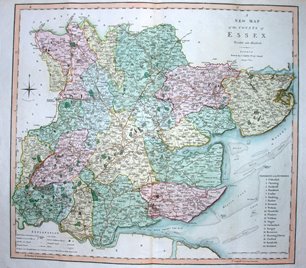
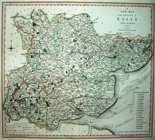
Charles Smith was a stationer and map & globe seller trading from 172 Strand in London, starting in about 1800. He commisioned Jones & Smith (no relation) of Pentonville Road (& later also Strand) to engrave a set of county maps, based on the latest available surveys. These started appearing in 1801, and in 1804 were bound as the New English Atlas; the maps continued to be published - with the addition of railways and changes to place names - until the 1860s.
The maps are created to a high standard, and must have been in close competition with Cary's New English Atlas. Smith published many issues and editions - 4 issues of the map of Sussex and nine issues of the map of Lincolnshire before he officially published the "Second Edition" in 1808 according to Kingsley and Carroll respectively. There were further editions in 1818 and various dates to the 1840s - as atlases and/or loose sheets - and then via lithographic transfers as maps sold by the engravers (Smith & Son" by then) in the 1850s & 60s.
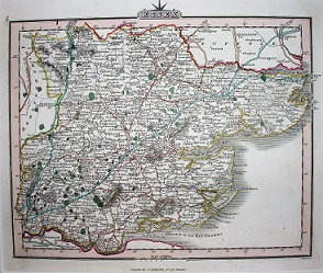
The scales of the maps varied by county - Essex was about 1:188,000 - and in 1822 Charles Smith published a new atlas at around half the former scale, 1:415,000, engraved this time by someone called Pickett. The new atlas had exacly the same names as the earlier one - New English Atlas - and openly stated itself to be "a reduction of his large folio atlas"; it looks very like a Cary map (even more so than the 1801 maps). It was published half a dozen or more times from 1822 to the 1840s.
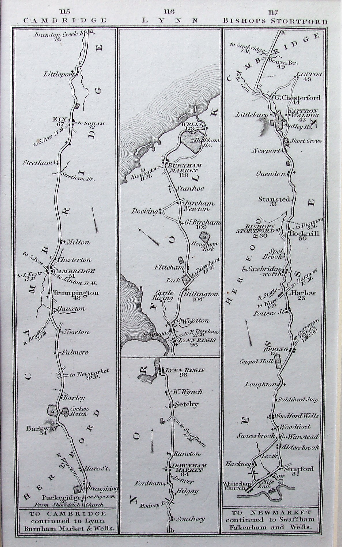
Charles Smith also published a Road Book: Smith's new pocket companion to the roads of England and Wales and part of Scotland. There are 42 plates with three strips to a plate at a scale of 1:550,000 (on plates concerning Essex at least), basically derived from the Senex plates. The Companion was published a few more times up to the mid-1830s.
Return to the Map publishers main page.