Essex
The Atlas was first published in 1837 (Essex is dated 1835), and then several times to 1871 (or later), as Hobson's Fox Hunting Atlas (1850 to 1880), as Walker's Fox Hunting Atlas (up to 1895) and as Lett's Popular Atlas (1884 & 87). The maps were also published separately, dissected on cloth and folded up between boards - as here.
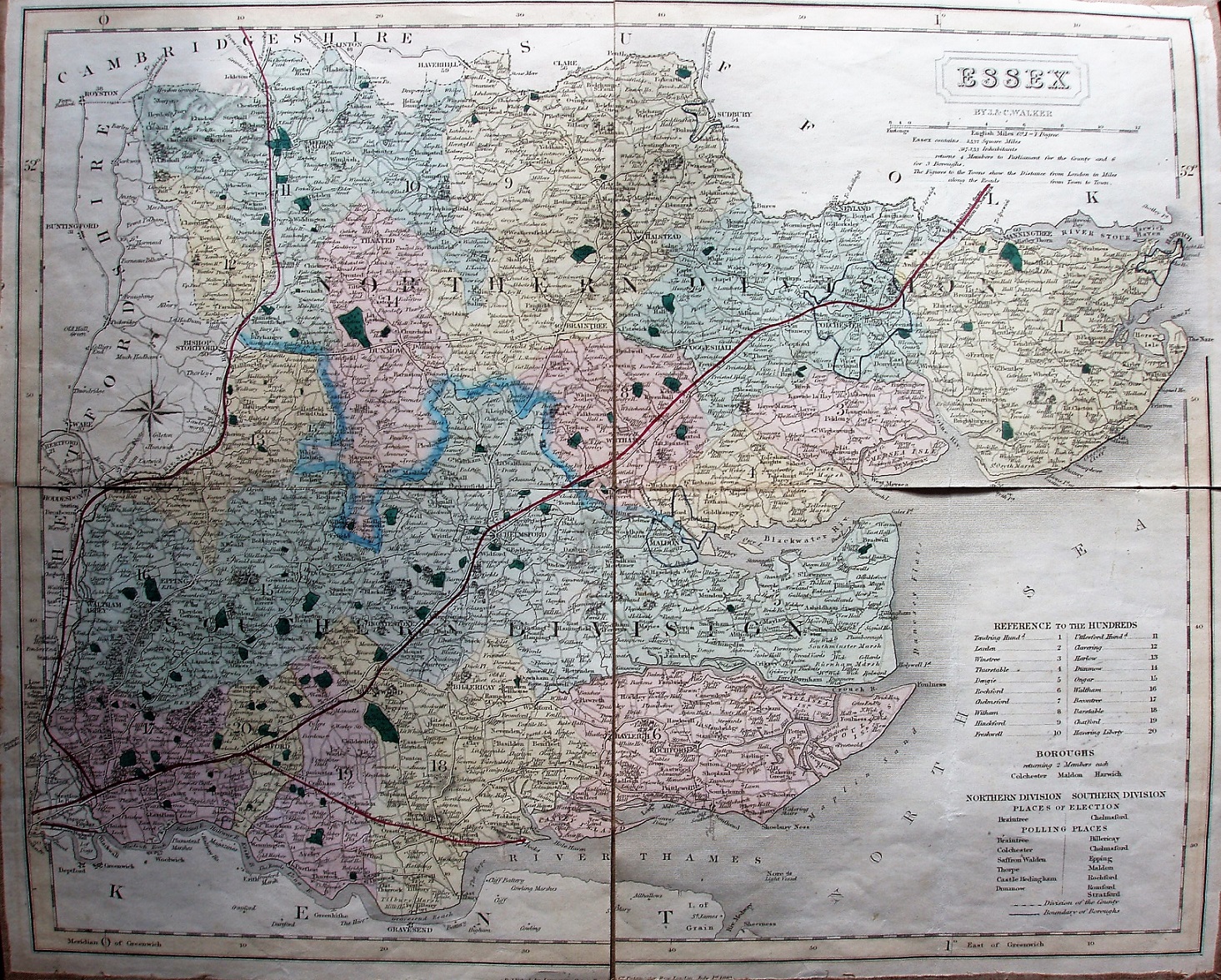
Hundreds are referenced to a table, plus listings parliamentary boroughs, places of election and polling places. Hundreds are colour washed (but not edge-coloured), with Colchester, Harwich & Maldon Boroughs all blue-lined. Six Polling Places in North, 7 in the South. Divisions thickly edge-coloured. Major roads have a thicker line on one side; all roads uncoloured.
Stil no railway in Kent.
Black quads to Bishops Stortford and to Chelmsford, but beyond those pecked black line all way towards Cambridge and towards Norwich; red over whole length. Also has Blackwall Rail, and the Romford - Thames Haven Docks (named), both red on pecked black.
Under the cartouche is "By J & C Walker", but along the bottom is "Published by Longman, Orme, Rees & Co, Paternoster Row, London, July 1st 1840". I estimate its selling date as being c.1840 as no lines authorised after 1839 have been added.
Scale correct at 1+12 miles = 83mm, or 3.9 miles/inch, ie 1:250,000.